How to get to D C Magic by bus?
Click on the bus route to see step by step directions with maps, line arrival times and updated time schedules.
From Consulate General Of Peru, Washington
66 minFrom Children's National Columbia heights shuttle, Washington
53 minFrom The Fairmont Washington, D.C., Washington
68 minFrom Embassy Suites by Hilton Washington DC Georgetown, Washington
64 minFrom Meridian Hill Park, Washington
55 minFrom AMC Theatres-Loews Georgetown 14, Washington
60 minFrom Astoria, Washington
63 minFrom Park Hyatt Washington D.C. (Washington DC Hyatt), Washington
68 minFrom Dumbarton Oaks, Washington
51 minFrom 17th St NW, Washington
60 min
How to get to D C Magic by metro?
Click on the metro route to see step by step directions with maps, line arrival times and updated time schedules.
From Consulate General Of Peru, Washington
39 minFrom Children's National Columbia heights shuttle, Washington
42 minFrom The Fairmont Washington, D.C., Washington
40 minFrom Embassy Suites by Hilton Washington DC Georgetown, Washington
37 minFrom Meridian Hill Park, Washington
47 minFrom AMC Theatres-Loews Georgetown 14, Washington
53 minFrom Astoria, Washington
35 minFrom Park Hyatt Washington D.C. (Washington DC Hyatt), Washington
40 minFrom Dumbarton Oaks, Washington
51 minFrom 17th St NW, Washington
35 min
Bus stops near D C Magic in Montgomery County
Metro station near D C Magic in Montgomery County
- Tenleytown Metro Station, 27 min walk,VIEW
Bus lines to D C Magic in Montgomery County
What are the closest stations to D C Magic?
The closest stations to D C Magic are:
- Woodmont Av+Cheltenham Dr is 112 yards away, 2 min walk.
- Old Georgetown Rd & Fairmont Ave is 272 yards away, 4 min walk.
- Wilson Ln & Clarendon Rd is 276 yards away, 4 min walk.
- Tenleytown Metro Station is 2232 yards away, 27 min walk.
Which bus lines stop near D C Magic?
These bus lines stop near D C Magic: D96, M70.
Which metro line stops near D C Magic?
RED (Shady Grove)
What’s the nearest metro station to D C Magic in Montgomery County?
The nearest metro station to D C Magic in Montgomery County is Tenleytown Metro Station. It’s a 27 min walk away.
What’s the nearest bus station to D C Magic in Montgomery County?
The nearest bus station to D C Magic in Montgomery County is Woodmont Av+Cheltenham Dr. It’s a 2 min walk away.
What time is the first metro to D C Magic in Montgomery County?
The RED is the first metro that goes to D C Magic in Montgomery County. It stops nearby at 5:21 AM.
What time is the last metro to D C Magic in Montgomery County?
The RED is the last metro that goes to D C Magic in Montgomery County. It stops nearby at 12:19 AM.
What time is the first bus to D C Magic in Montgomery County?
The M70 is the first bus that goes to D C Magic in Montgomery County. It stops nearby at 4:55 AM.
What time is the last bus to D C Magic in Montgomery County?
The M70 is the last bus that goes to D C Magic in Montgomery County. It stops nearby at 2:16 AM.
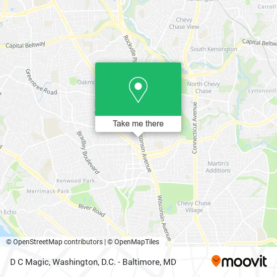
See D C Magic, Montgomery County, on the map
Public Transit to D C Magic in Montgomery County
Wondering how to get to D C Magic in Montgomery County? Moovit helps you find the best way to get to D C Magic with step-by-step directions from the nearest public transit station.
Moovit provides free maps and live directions to help you navigate through your city. View schedules, routes, timetables, and find out how long does it take to get to D C Magic in real time.
Looking for the nearest stop or station to D C Magic? Check out this list of stops closest to your destination: Woodmont Av+Cheltenham Dr; Old Georgetown Rd & Fairmont Ave; Wilson Ln & Clarendon Rd; Tenleytown Metro Station.
Bus: D96, M70, 29, 30, 32, 34, 47, 70.Metro: RED.
Want to see if there’s another route that gets you there at an earlier time? Moovit helps you find alternative routes or times. Get directions from and directions to D C Magic easily from the Moovit App or Website.
We make riding to D C Magic easy, which is why over 1.5 million users, including users in Montgomery County, trust Moovit as the best app for public transit. You don’t need to download an individual bus app or train app, Moovit is your all-in-one transit app that helps you find the best bus time or train time available.
For information on prices of bus and metro, costs and ride fares to D C Magic, please check the Moovit app.
Use the app to navigate to popular places including to the airport, hospital, stadium, grocery store, mall, coffee shop, school, college, and university.
D C Magic Address: 7801 Norfolk Ave Bethesda, MD 20814 street in Montgomery County
- Allstate Insurance,
- Management Cv,
- Miso3,
- Strategic Planning,
- Playmaker Systems,
- Ascend Institute of Martial Arts,
- BGR Burgers Grilled Right,
- Coalition Tattoo,
- Tattoo Haven,
- Vspfamily,
- Homes Simply Sold,
- Windsor Bethesda Apartments,
- Carlos Buys Houses,
- Equal Housing Opportunity,
- Core Immersive Labs,
- World of Wood,
- Real Estate Sells with Sully at Keller Williams Capital Properties,
- Bethesda Boards,
- Record Nations,
- Bethesda Scooters & Boards
Places Near D C Magic (Montgomery County)
- Amazon Hq2, Arlington County,
- M&T Bank Stadium, Baltimore,
- Rock Creek Tennis Center, Washington,
- The Anthem, Washington,
- National Zoo, Washington,
- National Theatre, Washington,
- Basilica of the National Shrine, Washington,
- Washington DC VA Medical Center, Washington,
- Washington National Cathedral, Washington,
- Warner Theatre, Washington,
- PG Mall, Prince George's County,
- Capital One Arena, Washington,
- Georgetown, Washington,
- Museum Of The Bible, Washington,
- Pennsylvania Ave NW (3rd st and pennsylvania), Washington,
- Marriott Marquis Washington, DC, Washington,
- National Museum of African American History and Culture, Washington,
- Sibley Memorial Hospital, Washington,
- Camden Yards, Baltimore,
- Westfield Montgomery Mall, Montgomery County
How to get to popular places in Washington, D.C. - Baltimore, MD with public transit
Get around Montgomery County by public transit!
Traveling around Montgomery County has never been so easy. See step by step directions as you travel to any attraction, street or major public transit station. View bus and train schedules, arrival times, service alerts and detailed routes on a map, so you know exactly how to get to anywhere in Montgomery County.
When traveling to any destination around Montgomery County use Moovit's Live Directions with Get Off Notifications to know exactly where and how far to walk, how long to wait for your line, and how many stops are left. Moovit will alert you when it's time to get off — no need to constantly re-check whether yours is the next stop.
Wondering how to use public transit in Montgomery County or how to pay for public transit in Montgomery County? Moovit public transit app can help you navigate your way with public transit easily, and at minimum cost. It includes public transit fees, ticket prices, and costs. Looking for a map of Montgomery County public transit lines? Moovit public transit app shows all public transit maps in Montgomery County with all Bus, Train, Metro, Light Rail and Ferry routes and stops on an interactive map.
Washington, D.C. - Baltimore, MD has 5 transit type(s), including: Bus, Train, Metro, Light Rail and Ferry, operated by several transit agencies, including WMATA, Montgomery County Ride On, Fairfax Connector, TheBus, PRTC, DASH - Alexandria, Arlington Transit (ART), RTA of Central Maryland, MDOT MTA, MDOT MTA Light RailLink, MDOT MTA Commuter Bus, MDOT MTA Local Bus, FXBGO!, Virginia Railway Express (VRE) and MARC