How to get to D Moda by bus?
Click on the bus route to see step by step directions with maps, line arrival times and updated time schedules.
From Hospital HM Universitario Torrelodones, Torrelodones
64 minFrom Polígono P-29, Collado Villalba
55 minFrom Hospital Público de Collado Villalba, Collado Villalba
49 minFrom Polígono Európolis, Las Rozas De Madrid
86 minFrom Costco Wholesale, Las Rozas De Madrid
78 minFrom Hospital De La Fuenfría., Cuenca Del Guadarrama
78 minFrom Manzanares el Real, Manzanares El Real
88 minFrom The Style Outlets Las Rozas, Las Rozas De Madrid
66 minFrom Piscinas Naturales Las Berceas, Cercedilla
20 minFrom Heron City Madrid, Área Metropolitana De Madrid Y Corredor Del Henares
65 min
Bus stops near D Moda in Guadarrama
Train station near D Moda in Guadarrama
- Los Molinos - Guadarrama, 16 min walk,VIEW
Bus lines to D Moda in Guadarrama
- 4, Polideportivo,VIEW
- 690, Eras - Urb. Los Copos,VIEW
- 660, Hospital Guadarrama - Urb. Fresnos Jarosa,VIEW
- 664, P.º Moret - Moncloa,VIEW
- VAC246, 2: Segovia (por Guadarrama),VIEW
- VAC246, 5 San Rafael - El Espinar (por Guadarrama),VIEW
- VAC246, 2 Madrid (Moncloa) (Por Guadarrama),VIEW
- VAC223, Ruta 4: Madrid (Ruta),VIEW
- 680, Collado Villalba (Hospital) - Cercedilla,VIEW
- 682, Madrid (Moncloa) - Villalba - Guadarrama,VIEW
- 684, Madrid (Moncloa) - Cercedilla (por Guadarrama),VIEW
- 685, Majadahonda (Hospital) - Las Rozas - Guadarrama,VIEW
- 688, Madrid (Moncloa) - Los Molinos,VIEW
- N602, Madrid (Moncloa) - Collado Villalba - Guadarrama,VIEW
- 681, Av. Serrana - Ctra. N-Vi,VIEW
What are the closest stations to D Moda?
The closest stations to D Moda are:
- Escoriales - Polideportivo is 245 meters away, 4 min walk.
- Escorial - Hospital Guadarrama is 282 meters away, 4 min walk.
- Escoriales - Hospital Guadarrama is 292 meters away, 4 min walk.
- Hospital Guadarrama - Urb. Fresnos Jarosa is 478 meters away, 7 min walk.
- Los Molinos - Guadarrama is 1202 meters away, 16 min walk.
Which bus lines stop near D Moda?
These bus lines stop near D Moda: 682, 684, 685.
What’s the nearest train station to D Moda in Guadarrama?
The nearest train station to D Moda in Guadarrama is Los Molinos - Guadarrama. It’s a 16 min walk away.
What’s the nearest bus station to D Moda in Guadarrama?
The nearest bus stations to D Moda in Guadarrama are Escoriales - Polideportivo, Escorial - Hospital Guadarrama and Escoriales - Hospital Guadarrama. The closest one is a 4 min walk away.
What time is the first train to D Moda in Guadarrama?
The C8B is the first train that goes to D Moda in Guadarrama. It stops nearby at 6:35 AM.
What time is the last train to D Moda in Guadarrama?
The C8B is the last train that goes to D Moda in Guadarrama. It stops nearby at 12:16 AM.
What time is the first bus to D Moda in Guadarrama?
The 684 is the first bus that goes to D Moda in Guadarrama. It stops nearby at 4:25 AM.
What time is the last bus to D Moda in Guadarrama?
The N602 is the last bus that goes to D Moda in Guadarrama. It stops nearby at 2:18 AM.
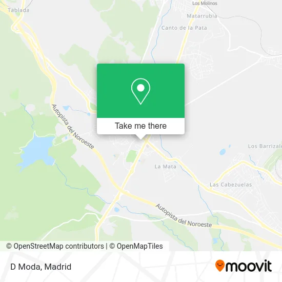
See D Moda, Guadarrama, on the map
Public Transit to D Moda in Guadarrama
Wondering how to get to D Moda in Guadarrama? Moovit helps you find the best way to get to D Moda with step-by-step directions from the nearest public transit station.
Moovit provides free maps and live directions to help you navigate through your city. View schedules, routes, timetables, and find out how long does it take to get to D Moda in real time.
Looking for the nearest stop or station to D Moda? Check out this list of stops closest to your destination: Escoriales - Polideportivo; Escorial - Hospital Guadarrama; Escoriales - Hospital Guadarrama; Hospital Guadarrama - Urb. Fresnos Jarosa; Los Molinos - Guadarrama.
Bus: 682, 684, 685, 4, 690, 660, 664, VAC246, VAC246, VAC246, VAC223, 680, 688, 681.Train: C8B, REG.
Want to see if there’s another route that gets you there at an earlier time? Moovit helps you find alternative routes or times. Get directions from and directions to D Moda easily from the Moovit App or Website.
We make riding to D Moda easy, which is why over 1.5 million users, including users in Guadarrama, trust Moovit as the best app for public transit. You don’t need to download an individual bus app or train app, Moovit is your all-in-one transit app that helps you find the best bus time or train time available.
For information on prices of bus, costs and ride fares to D Moda, please check the Moovit app.
Use the app to navigate to popular places including to the airport, hospital, stadium, grocery store, mall, coffee shop, school, college, and university.
D Moda Address: Calle San Roque, 28440 Guadarrama street in Guadarrama
- García del Barrio J,
- Calle Río Arena,
- Inversiones y Proyectos Parthenon,
- Kebab Fk,
- Guardia Civil - Cuartel De Guadarrama,
- Bar Aperitivos Castilla,
- Picoteo,
- Apartamentos La Olma,
- Cloyser,
- Lenceria Corsetería,
- Bar John,
- Detalle's & Brillos,
- Aromay,
- Delicias del Cielo,
- Bar Herreros,
- Bar Manolo,
- Calle Luna, 1,
- Shopping 3B Gran Bazar,
- Calle Camino Real,
- Piner Asesores
Places Near D Moda (Guadarrama)
- Sala La Riviera, Madrid,
- Rastro De Madrid, Área Metropolitana De Madrid Y Corredor Del Henares,
- Hospital Universitario La Paz, Madrid,
- Mendez Alvaro, Madrid,
- Mercadillo de Majadahonda, Majadahonda,
- Centro Comercial La Gavia, Área Metropolitana De Madrid Y Corredor Del Henares,
- Tres Aguas, Alcorcón,
- Centro Comercial Oasiz Madrid, Área Metropolitana De Madrid Y Corredor Del Henares,
- Hospital Universitario Ramón y Cajal, Madrid,
- Plaza Mayor, Madrid,
- Hospital Clínico Universitario San Carlos, Madrid,
- Centro Comercial La Vaguada, Área Metropolitana De Madrid Y Corredor Del Henares,
- Centro Comercial Islazul, Área Metropolitana De Madrid Y Corredor Del Henares,
- Plenilunio, Área Metropolitana De Madrid Y Corredor Del Henares,
- Estacion de Chamartin, Madrid,
- Wizink Center, Madrid,
- Calle de López de Hoyos 169, Madrid,
- Estadio Wanda Metropolitano, Área Metropolitana De Madrid Y Corredor Del Henares,
- Palacio De Vistalegre, Área Metropolitana De Madrid Y Corredor Del Henares,
- Nassica, Área Metropolitana De Madrid Y Corredor Del Henares
How to get to popular places in Madrid with public transit
Get around Guadarrama by public transit!
Traveling around Guadarrama has never been so easy. See step by step directions as you travel to any attraction, street or major public transit station. View bus and train schedules, arrival times, service alerts and detailed routes on a map, so you know exactly how to get to anywhere in Guadarrama.
When traveling to any destination around Guadarrama use Moovit's Live Directions with Get Off Notifications to know exactly where and how far to walk, how long to wait for your line, and how many stops are left. Moovit will alert you when it's time to get off — no need to constantly re-check whether yours is the next stop.
Wondering how to use public transit in Guadarrama or how to pay for public transit in Guadarrama? Moovit public transit app can help you navigate your way with public transit easily, and at minimum cost. It includes public transit fees, ticket prices, and costs. Looking for a map of Guadarrama public transit lines? Moovit public transit app shows all public transit maps in Guadarrama with all Bus, Train, Metro and Light Rail routes and stops on an interactive map.
Madrid has 4 transit type(s), including: Bus, Train, Metro and Light Rail, operated by several transit agencies, including Metro de Madrid, Metro Ligero, Tranvía de Parla, Renfe Cercanías - Servicios de Autobús especiales, Renfe Cercanias, Renfe Cercanías, EMT, Interurbanos, Urbanos de Alcalá de Henares, Urbanos de Alcobendas, Urbanos de Alcorcón, Urbanos de Algete, Urbanos de Aranjuez, Urbanos de Arganda del Rey and Urbanos de Arroyomolinos