Directions to D Modas (Cic) with public transportation
The following transit lines have routes that pass near D Modas
How to get to D Modas by bus?
Click on the bus route to see step by step directions with maps, line arrival times and updated time schedules.
From Shopping Estação, Rebouças
44 minFrom SESC da Esquina, Centro
46 minFrom Afonso Pena/Terminal Boqueirão (Sentido Afonso Pena), Boqueirão
56 minFrom Rua Coronel Dulcídio, Batel
49 minFrom Rua Brigadeiro Franco, Centro
50 minFrom Shopping & Sports, Xaxim
47 minFrom Santa Quiteria, Santa Quitéria
46 minFrom PUCPR, Prado Velho
42 minFrom Estação Tubo Visconde de Nácar, Centro
45 minFrom Praça Osório, Centro
47 min
Bus stops near D Modas in Cic
Bus lines to D Modas in Cic
- H02 ARAUCÁRIA / CAPÃO RASO, ARAUCÁRIA / CAPÃO RASO,VIEW
- F05 FAZENDA / CIC, FAZENDA / CIC,VIEW
- H20 ANGÉLICA / CAPÃO RASO, ANGÉLICA / CAPÃO RASO,VIEW
- 040 INTERBAIRROS IV, INTERBAIRROS IV,VIEW
- X55 REFORÇO CIC / AV. J.K., REFORÇO CIC / AV. J.K.,VIEW
- 210 CABRAL / CIC, CABRAL / CIC,VIEW
- 607 COLOMBO / CIC, COLOMBO / CIC,VIEW
- 612 PORTÃO / CIC, PORTÃO / CIC,VIEW
- 619 SANTA RITA / CIC, SANTA RITA / CIC,VIEW
- 627 BOSCH, BOSCH,VIEW
- 628 CARBOMAFRA, CARBOMAFRA,VIEW
- 644 PINHEIRINHO / CIC, PINHEIRINHO / CIC,VIEW
- 652 VILA VERDE, VILA VERDE,VIEW
- 653 SABARÁ, SABARÁ,VIEW
- 654 CAMPO ALEGRE, CAMPO ALEGRE,VIEW
- 685 RIO BONITO / CIC, RIO BONITO / CIC,VIEW
- 712 JARDIM INDEPENDÊNCIA / CIC, JARDIM INDEPENDÊNCIA / CIC,VIEW
- 723 EMÍLIO ROMANI, EMÍLIO ROMANI,VIEW
- 773 VIZINHANÇA / SANTA RITA, VIZINHANÇA / SANTA RITA,VIEW
- 826 CAMPO COMPRIDO / CIC, CAMPO COMPRIDO / CIC,VIEW
What are the closest stations to D Modas?
The closest stations to D Modas are:
- Terminal CIC is 138 meters away, 3 min walk.
- Terminal CIC (644 / 709) is 219 meters away, 4 min walk.
- R. Pedro Gusso, 3841 is 250 meters away, 4 min walk.
Which bus lines stop near D Modas?
These bus lines stop near D Modas: 040 INTERBAIRROS IV, 607 COLOMBO / CIC, 612 PORTÃO / CIC, 628 CARBOMAFRA, F05 FAZENDA / CIC.
What’s the nearest bus station to D Modas in Cic?
The nearest bus station to D Modas in Cic is Terminal CIC. It’s a 3 min walk away.
What time is the first bus to D Modas in Cic?
The 609 MAD. CIC is the first bus that goes to D Modas in Cic. It stops nearby at 4:07 AM.
What time is the last bus to D Modas in Cic?
The 609 MAD. CIC is the last bus that goes to D Modas in Cic. It stops nearby at 2:59 AM.
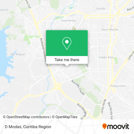
See D Modas, Cic, on the map
Public Transit to D Modas in Cic
Wondering how to get to D Modas in Cic? Moovit helps you find the best way to get to D Modas with step-by-step directions from the nearest public transit station.
Moovit provides free maps and live directions to help you navigate through your city. View schedules, routes, timetables, and find out how long does it take to get to D Modas in real time.
Looking for the nearest stop or station to D Modas? Check out this list of stops closest to your destination: Terminal CIC; Terminal CIC (644 / 709); R. Pedro Gusso.
Bus: 040 INTERBAIRROS IV, 607 COLOMBO / CIC, 612 PORTÃO / CIC, 628 CARBOMAFRA, F05 FAZENDA / CIC, H02 ARAUCÁRIA / CAPÃO RASO, H20 ANGÉLICA / CAPÃO RASO, X55 REFORÇO CIC / AV. J.K., 709 VILA TIRADENTES / CIC, 609 MAD. CIC.
Want to see if there’s another route that gets you there at an earlier time? Moovit helps you find alternative routes or times. Get directions from and directions to D Modas easily from the Moovit App or Website.
We make riding to D Modas easy, which is why over 1.5 million users, including users in Cic, trust Moovit as the best app for public transit. You don’t need to download an individual bus app or train app, Moovit is your all-in-one transit app that helps you find the best bus time or train time available.
For information on prices of bus, costs and ride fares to D Modas, please check the Moovit app.
Use the app to navigate to popular places including to the airport, hospital, stadium, grocery store, mall, coffee shop, school, college, and university.
D Modas Address: Rua Léa Moreira de Souza Moura, 31 Cidade Industrial de Curitiba Curitiba-PR 81315-680 street in Cic
- Mel Casa de Festa e Comércio de Doces e Embalagens,
- Laboratorio de Analises Clinicas das Nações,
- Grarony Comércio de Moveis e Eletrodomesticos,
- Paraná Banco,
- Correios,
- Terminal Medicamentos e Perfumaria,
- Farmais,
- Drogamed,
- House do Siri Cascudo,
- Izabela Presentes,
- Casa China,
- Transportes Alves,
- Ehnvests Gold,
- Congregação Cristã do Brasil,
- Incrível Mulher,
- Daniel Zorze Bar,
- CIC,
- Pão De Queijo Master,
- Rua Davi Xavier da Silva, 1089 - Cidade Industrial,
- Passo a Passo Calçados
Places Near D Modas (Cic)
- Arena Da Baixada - Curitiba,
- Jockey Plaza Shopping Center, Tarumã,
- Hospital do Rocio, Campo,
- Shopping Estação, Rebouças,
- Hospital Da Cruz Vermelha, Batel,
- Rua General Mário Tourinho, Campina Do Siqueira,
- Jardim Botânico de Curitiba PR, Centro,
- Pontifícia Universidade Católica do Paraná (PUCPR), Prado Velho,
- Campo Largo, Campo,
- Hospital de Clínicas (HC - UFPR), Centro,
- Hospital Erasto Gaertner, Jardim Das Américas,
- Hospital Nossa Senhora Das Graças, Mercês,
- Hospital Angelina Caron, Campina Grande Do Sul,
- Shopping Palladium, Portão,
- Hhhhh, Fazendinha,
- Parque Barigui, Mercês,
- Rua Martim Afonso 558, Mercês,
- Hospital Universitário Evangélico de Curitiba, Bigorrilho,
- Hospital Madalena Sofia, Bairro Alto,
- Park Shopping Barigüi, Mossunguê
How to get to popular places in Curitiba Region with public transit
Get around Cic by public transit!
Traveling around Cic has never been so easy. See step by step directions as you travel to any attraction, street or major public transit station. View bus and train schedules, arrival times, service alerts and detailed routes on a map, so you know exactly how to get to anywhere in Cic.
When traveling to any destination around Cic use Moovit's Live Directions with Get Off Notifications to know exactly where and how far to walk, how long to wait for your line, and how many stops are left. Moovit will alert you when it's time to get off — no need to constantly re-check whether yours is the next stop.
Wondering how to use public transit in Cic or how to pay for public transit in Cic? Moovit public transit app can help you navigate your way with public transit easily, and at minimum cost. It includes public transit fees, ticket prices, and costs. Looking for a map of Cic public transit lines? Moovit public transit app shows all public transit maps in Cic with all Bus and Cable Car routes and stops on an interactive map.
Curitiba Region has 2 transit type(s), including: Bus and Cable Car, operated by several transit agencies, including Sistema Integrado de Mobilidade (URBS), Sistema Integrado de Mobilidade (AMEP), URBS (Cartões bancários e Dinheiro), URBS (Cartões bancários / Cartão URBS), AMEP (Cartões bancários / Cartão MetroCard), AMEP (Cartões bancários / Cartão MetroCard / Dinheiro), Viação Colombo (Dinheiro), TRIAR (Cartão TRIAR / Dinheiro), Empresa Curitiba Cerro Azul (Dinheiro), Expresso Nossa Senhora da Penha (Dinheiro), Empresa Campo Alto Tijucas (Dinheiro), Auto Viação São José (Cartão VEM / Dinheiro), BRT S/A (Cartão VEM / Dinheiro), TransPiedade (Cartão Cidadão / Dinheiro) and Oceânica Sul (Cartão Transporte / Dinheiro)