How to get to D Raymonds Automotriz Auto Care by bus?
Click on the bus route to see step by step directions with maps, line arrival times and updated time schedules.
From Vista las Cumbres, Aguascalientes
45 minFrom Av Eugenio Garza Sada, Aguascalientes
47 minFrom Tec De Monterrey Campus Aguascalientes, Aguascalientes
51 minFrom Tec de Monterrey Campus Ags, Aguascalientes
48 minFrom Fraccionamiento Cerro Alto, Aguascalientes
46 minFrom Nissan Planta Powertrain, Aguascalientes
39 minFrom Fraccionamiento Los Encinos, Aguascalientes
54 minFrom Quintas Miguel Gerónimo, Aguascalientes
58 minFrom Colosio, Aguascalientes
46 min
Bus stops near D Raymonds Automotriz Auto Care in Aguascalientes
Bus lines to D Raymonds Automotriz Auto Care in Aguascalientes
- RUTA 02, Centro (Jardín Carpio),VIEW
- RUTA 40, Terminal Oriente - Terminal Oriente (N),VIEW
- RUTA 42, Bellavista,VIEW
- RUTA 40, Terminal Oriente - Terminal Oriente (S),VIEW
- RUTA 07, Villas Las Palmas - Centro (Jardínde Zaragoza),VIEW
- RUTA 18, Lunaria - UAA,VIEW
- RUTA 36, Lunaria - Centro (Mercado Terán),VIEW
- RUTA 28, Jesús María,VIEW
- RUTA 37, Hacienda San Marcos,VIEW
What are the closest stations to D Raymonds Automotriz Auto Care?
The closest stations to D Raymonds Automotriz Auto Care are:
- Aguascalientes Sur, 405b is 211 meters away, 3 min walk.
- Avenida Aguascalientes Sur, 502 is 326 meters away, 5 min walk.
- Avenida Aguascalientes Sur, 1100 is 377 meters away, 5 min walk.
- Avenida Héroe De Nacozari, 204 is 520 meters away, 7 min walk.
Which bus lines stop near D Raymonds Automotriz Auto Care?
These bus lines stop near D Raymonds Automotriz Auto Care: RUTA 02, RUTA 28, RUTA 37, RUTA 40, RUTA 42.
What’s the nearest bus station to D Raymonds Automotriz Auto Care in Aguascalientes?
The nearest bus station to D Raymonds Automotriz Auto Care in Aguascalientes is Aguascalientes Sur, 405b. It’s a 3 min walk away.
What time is the first bus to D Raymonds Automotriz Auto Care in Aguascalientes?
The RUTA 40 is the first bus that goes to D Raymonds Automotriz Auto Care in Aguascalientes. It stops nearby at 5:56 AM.
What time is the last bus to D Raymonds Automotriz Auto Care in Aguascalientes?
The RUTA 07 is the last bus that goes to D Raymonds Automotriz Auto Care in Aguascalientes. It stops nearby at 10:56 PM.
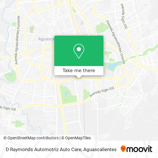
See D Raymonds Automotriz Auto Care, Aguascalientes, on the map
Public Transit to D Raymonds Automotriz Auto Care in Aguascalientes
Wondering how to get to D Raymonds Automotriz Auto Care in Aguascalientes? Moovit helps you find the best way to get to D Raymonds Automotriz Auto Care with step-by-step directions from the nearest public transit station.
Moovit provides free maps and live directions to help you navigate through your city. View schedules, routes, timetables, and find out how long does it take to get to D Raymonds Automotriz Auto Care in real time.
Looking for the nearest stop or station to D Raymonds Automotriz Auto Care? Check out this list of stops closest to your destination: Aguascalientes Sur; Avenida Aguascalientes Sur; Avenida Aguascalientes Sur; Avenida Héroe De Nacozari.
Bus: RUTA 02, RUTA 28, RUTA 37, RUTA 40, RUTA 42, RUTA 07, RUTA 18, RUTA 36.
Want to see if there’s another route that gets you there at an earlier time? Moovit helps you find alternative routes or times. Get directions from and directions to D Raymonds Automotriz Auto Care easily from the Moovit App or Website.
We make riding to D Raymonds Automotriz Auto Care easy, which is why over 1.5 million users, including users in Aguascalientes, trust Moovit as the best app for public transit. You don’t need to download an individual bus app or train app, Moovit is your all-in-one transit app that helps you find the best bus time or train time available.
For information on prices of bus, costs and ride fares to D Raymonds Automotriz Auto Care, please check the Moovit app.
Use the app to navigate to popular places including to the airport, hospital, stadium, grocery store, mall, coffee shop, school, college, and university.
D Raymonds Automotriz Auto Care Address: D Raymonds Automotriz Auto Care, Avenida Aguascalientes Sur 507, Fraccionamiento México, 20270 Agua street in Aguascalientes
- Bbva Bancomer,
- Balconeria Jauregui,
- Union Bank of Switzerland,
- Tortillas de Harina Nieto,
- Tienda de Abarrotes Paty,
- Quinta Real Aguascalientes,
- Fraccionamiento México,
- Centros Euroestetica Aguascalientes,
- Yotsuba Sushi,
- La Crepería Fd Rev,
- Laboratorios Analíticos Sinai,
- Pollos Rostizados,
- Concordia Aguascalientes, S.A. de C.V.,
- Los Reyes del Chicharrón,
- Uñas Yoya,
- Agro Industrial Hidraulica,
- Vidrio y Aluminio Cervantes,
- Refacciones para Linea Blanca,
- Refacc Nueva,
- Tostes Veterinaria
Places Near D Raymonds Automotriz Auto Care (Aguascalientes)
- Villasuncion, Aguascalientes,
- Parque Las Tres Centurias, Aguascalientes,
- clinica 3 uaa, Aguascalientes,
- Hospital Imss No. 3, Aguascalientes,
- Centro Comercial Altaria, Aguascalientes,
- Nuevo Hospital Hidalgo, Aguascalientes,
- Jesús María, Aguascalientes,
- Central De Autobuses, Aguascalientes,
- Ciudad industrial, Aguascalientes,
- Universidad Autónoma de Aguascalientes, Aguascalientes,
- Aeropuerto de Aguascalientes S.A. de C.V., Aguascalientes,
- Villas de Nuestra Señora de la Asunción, Aguascalientes,
- Imss Clinica 1, Aguascalientes,
- Agropecuario, Aguascalientes,
- ESPACIOS, Aguascalientes,
- La Isla San Marcos, Aguascalientes,
- Blvd. Luis Donaldo Colosio, Aguascalientes,
- Terminal De Combis, Aguascalientes,
- Centro, Aguascalientes,
- Isla San Marcos, Aguascalientes
How to get to popular places in Aguascalientes with public transit
Get around Aguascalientes by public transit!
Traveling around Aguascalientes has never been so easy. See step by step directions as you travel to any attraction, street or major public transit station. View bus and train schedules, arrival times, service alerts and detailed routes on a map, so you know exactly how to get to anywhere in Aguascalientes.
When traveling to any destination around Aguascalientes use Moovit's Live Directions with Get Off Notifications to know exactly where and how far to walk, how long to wait for your line, and how many stops are left. Moovit will alert you when it's time to get off — no need to constantly re-check whether yours is the next stop.
Wondering how to use public transit in Aguascalientes or how to pay for public transit in Aguascalientes? Moovit public transit app can help you navigate your way with public transit easily, and at minimum cost. It includes public transit fees, ticket prices, and costs. Looking for a map of Aguascalientes public transit lines? Moovit public transit app shows all public transit maps in Aguascalientes with all bus routes and stops on an interactive map.
Aguascalientes has 1 transit type(s), including: bus, operated by several transit agencies, including Coordinación General de Movilidad