How to get to D St Chaplin St SE by bus?
Click on the bus route to see step by step directions with maps, line arrival times and updated time schedules.
From Hilton Arlington National Landing, Arlington County
126 minFrom Wework 655 New York Ave NW, Washington
44 minFrom Hampton Inn Crystal City, Arlington County
125 minFrom Hilton Garden Inn Reagan National Airport, Arlington County
127 minFrom Gordon Ramsay Hell's Kitchen, Washington
57 minFrom Yours Truly, Washington
67 minFrom Basilica of the National Shrine of the Immaculate Conception, Washington
81 minFrom The Westin Crystal City Hotel, Arlington County
125 minFrom Northwestern High School, Prince George's County
88 minFrom U.S. Department of State, Harry S Truman Building, Washington
80 min
How to get to D St Chaplin St SE by metro?
Click on the metro route to see step by step directions with maps, line arrival times and updated time schedules.
From Hilton Arlington National Landing, Arlington County
49 minFrom Wework 655 New York Ave NW, Washington
41 minFrom Hampton Inn Crystal City, Arlington County
53 minFrom Hilton Garden Inn Reagan National Airport, Arlington County
54 minFrom Gordon Ramsay Hell's Kitchen, Washington
42 minFrom Yours Truly, Washington
44 minFrom Basilica of the National Shrine of the Immaculate Conception, Washington
53 minFrom The Westin Crystal City Hotel, Arlington County
51 minFrom Northwestern High School, Prince George's County
70 minFrom U.S. Department of State, Harry S Truman Building, Washington
47 min
Bus stops near D St Chaplin St SE in Washington
Metro stations near D St Chaplin St SE in Washington
Bus lines to D St Chaplin St SE in Washington
What are the closest stations to D St Chaplin St SE?
The closest stations to D St Chaplin St SE are:
- Texas Av Se+Chaplin St SE is 199 yards away, 3 min walk.
- Ely Pl Se+Ridge Rd SE is 963 yards away, 12 min walk.
- Benning Rd Metro Station is 3633 yards away, 43 min walk.
- Deanwood Metro Station is 4098 yards away, 48 min walk.
Which bus lines stop near D St Chaplin St SE?
These bus lines stop near D St Chaplin St SE: C23, C37, D24.
Which metro lines stop near D St Chaplin St SE?
These metro lines stop near D St Chaplin St SE: BLUE, SILVER.
What’s the nearest bus station to D St Chaplin St SE in Washington?
The nearest bus station to D St Chaplin St SE in Washington is Texas Av Se+Chaplin St SE. It’s a 3 min walk away.
What time is the first metro to D St Chaplin St SE in Washington?
The BLUE is the first metro that goes to D St Chaplin St SE in Washington. It stops nearby at 5:01 AM.
What time is the last metro to D St Chaplin St SE in Washington?
The ORANGE is the last metro that goes to D St Chaplin St SE in Washington. It stops nearby at 12:28 AM.
What time is the first bus to D St Chaplin St SE in Washington?
The C37 is the first bus that goes to D St Chaplin St SE in Washington. It stops nearby at 4:35 AM.
What time is the last bus to D St Chaplin St SE in Washington?
The C37 is the last bus that goes to D St Chaplin St SE in Washington. It stops nearby at 2:28 AM.
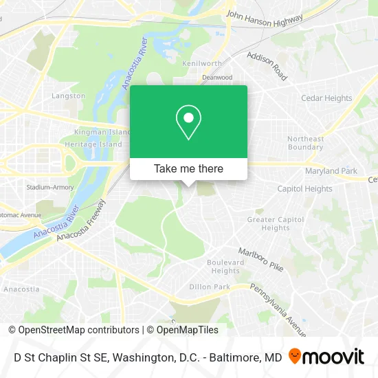
See D St Chaplin St SE, Washington, on the map
Public Transit to D St Chaplin St SE in Washington
Wondering how to get to D St Chaplin St SE in Washington? Moovit helps you find the best way to get to D St Chaplin St SE with step-by-step directions from the nearest public transit station.
Moovit provides free maps and live directions to help you navigate through your city. View schedules, routes, timetables, and find out how long does it take to get to D St Chaplin St SE in real time.
Looking for the nearest stop or station to D St Chaplin St SE? Check out this list of stops closest to your destination: Texas Av Se+Chaplin St SE; Ely Pl Se+Ridge Rd SE; Benning Rd Metro Station; Deanwood Metro Station.
Bus: C23, C37, D24, C35.Metro: BLUE, SILVER, ORANGE.
Want to see if there’s another route that gets you there at an earlier time? Moovit helps you find alternative routes or times. Get directions from and directions to D St Chaplin St SE easily from the Moovit App or Website.
We make riding to D St Chaplin St SE easy, which is why over 1.5 million users, including users in Washington, trust Moovit as the best app for public transit. You don’t need to download an individual bus app or train app, Moovit is your all-in-one transit app that helps you find the best bus time or train time available.
For information on prices of bus and metro, costs and ride fares to D St Chaplin St SE, please check the Moovit app.
Use the app to navigate to popular places including to the airport, hospital, stadium, grocery store, mall, coffee shop, school, college, and university.
D St Chaplin St SE Address: Washington, DC 20019 street in Washington
- Mackie's Tax and Accounting Service,
- Texas Ave SE & F,
- F St SE Building 4366,
- Dr Griffin Doyle,
- Seed Public Charter School (SEED School of Washington, D.C.),
- Fort DuPont Park,
- Olqp Summer Enrichment Camp,
- Our Lady Queen Of Peace Catholic Church,
- Ece Is Life,
- 200 Stoddert Pl SE,
- 41st St NE and E Capitol St,
- U8 bus stop,
- DC Public Library,
- Historic Woodlawn Cemetery,
- Benning Road DMV,
- Benning Rd SE (benning road and E St SE),
- Bennington Station DC,
- DC Housing Authority,
- Benning Rd NE (benning road and E Capitol St SE),
- Shrimp Boat
Places Near D St Chaplin St SE (Washington)
- PG Mall, Prince George's County,
- Museum Of The Bible, Washington,
- National Museum of African American History and Culture, Washington,
- Sibley Memorial Hospital, Washington,
- Amazon Hq2, Arlington County,
- Rock Creek Tennis Center, Washington,
- Georgetown, Washington,
- National Mall, Washington,
- Washington National Cathedral, Washington,
- Marriott Marquis Washington, DC, Washington,
- Warner Theatre, Washington,
- The Anthem, Washington,
- Westfield Montgomery Mall, Montgomery County,
- Basilica of the National Shrine, Washington,
- Washington DC VA Medical Center, Washington,
- M&T Bank Stadium, Baltimore,
- Camden Yards, Baltimore,
- National Zoo, Washington,
- Capital One Arena, Washington,
- Pennsylvania Ave NW (3rd st and pennsylvania), Washington
How to get to popular places in Washington, D.C. - Baltimore, MD with public transit
Get around Washington by public transit!
Traveling around Washington has never been so easy. See step by step directions as you travel to any attraction, street or major public transit station. View bus and train schedules, arrival times, service alerts and detailed routes on a map, so you know exactly how to get to anywhere in Washington.
When traveling to any destination around Washington use Moovit's Live Directions with Get Off Notifications to know exactly where and how far to walk, how long to wait for your line, and how many stops are left. Moovit will alert you when it's time to get off — no need to constantly re-check whether yours is the next stop.
Wondering how to use public transit in Washington or how to pay for public transit in Washington? Moovit public transit app can help you navigate your way with public transit easily, and at minimum cost. It includes public transit fees, ticket prices, and costs. Looking for a map of Washington public transit lines? Moovit public transit app shows all public transit maps in Washington with all Bus, Train, Metro, Light Rail and Ferry routes and stops on an interactive map.
Washington, D.C. - Baltimore, MD has 5 transit type(s), including: Bus, Train, Metro, Light Rail and Ferry, operated by several transit agencies, including WMATA, Montgomery County Ride On, Fairfax Connector, TheBus, PRTC, DASH - Alexandria, Arlington Transit (ART), RTA of Central Maryland, MDOT MTA, MDOT MTA Light RailLink, MDOT MTA Commuter Bus, MDOT MTA Local Bus, FXBGO!, Virginia Railway Express (VRE) and MARC