How to get to Da Lucio by bus?
Click on the bus route to see step by step directions with maps, line arrival times and updated time schedules.
From GRN-Klinik Schwetzingen, Schwetzingen
107 minFrom Thoraxklinik Heidelberg, Neuenheim
130 minFrom Möbel Höffner, Schwetzingen
76 minFrom Hans-Warsch-Platz,Ludwigshafen Oggersheim, Ludwigshafen-Oggersheim
93 minFrom Universitätsklinikum Heidelberg-Notaufnahme, Neuenheim
127 minFrom Globus Getränkecenter, Ludwigshafen-Oggersheim
289 minFrom Globus Getränkemarkt, Ludwigshafen-Oggersheim
290 minFrom Berufsbildende Schule Technik 2, Ludwigshafen-Mundenheim
191 minFrom Marie-Baum-Schule Heidelberg, Wieblingen
128 min
How to get to Da Lucio by train?
Click on the train route to see step by step directions with maps, line arrival times and updated time schedules.
From GRN-Klinik Schwetzingen, Schwetzingen
70 minFrom Möbel Höffner, Schwetzingen
66 minFrom Hans-Warsch-Platz,Ludwigshafen Oggersheim, Ludwigshafen-Oggersheim
79 minFrom Berufsbildende Schule Technik 2, Ludwigshafen-Mundenheim
77 minFrom Krankenhaus GRN, Weinheim
100 minFrom Marie-Baum-Schule Heidelberg, Wieblingen
77 min
Bus stops near Da Lucio in Neckarstadt-Ost/Wohlgelegen
Light Rail stations near Da Lucio in Neckarstadt-Ost/Wohlgelegen
Bus lines to Da Lucio in Neckarstadt-Ost/Wohlgelegen
What are the closest stations to Da Lucio?
The closest stations to Da Lucio are:
- Mannheim, Leoniweg is 328 meters away, 5 min walk.
- Leoniweg is 341 meters away, 5 min walk.
- Ulmenweg is 399 meters away, 6 min walk.
- Mannheim, Landwehrstraße Bstg B is 404 meters away, 6 min walk.
- Käfertal, Boveristeg is 771 meters away, 11 min walk.
Which train lines stop near Da Lucio?
These train lines stop near Da Lucio: S10, S9.
Which light rail lines stop near Da Lucio?
These light rail lines stop near Da Lucio: 4, 4A, 5, RNV 4.
Which bus lines stop near Da Lucio?
These bus lines stop near Da Lucio: RNV 50, RNV 6, RNV 60.
What’s the nearest light rail station to Da Lucio in Neckarstadt-Ost/Wohlgelegen?
The nearest light rail stations to Da Lucio in Neckarstadt-Ost/Wohlgelegen are Ulmenweg and Mannheim, Landwehrstraße Bstg B. The closest one is a 6 min walk away.
What’s the nearest bus station to Da Lucio in Neckarstadt-Ost/Wohlgelegen?
The nearest bus stations to Da Lucio in Neckarstadt-Ost/Wohlgelegen are Mannheim, Leoniweg and Leoniweg. The closest one is a 5 min walk away.
What time is the first light rail to Da Lucio in Neckarstadt-Ost/Wohlgelegen?
The 4 is the first light rail that goes to Da Lucio in Neckarstadt-Ost/Wohlgelegen. It stops nearby at 3:36 AM.
What time is the last light rail to Da Lucio in Neckarstadt-Ost/Wohlgelegen?
The RNV 4 is the last light rail that goes to Da Lucio in Neckarstadt-Ost/Wohlgelegen. It stops nearby at 2:03 AM.
What time is the first bus to Da Lucio in Neckarstadt-Ost/Wohlgelegen?
The RNV 58 is the first bus that goes to Da Lucio in Neckarstadt-Ost/Wohlgelegen. It stops nearby at 5:25 AM.
What time is the last bus to Da Lucio in Neckarstadt-Ost/Wohlgelegen?
The RNV 60 is the last bus that goes to Da Lucio in Neckarstadt-Ost/Wohlgelegen. It stops nearby at 1:22 AM.
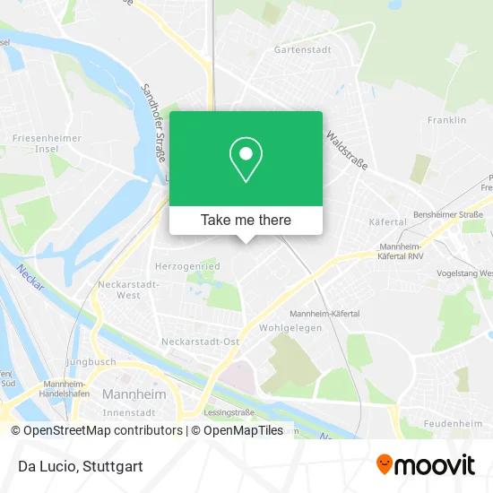
See Da Lucio, Neckarstadt-Ost/Wohlgelegen, on the map
Public Transit to Da Lucio in Neckarstadt-Ost/Wohlgelegen
Wondering how to get to Da Lucio in Neckarstadt-Ost/Wohlgelegen? Moovit helps you find the best way to get to Da Lucio with step-by-step directions from the nearest public transit station.
Moovit provides free maps and live directions to help you navigate through your city. View schedules, routes, timetables, and find out how long does it take to get to Da Lucio in real time.
Looking for the nearest stop or station to Da Lucio? Check out this list of stops closest to your destination: Mannheim; Leoniweg; Ulmenweg; Mannheim; Käfertal.
Train: S10, S9.Light Rail: 4, 4A, 5, RNV 4.Bus: RNV 50, RNV 6, RNV 60, 60, 60E, RNV 58.
Want to see if there’s another route that gets you there at an earlier time? Moovit helps you find alternative routes or times. Get directions from and directions to Da Lucio easily from the Moovit App or Website.
We make riding to Da Lucio easy, which is why over 1.5 million users, including users in Neckarstadt-Ost/Wohlgelegen, trust Moovit as the best app for public transit. You don’t need to download an individual bus app or train app, Moovit is your all-in-one transit app that helps you find the best bus time or train time available.
For information on prices of bus, light rail and train, costs and ride fares to Da Lucio, please check the Moovit app.
Use the app to navigate to popular places including to the airport, hospital, stadium, grocery store, mall, coffee shop, school, college, and university.
Da Lucio Address: An der Radrennbahn 8 68169 Mannheim street in Neckarstadt-Ost/Wohlgelegen
- Zum Treiber,
- Shemrun Restaurant,
- Mannheimia,
- Kleintierzüchterverein 1902 Vorwärts,
- Kleintierzuchtverein Fortschritt E. V.,
- Gaststätte Des Kleintierzuchtverein Fortschritt E. V.,
- Zur Hexe,
- Kleintierzüchterverein Fortschritt,
- Die Kleine Kneipe,
- SOS-Mittelständler in Not,
- Erwin Feike Gas Wasser Sanitärinstallationen,
- Leo Sun,
- Süddeutscher Schutz-und Polizeihundeverein,
- Tapas y Mas,
- Gaststätte Des Sspv,
- Photouniversum,
- Polizeipräsidium Mannheim Verkehrsdienst,
- Rudi Und Willi Altig Radstadion,
- Rapidapps,
- Viridio
Places Near Da Lucio (Neckarstadt-Ost/Wohlgelegen)
- Waldfriedhof, Degerloch,
- Schleyerhalle, Bad Cannstatt,
- Geilhaus Haus 33a, Reutlingen-Betzingen,
- SI-Centrum, Möhringen,
- Porsche-Arena, Bad Cannstatt,
- Pariser Platz Stuttgart, Stuttgart-Mitte,
- Hauptbahnhof Stuttgart, Stuttgart-Mitte,
- FlixBus Haltestelle, Stuttgart,
- Mercedes-Benz Museum, Bad Cannstatt,
- Klinikum Stuttgart - Katharinenhospital, Stuttgart-Mitte,
- Mercedes-Benz Museum (Mercedes Museum Stuttgart), Bad Cannstatt,
- Gasometer Pforzheim, Pforzheim,
- Wilhelma (U-Bahn Wilhelma), Bad Cannstatt,
- Gleis 101/102 (tief), Stuttgart-Mitte,
- Porsche Museum, Zuffenhausen,
- Hanns-Martin-Schleyer-Halle (Stuttgart Hans-Martin-Schleyerhalle), Bad Cannstatt,
- Marmorsaal Im Weissenburgpark, Stuttgart-Süd,
- Im Wizemann (Halle), Bad Cannstatt,
- Mettingen Eros-Center Puff Laufhaus, Esslingen Am Neckar,
- Hanns-Martin-Schleyer-Halle, Bad Cannstatt
How to get to popular places in Stuttgart with public transit
Get around Neckarstadt-Ost/Wohlgelegen by public transit!
Traveling around Neckarstadt-Ost/Wohlgelegen has never been so easy. See step by step directions as you travel to any attraction, street or major public transit station. View bus and train schedules, arrival times, service alerts and detailed routes on a map, so you know exactly how to get to anywhere in Neckarstadt-Ost/Wohlgelegen.
When traveling to any destination around Neckarstadt-Ost/Wohlgelegen use Moovit's Live Directions with Get Off Notifications to know exactly where and how far to walk, how long to wait for your line, and how many stops are left. Moovit will alert you when it's time to get off — no need to constantly re-check whether yours is the next stop.
Wondering how to use public transit in Neckarstadt-Ost/Wohlgelegen or how to pay for public transit in Neckarstadt-Ost/Wohlgelegen? Moovit public transit app can help you navigate your way with public transit easily, and at minimum cost. It includes public transit fees, ticket prices, and costs. Looking for a map of Neckarstadt-Ost/Wohlgelegen public transit lines? Moovit public transit app shows all public transit maps in Neckarstadt-Ost/Wohlgelegen with all Bus, Train, Subway, Light Rail, Ferry, S-Bahn and Funicular routes and stops on an interactive map.
Stuttgart has 7 transit type(s), including: Bus, Train, Subway, Light Rail, Ferry, S-Bahn and Funicular, operated by several transit agencies, including SSB - Stadtbahn, SSB, SSB - Seilbahn / Zacke, S-Bahn Stuttgart, Rhein-Neckar-Verkehr GmbH (rnv), Karlsruher Verkehrsverbund, DB AG, DB Regiobus BW, Arverio Baden-Württemberg GmbH, DB RegioNetz Verkehrs GmbH Westfrankenbahn, DB Regio AG Baden-Württemberg, Südwestdeutsche Verkehrs-AG, DB Regio AG Mitte Region Hessen, DB and Bodensee-Oberschwaben-Bahn