How to get to Dade Farm Store by bus?
Click on the bus route to see step by step directions with maps, line arrival times and updated time schedules.
From Miami Open Tennis, Key Biscayne
81 minFrom Jackson memorial hospital West Wing, Miami
68 minFrom Hilton-Miami Downtown, Miami
85 minFrom Hampton Inn Suites Miami Wynwood Design District FL, Miami
78 minFrom Even Hotel Miami - Airport, An Ihg Hotel, Miami
39 minFrom Silverspot Cinema, Miami
63 minFrom AC Hotel-Miami Wynwood, Miami
79 minFrom San Marco Island, Miami
99 minFrom Mall Of The Americas, North Westside
53 minFrom Biscayne Blvd, Miami
77 min
How to get to Dade Farm Store by train?
Click on the train route to see step by step directions with maps, line arrival times and updated time schedules.
Bus stops near Dade Farm Store in Miami
Train station near Dade Farm Store in Miami
- University, 24 min walk,VIEW
Bus lines to Dade Farm Store in Miami
What are the closest stations to Dade Farm Store?
The closest stations to Dade Farm Store are:
- Ponce De Leon Blvd@cadima Av is 264 yards away, 4 min walk.
- Sw 37 Av & Sw 28 St is 340 yards away, 4 min walk.
- Douglas Park is 495 yards away, 6 min walk.
- University is 1946 yards away, 24 min walk.
Which bus lines stop near Dade Farm Store?
These bus lines stop near Dade Farm Store: 37, MIACOCO.
Which train lines stop near Dade Farm Store?
These train lines stop near Dade Farm Store: GREEN, ORANGE.
What’s the nearest train station to Dade Farm Store in Miami?
The nearest train station to Dade Farm Store in Miami is University. It’s a 24 min walk away.
What’s the nearest bus station to Dade Farm Store in Miami?
The nearest bus stations to Dade Farm Store in Miami are Ponce De Leon Blvd@cadima Av and Sw 37 Av & Sw 28 St. The closest one is a 4 min walk away.
What time is the first train to Dade Farm Store in Miami?
The GREEN is the first train that goes to Dade Farm Store in Miami. It stops nearby at 5:06 AM.
What time is the last train to Dade Farm Store in Miami?
The GREEN is the last train that goes to Dade Farm Store in Miami. It stops nearby at 12:58 AM.
What time is the first bus to Dade Farm Store in Miami?
The 37 is the first bus that goes to Dade Farm Store in Miami. It stops nearby at 4:22 AM.
What time is the last bus to Dade Farm Store in Miami?
The 37 is the last bus that goes to Dade Farm Store in Miami. It stops nearby at 1:39 AM.
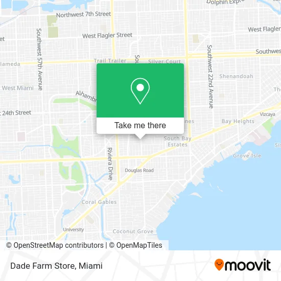
See Dade Farm Store, Miami, on the map
Public Transit to Dade Farm Store in Miami
Wondering how to get to Dade Farm Store in Miami? Moovit helps you find the best way to get to Dade Farm Store with step-by-step directions from the nearest public transit station.
Moovit provides free maps and live directions to help you navigate through your city. View schedules, routes, timetables, and find out how long does it take to get to Dade Farm Store in real time.
Looking for the nearest stop or station to Dade Farm Store? Check out this list of stops closest to your destination: Ponce De Leon Blvd@cadima Av; Sw 37 Av & Sw 28 St; Douglas Park; University.
Bus: 37, MIACOCO, CGABLE.Train: GREEN, ORANGE.
Want to see if there’s another route that gets you there at an earlier time? Moovit helps you find alternative routes or times. Get directions from and directions to Dade Farm Store easily from the Moovit App or Website.
We make riding to Dade Farm Store easy, which is why over 1.5 million users, including users in Miami, trust Moovit as the best app for public transit. You don’t need to download an individual bus app or train app, Moovit is your all-in-one transit app that helps you find the best bus time or train time available.
For information on prices of bus, train and light rail, costs and ride fares to Dade Farm Store, please check the Moovit app.
Use the app to navigate to popular places including to the airport, hospital, stadium, grocery store, mall, coffee shop, school, college, and university.
Dade Farm Store Address: 2756 SW 37th Ave Miami, FL 33133 street in Miami
- Dr. Daniel Alfonso,
- Empowered Living Chiro,
- McHarry and Associates,
- Innovative Pediatric Learning Center of Miami,
- Janita Lindsay MS,
- Triumph Steps,
- Douglas Place Condominiums,
- America Cell USA Coconut Grove,
- Lannes & Garcia,
- MVP Korean Massage,
- Transekur,
- Actsys Garage Doors,
- Eastern Medical,
- Florida Health Clinic,
- Yill Health,
- Hernan Rodriguez DMD,
- Adobetec,
- Sanitas Medical Center - Coral Gables,
- One Oculoplastics,
- Avarbock Chamorro Dermatology
Places Near Dade Farm Store (Miami)
- Zoo Miami, Miami,
- Dolphin Mall Bus, Miami,
- Bayside Marketplace, Miami,
- Hard Rock Stadium, Miami Gardens,
- Dolphin Mall, Miami,
- Miami VA Hospital, Miami,
- Miami-Dade County Courthouse, Miami,
- Port of Miami Cruise Terminal, Miami,
- Sawgrass Mall, Miami,
- Aventura Mall, Miami Beach,
- Brickell City Centre, Miami,
- Marlins Park, Miami,
- Keiser University Flagship Campus, West Palm Beach,
- Little Havana, Miami,
- Richard E. Gerstein Justice Building, Miami,
- Sawgrass mall ( FL ), Miami Beach,
- Miami Freedom Park, Miami,
- Aventura Mall, Miami,
- Wynwood, Miami,
- Miami Design District, Miami
How to get to popular places in Miami with public transit
Get around Miami by public transit!
Traveling around Miami has never been so easy. See step by step directions as you travel to any attraction, street or major public transit station. View bus and train schedules, arrival times, service alerts and detailed routes on a map, so you know exactly how to get to anywhere in Miami.
When traveling to any destination around Miami use Moovit's Live Directions with Get Off Notifications to know exactly where and how far to walk, how long to wait for your line, and how many stops are left. Moovit will alert you when it's time to get off — no need to constantly re-check whether yours is the next stop.
Wondering how to use public transit in Miami or how to pay for public transit in Miami? Moovit public transit app can help you navigate your way with public transit easily, and at minimum cost. It includes public transit fees, ticket prices, and costs. Looking for a map of Miami public transit lines? Moovit public transit app shows all public transit maps in Miami with all Bus, Train, Light Rail and Ferry routes and stops on an interactive map.
Miami has 4 transit type(s), including: Bus, Train, Light Rail and Ferry, operated by several transit agencies, including Broward County Transit, Miami-Dade Transit, Metrorail, Palm Tran, Tri-Rail, Brightline, MARTY, City of Homestead Trolley, Key West Transit, Treasure Coast Connector, GoLine IRT, Amtrak, Greyhound-us, FlixBus-us and Aventura Express Shuttle Bus