Directions to Daingerfield Island (Alexandria) with public transportation
The following transit lines have routes that pass near Daingerfield Island
 Bus: 34, 43, A1X, A70, F19.
- Train: MANASSAS LINE, FREDERICKSBURG LINE.
- Metro: BLUE, YELLOW.
How to get to Daingerfield Island by bus?
Click on the bus route to see step by step directions with maps, line arrival times and updated time schedules.
From HYATT house Washington DC/the Wharf, Washington
131 minFrom Omni Shoreham Hotel, Washington
110 minFrom Children's Hospital, Washington
126 minFrom The Normandy Hotel, Washington
128 minFrom Howard University, Washington
145 minFrom Astoria, Washington
94 minFrom Ivy City, Washington
161 minFrom White House, Washington
119 minFrom Glover Park, Washington
114 minFrom Proper 21, Washington
96 min
How to get to Daingerfield Island by train?
Click on the train route to see step by step directions with maps, line arrival times and updated time schedules.
How to get to Daingerfield Island by metro?
Click on the metro route to see step by step directions with maps, line arrival times and updated time schedules.
From HYATT house Washington DC/the Wharf, Washington
67 minFrom Omni Shoreham Hotel, Washington
71 minFrom Children's Hospital, Washington
75 minFrom The Normandy Hotel, Washington
76 minFrom Howard University, Washington
76 minFrom Astoria, Washington
74 minFrom White House, Washington
70 minFrom Proper 21, Washington
66 min
Train station near Daingerfield Island in Alexandria
- Crystal City, 10 min walk,VIEW
Metro station near Daingerfield Island in Alexandria
- Braddock Rd - North Side Braddock Rd. at West St., 13 min walk,VIEW
Bus stops near Daingerfield Island in Alexandria
Bus lines to Daingerfield Island in Alexandria
What are the closest stations to Daingerfield Island?
The closest stations to Daingerfield Island are:
- Crystal City is 773 yards away, 10 min walk.
- Braddock Rd - North Side Braddock Rd. at West St. is 1045 yards away, 13 min walk.
- Potomac Av+E Reed Av is 2644 yards away, 31 min walk.
- Potomac Yard Center is 2725 yards away, 32 min walk.
- Potomac Yard+Bus Bay C is 3088 yards away, 36 min walk.
Which bus lines stop near Daingerfield Island?
These bus lines stop near Daingerfield Island: 34, 43, A1X, A70, F19.
Which train line stops near Daingerfield Island?
MANASSAS LINE (Broad Run)
Which metro lines stop near Daingerfield Island?
These metro lines stop near Daingerfield Island: BLUE, YELLOW.
What’s the nearest metro station to Daingerfield Island in Alexandria?
The nearest metro station to Daingerfield Island in Alexandria is Braddock Rd - North Side Braddock Rd. at West St.. It’s a 13 min walk away.
What’s the nearest train station to Daingerfield Island in Alexandria?
The nearest train station to Daingerfield Island in Alexandria is Crystal City. It’s a 10 min walk away.
What time is the first metro to Daingerfield Island in Alexandria?
The YELLOW is the first metro that goes to Daingerfield Island in Alexandria. It stops nearby at 5:06 AM.
What time is the last metro to Daingerfield Island in Alexandria?
The YELLOW is the last metro that goes to Daingerfield Island in Alexandria. It stops nearby at 12:33 AM.
What time is the first train to Daingerfield Island in Alexandria?
The MANASSAS LINE is the first train that goes to Daingerfield Island in Alexandria. It stops nearby at 6:04 AM.
What time is the last train to Daingerfield Island in Alexandria?
The MANASSAS LINE is the last train that goes to Daingerfield Island in Alexandria. It stops nearby at 7:15 PM.
What time is the first bus to Daingerfield Island in Alexandria?
The 33 is the first bus that goes to Daingerfield Island in Alexandria. It stops nearby at 5:00 AM.
What time is the last bus to Daingerfield Island in Alexandria?
The A70 is the last bus that goes to Daingerfield Island in Alexandria. It stops nearby at 1:00 AM.
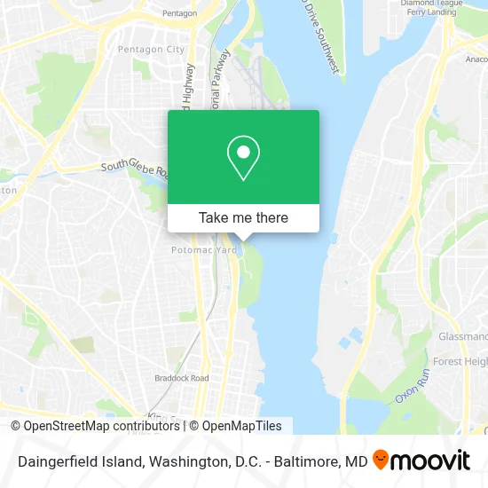
See Daingerfield Island, Alexandria, on the map
Public Transit to Daingerfield Island in Alexandria
Wondering how to get to Daingerfield Island in Alexandria? Moovit helps you find the best way to get to Daingerfield Island with step-by-step directions from the nearest public transit station.
Moovit provides free maps and live directions to help you navigate through your city. View schedules, routes, timetables, and find out how long does it take to get to Daingerfield Island in real time.
Looking for the nearest stop or station to Daingerfield Island? Check out this list of stops closest to your destination: Crystal City; Braddock Rd - North Side Braddock Rd. at West St.; Potomac Av+E Reed Av; Potomac Yard Center; Potomac Yard+Bus Bay C.
Bus: 34, 43, A1X, A70, F19, 33, 36A, 36B.Train: MANASSAS LINE, FREDERICKSBURG LINE.Metro: BLUE, YELLOW.
Want to see if there’s another route that gets you there at an earlier time? Moovit helps you find alternative routes or times. Get directions from and directions to Daingerfield Island easily from the Moovit App or Website.
We make riding to Daingerfield Island easy, which is why over 1.7 million users, including users in Alexandria, trust Moovit as the best app for public transit. You don’t need to download an individual bus app or train app, Moovit is your all-in-one transit app that helps you find the best bus time or train time available.
For information on prices of bus, metro and train, costs and ride fares to Daingerfield Island, please check the Moovit app.
Use the app to navigate to popular places including to the airport, hospital, stadium, grocery store, mall, coffee shop, school, college, and university.
Daingerfield Island Address: 1 Marina Dr street in Alexandria
- Washington Sailing Marina,
- Daingerfield Island Sailing Club,
- Daingerfield Island,
- Potomac Yard / Potomac Greens, Virginia,
- Potomac Yard Metro Station,
- Colpark Loc 45,
- Avalon Potomac Yard,
- STARBUCKS,
- Potomac Yard Shopping Center - Staples / Petsmart,
- Target Alexandria,
- Richmond Hwy and Glebe Rd,
- The Frasier,
- Omar's Pitas & Platters,
- Barnes & Noble,
- Cpyr Shopping Center,
- Amazon Fresh-Alexandria,
- Navy Federal Credit Union,
- Potomac Yard Shuttle,
- TW&M 221 Pos,
- The World Bank
Places Near Daingerfield Island (Alexandria)
- National Theatre, Washington,
- Capital One Arena, Washington,
- Rock Creek Tennis Center, Washington,
- Westfield Montgomery Mall, Montgomery County,
- The Anthem, Washington,
- Pennsylvania Ave NW (3rd st and pennsylvania), Washington,
- Warner Theatre, Washington,
- Camden Yards, Baltimore,
- M&T Bank Stadium, Baltimore,
- PG Mall, Prince George's County,
- Georgetown, Washington,
- Museum Of The Bible, Washington,
- Marriott Marquis Washington, DC, Washington,
- Sibley Memorial Hospital, Washington,
- Amazon Hq2, Arlington County,
- National Zoo, Washington,
- National Museum of African American History and Culture, Washington,
- Washington DC VA Medical Center, Washington,
- Washington National Cathedral, Washington,
- Basilica of the National Shrine, Washington
How to get to popular places in Washington, D.C. - Baltimore, MD with public transit
Get around Alexandria by public transit!
Traveling around Alexandria has never been so easy. See step by step directions as you travel to any attraction, street or major public transit station. View bus and train schedules, arrival times, service alerts and detailed routes on a map, so you know exactly how to get to anywhere in Alexandria.
When traveling to any destination around Alexandria use Moovit's Live Directions with Get Off Notifications to know exactly where and how far to walk, how long to wait for your line, and how many stops are left. Moovit will alert you when it's time to get off — no need to constantly re-check whether yours is the next stop.
Wondering how to use public transit in Alexandria or how to pay for public transit in Alexandria? Moovit public transit app can help you navigate your way with public transit easily, and at minimum cost. It includes public transit fees, ticket prices, and costs. Looking for a map of Alexandria public transit lines? Moovit public transit app shows all public transit maps in Alexandria with all Bus, Train, Metro, Light Rail and Ferry routes and stops on an interactive map.
Washington, D.C. - Baltimore, MD has 5 transit type(s), including: Bus, Train, Metro, Light Rail and Ferry, operated by several transit agencies, including WMATA, Montgomery County Ride On, Fairfax Connector, TheBus, PRTC, DASH - Alexandria, Arlington Transit (ART), RTA of Central Maryland, MDOT MTA, MDOT MTA Light RailLink, MDOT MTA Commuter Bus, MDOT MTA Local Bus, FXBGO!, Virginia Railway Express (VRE) and MARC