Daly / Broadway stop - Tuesday schedule
| Line | Direction | Time |
|---|---|---|
| 251 | Lynwood C Line Station | 4:31 AM |
| 251 | Lynwood C Line Station | 4:48 AM |
| 251 | Lynwood C Line Station | 5:03 AM |
| 251 | Lynwood C Line Station | 5:18 AM |
| 251 | Lynwood C Line Station | 5:32 AM |
| 251 | Lynwood C Line Station | 5:44 AM |
| 251 | Lynwood C Line Station | 5:54 AM |
| 251 | Lynwood C Line Station | 6:03 AM |
| 251 | Lynwood C Line Station | 6:13 AM |
| 251 | Lynwood C Line Station | 6:23 AM |
| DASH | Counter Clockwise | 6:31 AM |
| 251 | Lynwood C Line Station | 6:32 AM |
| 251 | Lynwood C Line Station | 6:42 AM |
| 251 | Lynwood C Line Station | 6:52 AM |
| DASH | Counter Clockwise | 7:01 AM |
| 251 | Lynwood C Line Station | 7:02 AM |
| 251 | Lynwood C Line Station | 7:13 AM |
| 251 | Lynwood C Line Station | 7:23 AM |
| 251 | Lynwood C Line Station | 7:30 AM |
| DASH | Counter Clockwise | 7:31 AM |
| 251 | Lynwood C Line Station | 7:37 AM |
| 251 | Lynwood C Line Station | 7:45 AM |
| 251 | Lynwood C Line Station | 7:53 AM |
| DASH | Counter Clockwise | 8:01 AM |
| 251 | Lynwood C Line Station | 8:03 AM |
Directions to Daly / Broadway stop (Lincoln Heights) with public transit
The following transit lines have routes that pass near Daly / Broadway
 Bus: 251, 45, DASH, 182.
- Subway: A LINE.
- Train: AV LINE, OC LINE, RIV LINE, SB LINE, VC LINE.
How to get to Daly / Broadway stop by bus?
Click on the bus route to see step by step directions with maps, line arrival times and updated time schedules.
How to get to Daly / Broadway stop by subway?
Click on the subway route to see step by step directions with maps, line arrival times and updated time schedules.
Bus stops near Daly / Broadway stop in Lincoln Heights
- Broadway / Daly, 1 min walk,
- Broadway / Avenue 22, 3 min walk,
- Daly / Pasadena, 4 min walk,
- Broadway / Griffin, 6 min walk,
Subway stations near Daly / Broadway station in Lincoln Heights
- Chinatown Station, 10 min walk,
Train stations near Daly / Broadway station in Lincoln Heights
- Union Station, 13 min walk,
Bus lines to Daly / Broadway stop in Lincoln Heights
- 45, Harbor Freeway Station,
- DASH, Counter Clockwise,
- 251, Eagle Rock Plaza,
- 182, Huntington - Monterey,
What are the closest stations to Daly / Broadway?
The closest stations to Daly / Broadway are:
- Broadway / Daly is 49 yards away, 1 min walk.
- Broadway / Avenue 22 is 229 yards away, 3 min walk.
- Daly / Pasadena is 273 yards away, 4 min walk.
- Broadway / Griffin is 440 yards away, 6 min walk.
- Chinatown Station is 778 yards away, 10 min walk.
- Union Station is 1002 yards away, 13 min walk.
Which bus lines stop near Daly / Broadway?
These bus lines stop near Daly / Broadway: 251, 45.
Which subway line stops near Daly / Broadway?
A LINE (Northbound to Pomona North)
What’s the nearest subway station to Daly / Broadway in Lincoln Heights?
The nearest subway station to Daly / Broadway in Lincoln Heights is Chinatown Station. It’s a 10 min walk away.
What’s the nearest train station to Daly / Broadway in Lincoln Heights?
The nearest train station to Daly / Broadway in Lincoln Heights is Union Station. It’s a 13 min walk away.
What’s the nearest bus station to Daly / Broadway in Lincoln Heights?
The nearest bus station to Daly / Broadway in Lincoln Heights is Broadway / Daly. It’s a 1 min walk away.
What time is the first subway to Daly / Broadway in Lincoln Heights?
The A LINE is the first subway that goes to Daly / Broadway in Lincoln Heights. It stops nearby at 3:51 AM.
What time is the last subway to Daly / Broadway in Lincoln Heights?
The A LINE is the last subway that goes to Daly / Broadway in Lincoln Heights. It stops nearby at 1:05 AM.
What time is the first train to Daly / Broadway in Lincoln Heights?
The RIV LINE is the first train that goes to Daly / Broadway in Lincoln Heights. It stops nearby at 5:25 AM.
What time is the last train to Daly / Broadway in Lincoln Heights?
The SOUTHWEST CHIEF is the last train that goes to Daly / Broadway in Lincoln Heights. It stops nearby at 7:57 AM.
What time is the first bus to Daly / Broadway in Lincoln Heights?
The 45 is the first bus that goes to Daly / Broadway in Lincoln Heights. It stops nearby at 3:24 AM.
What time is the last bus to Daly / Broadway in Lincoln Heights?
The 251 is the last bus that goes to Daly / Broadway in Lincoln Heights. It stops nearby at 3:40 AM.
Daly / Broadway station
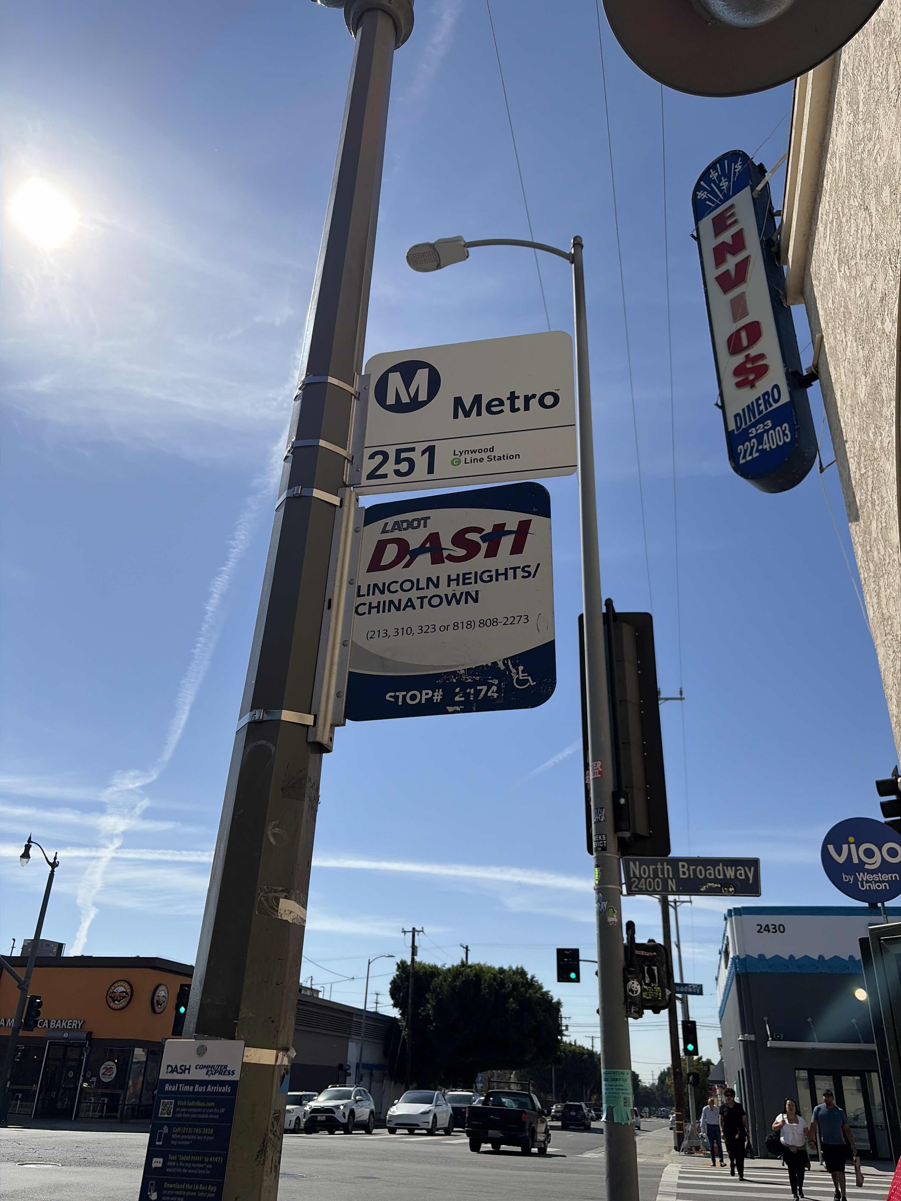 Taken by Anonymous
See Daly / Broadway stop, Lincoln Heights, on the map
Public transit to Daly / Broadway stop (ID: 9512) in Lincoln Heights
Looking for directions to Daly / Broadway in Lincoln Heights, United States?
Download the Moovit App to find the current schedule and step-by-step directions for Bus or Subway routes that pass through Daly / Broadway.
Looking for the nearest stops closest to Daly / Broadway ? Check out this list of closest stops to your destination: Broadway / Daly; Broadway / Avenue 22; Daly / Pasadena; Broadway / Griffin; Chinatown Station; Union Station.
Bus: 251, 45, DASH, 182.Subway: A LINE.Train: AV LINE, OC LINE, RIV LINE, SB LINE, VC LINE.
We make riding on public transit to Daly / Broadway easy, which is why over 1.5 million users, including users in Lincoln Heights trust Moovit as the best app for public transit.
Use the app to navigate to popular places including to the airport, hospital, stadium, grocery store, mall, coffee shop, school, college, and university.
Daly / Broadway stop’s code is 9512
The first line to this stop is 251, at 4:31 AM, and the last line is 251 at 4:10 AM.
2407 N Daly St, Los Angeles, CA, USA
This stop serves Metro and LADOT’s lines
- Broadway / Daly,
- Broadway / Avenue 22,
- Daly / Pasadena,
- Broadway / Griffin
Bus stops near Daly / Broadway stop
- Chinatown Station
Subway station near Daly / Broadway station
- Union Station
Train station near Daly / Broadway station
- Burbank Blvd & Laurel Canyon Blvd (Eastbound),
- Laurel Canyon / Sheldon,
- Figueroa / Pacific Coast Highway,
- Pacific Ave & Ocean Blvd (Southbound),
- Space Park Dr & Aviation Blvd,
- 55th & Compton Ave. (CW),
- Highland Park Station,
- Sepulveda / Sherman Way,
- Olympic / Grande Vista,
- Fullerton Park and Ride Dock6,
- Slauson / Telegraph,
- 6th / Los Angeles,
- Santa Monica / Westwood,
- Sherman Way / Tampa,
- San Vicente Blvd & Bundy Dr,
- Obama / LA Cienega,
- Tampa / Nordhoff,
- Rosecrans / Western,
- Channel Islands & Victoria,
- Topanga Canyon / Lassen
Popular public transit stations in Lincoln Heights
Get around Lincoln Heights by public transit!
Traveling around Lincoln Heights has never been so easy. See step by step directions as you travel to any attraction, street or major public transit station. View bus and train schedules, arrival times, service alerts and detailed routes on a map, so you know exactly how to get to anywhere in Lincoln Heights.
When traveling to any destination around Lincoln Heights use Moovit's Live Directions with Get Off Notifications to know exactly where and how far to walk, how long to wait for your line, and how many stops are left. Moovit will alert you when it's time to get off — no need to constantly re-check whether yours is the next stop.
Wondering how to use public transit in Lincoln Heights or how to pay for public transit in Lincoln Heights? Moovit public transit app can help you navigate your way with public transit easily, and at minimum cost. It includes public transit fees, ticket prices, and costs. Looking for a map of Lincoln Heights public transit lines? Moovit public transit app shows all public transit maps in Lincoln Heights with all Bus, Train, Subway, Ferry and Funicular routes and stops on an interactive map.
Los Angeles has 5 transit type(s), including: Bus, Train, Subway, Ferry and Funicular, operated by several transit agencies, including Metro, Alhambra Community Transit, Arcadia Transit, Artesia Transit, AVTA, Baldwin Park Transit, Beach Cities Transit, Beaumont Transit, Bell Gardens Town Trolley, Bellflower Bus, Big Blue Bus, Burbank Bus, Calabasas Trolley, Camarillo Area Transit and Carson Circuit