Directions to Danny's Dogs (Riviera Beach) with public transportation
The following transit lines have routes that pass near Danny's Dogs
 Bus: 30.
How to get to Danny's Dogs by bus?
Click on the bus route to see step by step directions with maps, line arrival times and updated time schedules.
From Kravis Center For the Performing Arts, West Palm Beach
60 minFrom Norton Museum of Art, West Palm Beach
74 minFrom Mar A Lago Building, West Palm Beach
112 minFrom West Palm Beach Palm Beach Airport PBI, West Palm Beach
90 minFrom Walmart West Palm Beach Supercenter, West Palm Beach
65 minFrom Keiser University Flagship Campus, West Palm Beach
67 minFrom Mar a Lago, West Palm Beach
113 minFrom Brightline West Palm Beach, West Palm Beach
58 minFrom Tanger Outlets Palm Beach, West Palm Beach
39 minFrom The Ballpark of the Palm Beaches, West Palm Beach
65 min
Bus stop near Danny's Dogs in Riviera Beach
- LAKE DR at CLAREMONT LN, 5 min walk,VIEW
Bus lines to Danny's Dogs in Riviera Beach
- 30, Rt 30 Westbound,VIEW
What are the closest stations to Danny's Dogs?
The closest stations to Danny's Dogs are:
- LAKE DR at CLAREMONT LN is 346 yards away, 5 min walk.
Which bus line stops near Danny's Dogs?
30 (Rt 30 Eastbound)
What’s the nearest bus station to Danny's Dogs in Riviera Beach?
The nearest bus station to Danny's Dogs in Riviera Beach is LAKE DR at CLAREMONT LN. It’s a 5 min walk away.
What time is the first bus to Danny's Dogs in Riviera Beach?
The 30 is the first bus that goes to Danny's Dogs in Riviera Beach. It stops nearby at 6:01 AM.
What time is the last bus to Danny's Dogs in Riviera Beach?
The 30 is the last bus that goes to Danny's Dogs in Riviera Beach. It stops nearby at 7:39 PM.
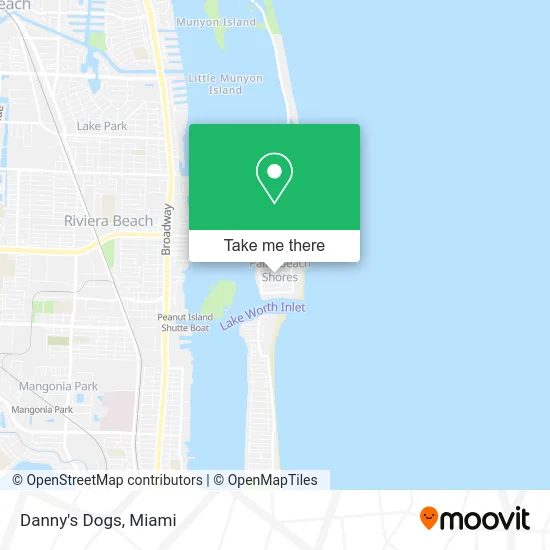
See Danny's Dogs, Riviera Beach, on the map
Public Transit to Danny's Dogs in Riviera Beach
Wondering how to get to Danny's Dogs in Riviera Beach? Moovit helps you find the best way to get to Danny's Dogs with step-by-step directions from the nearest public transit station.
Moovit provides free maps and live directions to help you navigate through your city. View schedules, routes, timetables, and find out how long does it take to get to Danny's Dogs in real time.
Looking for the nearest stop or station to Danny's Dogs? Check out this list of stops closest to your destination: LAKE DR at CLAREMONT LN.
Bus: 30.
Want to see if there’s another route that gets you there at an earlier time? Moovit helps you find alternative routes or times. Get directions from and directions to Danny's Dogs easily from the Moovit App or Website.
We make riding to Danny's Dogs easy, which is why over 1.5 million users, including users in Riviera Beach, trust Moovit as the best app for public transit. You don’t need to download an individual bus app or train app, Moovit is your all-in-one transit app that helps you find the best bus time or train time available.
For information on prices of bus, costs and ride fares to Danny's Dogs, please check the Moovit app.
Use the app to navigate to popular places including to the airport, hospital, stadium, grocery store, mall, coffee shop, school, college, and university.
Danny's Dogs Address: Tacoma Ln Palm Beach Shores, FL 33404 street in Riviera Beach
- Palm Beach Shores Park,
- Isla Palma Singer Island,
- Sailfish Marina Resort (Sailfish Marina's Sunset Celebration),
- Singer Island Inn,
- Peanut Island,
- Fernando Flats,
- Sailfish Marina Resort Restaurant,
- Buccaneer Marina Resort,
- Palm Beach Superyacht Institute,
- Marriott s Ocean Pointe Palm Beach Shores,
- Cobia Spa,
- Chiropractor Hand Pain Relief,
- Carpe Vita Sailboat Charters,
- Glass Action Charters,
- High Tides,
- Made You Hungry,
- Sands Hotel Singer Island,
- Palm Beach Shores Resort and Vacation Villas,
- Coral Sands,
- FPL EVolution
Places Near Danny's Dogs (Riviera Beach)
- Aventura Mall, Miami Beach,
- Miami-Dade County Courthouse, Miami,
- Sawgrass Mall, Miami,
- Brickell City Centre, Miami,
- Port of Miami Cruise Terminal, Miami,
- Zoo Miami, Miami,
- Miami Freedom Park, Miami,
- Miami VA Hospital, Miami,
- Marlins Park, Miami,
- Bayside Marketplace, Miami,
- Wynwood, Miami,
- Sawgrass mall ( FL ), Miami Beach,
- Hard Rock Stadium, Miami Gardens,
- Richard E. Gerstein Justice Building, Miami,
- Dolphin Mall Bus, Miami,
- Keiser University Flagship Campus, West Palm Beach,
- Dolphin Mall, Miami,
- Miami Design District, Miami,
- Little Havana, Miami,
- Aventura Mall, Miami
How to get to popular places in Miami with public transit
Get around Riviera Beach by public transit!
Traveling around Riviera Beach has never been so easy. See step by step directions as you travel to any attraction, street or major public transit station. View bus and train schedules, arrival times, service alerts and detailed routes on a map, so you know exactly how to get to anywhere in Riviera Beach.
When traveling to any destination around Riviera Beach use Moovit's Live Directions with Get Off Notifications to know exactly where and how far to walk, how long to wait for your line, and how many stops are left. Moovit will alert you when it's time to get off — no need to constantly re-check whether yours is the next stop.
Wondering how to use public transit in Riviera Beach or how to pay for public transit in Riviera Beach? Moovit public transit app can help you navigate your way with public transit easily, and at minimum cost. It includes public transit fees, ticket prices, and costs. Looking for a map of Riviera Beach public transit lines? Moovit public transit app shows all public transit maps in Riviera Beach with all Bus, Train, Light Rail and Ferry routes and stops on an interactive map.
Miami has 4 transit type(s), including: Bus, Train, Light Rail and Ferry, operated by several transit agencies, including Broward County Transit, Miami-Dade Transit, Metrorail, Palm Tran, Tri-Rail, Brightline, MARTY, City of Homestead Trolley, Key West Transit, Treasure Coast Connector, GoLine IRT, Amtrak, Greyhound-us, FlixBus-us and Aventura Express Shuttle Bus