Directions to Daring 2 B Different (Wichita) with public transportation
The following transit lines have routes that pass near Daring 2 B Different
How to get to Daring 2 B Different by bus?
Click on the bus route to see step by step directions with maps, line arrival times and updated time schedules.
From Phillips 66, Wichita
81 minFrom Spinemed Specialists, Wichita
38 minFrom Beauty Design by Elena, Wichita
49 minFrom Newspring Church (New Spring Church), Wichita
51 minFrom W Kellogg Dr / S Dugan Rd, Wichita
56 minFrom Walmart Supercenter, Wichita
55 minFrom Hoots, Wichita
43 minFrom Integrated Plastics Solutions, Wichita
49 minFrom 3025 North Rock Road, Wichita
60 minFrom Allstate Insurance (Allstate Ins Agency-Newry Tony L), Wichita
58 min
Bus stops near Daring 2 B Different in Wichita
Bus lines to Daring 2 B Different in Wichita
What are the closest stations to Daring 2 B Different?
The closest stations to Daring 2 B Different are:
- Grove And 9th St Ob is 82 yards away, 2 min walk.
- Hillside And 9th St Ib is 895 yards away, 11 min walk.
- 13th St And Grove Ob is 933 yards away, 12 min walk.
Which bus lines stop near Daring 2 B Different?
These bus lines stop near Daring 2 B Different: ROUTE21: DOUGLAS, ROUTE28: KU MED-.
What’s the nearest bus station to Daring 2 B Different in Wichita?
The nearest bus station to Daring 2 B Different in Wichita is Grove And 9th St Ob. It’s a 2 min walk away.
What time is the first bus to Daring 2 B Different in Wichita?
The ROUTE21: DOUGLAS is the first bus that goes to Daring 2 B Different in Wichita. It stops nearby at 4:51 AM.
What time is the last bus to Daring 2 B Different in Wichita?
The ROUTE21: DOUGLAS is the last bus that goes to Daring 2 B Different in Wichita. It stops nearby at 10:19 PM.
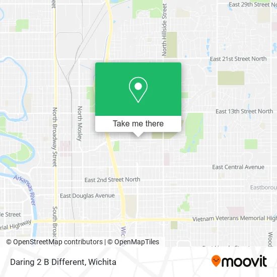
See Daring 2 B Different, Wichita, on the map
Public Transit to Daring 2 B Different in Wichita
Wondering how to get to Daring 2 B Different in Wichita? Moovit helps you find the best way to get to Daring 2 B Different with step-by-step directions from the nearest public transit station.
Moovit provides free maps and live directions to help you navigate through your city. View schedules, routes, timetables, and find out how long does it take to get to Daring 2 B Different in real time.
Looking for the nearest stop or station to Daring 2 B Different? Check out this list of stops closest to your destination: Grove And 9th St Ob; Hillside And 9th St Ib; 13th St And Grove Ob.
Bus: ROUTE21: DOUGLAS, ROUTE28: KU MED-, NORTH HIGH SCHOO, ROUTE27: N BDWY-.
Want to see if there’s another route that gets you there at an earlier time? Moovit helps you find alternative routes or times. Get directions from and directions to Daring 2 B Different easily from the Moovit App or Website.
We make riding to Daring 2 B Different easy, which is why over 1.5 million users, including users in Wichita, trust Moovit as the best app for public transit. You don’t need to download an individual bus app or train app, Moovit is your all-in-one transit app that helps you find the best bus time or train time available.
For information on prices of bus, costs and ride fares to Daring 2 B Different, please check the Moovit app.
Use the app to navigate to popular places including to the airport, hospital, stadium, grocery store, mall, coffee shop, school, college, and university.
Daring 2 B Different Address: 2418 E 9th St N Wichita, KS 67214 street in Wichita
- Urban League of Kansas Guild,
- CHD Boxing Club,
- Core Gardens of Wichita - Robin Rounds Memorial Garden,
- Rock Christian Fellowship,
- Wichita Elementary School (Sam E Spaght Elementary School),
- Spaght Multimedia Magnet,
- Marcus T Scott,
- E Murdock St Building 2510,
- Liberty Way Wichita,
- La Centre de Musique,
- Fred Douglass Lodge No. 99,
- Fred Douglas Lodge 99 Masonic (Fred Douglas Ldg 99 Masonic Temple),
- Augusta City Water & Sewage Dept,
- Liberty Hall Family Church,
- Wichita the Center for Graduate Medical Education,
- Ecton Amber Renee - Cardiovascular Care,
- Interstate Wrecker Service,
- Coldwell Banker Real Estate LLC,
- House of Prayer,
- Richardson Tara MD - Uksm-Psychiatry Clinic
Places Near Daring 2 B Different (Wichita)
- Wichita Dwight D. Eisenhower National Airport (ICT) (Wichita Eisenhower National Airport), Wichita,
- Spirit Aerosystems Inc, Building 1-198D,
- Spirit Aerosystems,
- North High School, Wichita,
- Hubb's glory hole, Wichita,
- McConnell Air Force Base, Mcconnell Afb,
- 21st & Maize, Wichita,
- East 21st Street North and Webb Road, Wichita,
- Bmer Tech Automotive, Wichita,
- Spirit AeroSystems, Bldg 2-280J (Section 9),
- Towne East Mall, Wichita,
- Total Card Solutions, Wichita,
- Westside Athletic Field (Friends University Baseball Field), Wichita,
- Sena African Hair Braiding LLC, Wichita,
- Afghan Halal Market, Wichita,
- Ratcliff Auto and Truck Repair, Wichita,
- Ascencion Via Christi Hospital St Francis, Wichita,
- Lopez Services, Wichita,
- Four Corners Cafe @ Wesley Medical Center, Wichita,
- Paige Place Apartments, Wichita
How to get to popular places in Wichita with public transit
Get around Wichita by public transit!
Traveling around Wichita has never been so easy. See step by step directions as you travel to any attraction, street or major public transit station. View bus and train schedules, arrival times, service alerts and detailed routes on a map, so you know exactly how to get to anywhere in Wichita.
When traveling to any destination around Wichita use Moovit's Live Directions with Get Off Notifications to know exactly where and how far to walk, how long to wait for your line, and how many stops are left. Moovit will alert you when it's time to get off — no need to constantly re-check whether yours is the next stop.
Wondering how to use public transit in Wichita or how to pay for public transit in Wichita? Moovit public transit app can help you navigate your way with public transit easily, and at minimum cost. It includes public transit fees, ticket prices, and costs. Looking for a map of Wichita public transit lines? Moovit public transit app shows all public transit maps in Wichita with all bus routes and stops on an interactive map.
Wichita has 1 transit type(s), including: bus, operated by several transit agencies, including Wichita Transit, Greyhound-us and FlixBus-us