How to get to Data Locksmith Inc Fairfax by bus?
Click on the bus route to see step by step directions with maps, line arrival times and updated time schedules.
From Spa World, Fairfax County
32 minFrom Reston Town Center, Fairfax County
41 minFrom Amazon Iad28, Fairfax County
53 minFrom Navy Federal Credit Union, Fairfax County
86 minFrom Fairfax County Courthouse, Fairfax County
30 minFrom Centreville, VA, Fairfax County
38 minFrom George Mason University, Fairfax County
43 minFrom Chantilly, VA, Fairfax County
22 minFrom Amazon Web Services - IAD21, Fairfax County
53 minFrom Burke, VA, Fairfax County
107 min
Bus stops near Data Locksmith Inc Fairfax in Fairfax County
Bus lines to Data Locksmith Inc Fairfax in Fairfax County
- 605, 605 Reston - Town Ctr,VIEW
- 622, 622 Penderbrook -Monument Dr,VIEW
- 630, 630 Centreville Park & Ride,VIEW
- 651, 651 Conference Center Dr,VIEW
- F60, West To Monument Dr,VIEW
- F61, West To Fair Oaks Mall,VIEW
- 670, 670 Franconia Springfield Limited Stop,VIEW
- 671, 671 Dunn Loring Metro,VIEW
- 672, 672 Dunn Loring Metro,VIEW
- 615, 615 Fair Oaks Hospital,VIEW
What are the closest stations to Data Locksmith Inc Fairfax?
The closest stations to Data Locksmith Inc Fairfax are:
- Monument Dr @ Fair Lakes Promenade is 150 yards away, 2 min walk.
- Monument Dr+Fair Lakes Pkwy is 165 yards away, 3 min walk.
- Monument Dr @ Polo Dr is 516 yards away, 7 min walk.
- Monument Dr Transit Ctr Bay A is 810 yards away, 10 min walk.
Which bus lines stop near Data Locksmith Inc Fairfax?
These bus lines stop near Data Locksmith Inc Fairfax: 605, 610, 630, 651, 670, F60.
What’s the nearest bus station to Data Locksmith Inc Fairfax in Fairfax County?
The nearest bus station to Data Locksmith Inc Fairfax in Fairfax County is Monument Dr @ Fair Lakes Promenade. It’s a 2 min walk away.
What time is the first bus to Data Locksmith Inc Fairfax in Fairfax County?
The F60 is the first bus that goes to Data Locksmith Inc Fairfax in Fairfax County. It stops nearby at 5:02 AM.
What time is the last bus to Data Locksmith Inc Fairfax in Fairfax County?
The 622 is the last bus that goes to Data Locksmith Inc Fairfax in Fairfax County. It stops nearby at 11:20 PM.
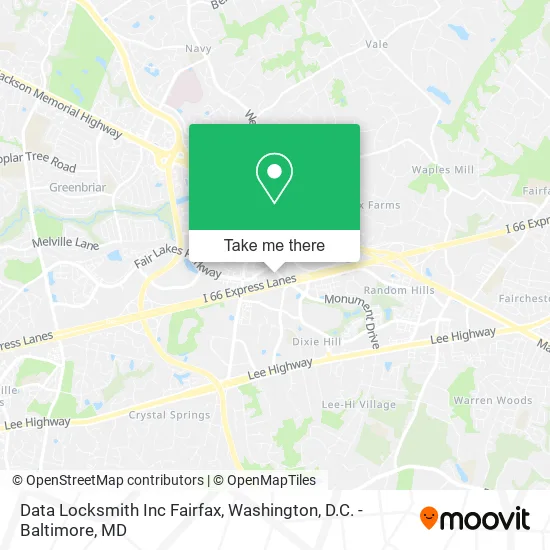
See Data Locksmith Inc Fairfax, Fairfax County, on the map
Public Transit to Data Locksmith Inc Fairfax in Fairfax County
Wondering how to get to Data Locksmith Inc Fairfax in Fairfax County? Moovit helps you find the best way to get to Data Locksmith Inc Fairfax with step-by-step directions from the nearest public transit station.
Moovit provides free maps and live directions to help you navigate through your city. View schedules, routes, timetables, and find out how long does it take to get to Data Locksmith Inc Fairfax in real time.
Looking for the nearest stop or station to Data Locksmith Inc Fairfax? Check out this list of stops closest to your destination: Monument Dr @ Fair Lakes Promenade; Monument Dr+Fair Lakes Pkwy; Monument Dr @ Polo Dr; Monument Dr Transit Ctr Bay A.
Bus: 605, 610, 630, 651, 670, F60, 622, F61, 671, 672, 615.
Want to see if there’s another route that gets you there at an earlier time? Moovit helps you find alternative routes or times. Get directions from and directions to Data Locksmith Inc Fairfax easily from the Moovit App or Website.
We make riding to Data Locksmith Inc Fairfax easy, which is why over 1.5 million users, including users in Fairfax County, trust Moovit as the best app for public transit. You don’t need to download an individual bus app or train app, Moovit is your all-in-one transit app that helps you find the best bus time or train time available.
For information on prices of bus, costs and ride fares to Data Locksmith Inc Fairfax, please check the Moovit app.
Use the app to navigate to popular places including to the airport, hospital, stadium, grocery store, mall, coffee shop, school, college, and university.
Data Locksmith Inc Fairfax Address: 12179 Fair Lakes Promenade Dr Fairfax, VA 22033 street in Fairfax County
- PNC Mortgage,
- Nordstrom Rack Fair Lakes Promenade,
- Mry Auto Detailing,
- Taco Bamba,
- Blink Charging,
- VMD,
- Stephen Bacci Loandepot,
- Afcea International,
- Demon on A Leash,
- Fairfax County Herrity Building Parking Garage,
- 11951 Fair Oaks Mall,
- Musa Deniz Hair Studio,
- Eternal Forge,
- AVIS,
- Smoothie Station,
- Toys"R"Us,
- Nigel Sainsbury Consulting,
- Valerie J Southern-Transportation,
- Dr Renee Elizabeth Funches, MD,
- Kaiser Permanente - Fair Oaks Medical Center
Places Near Data Locksmith Inc Fairfax (Fairfax County)
- Capital One Arena, Washington,
- Warner Theatre, Washington,
- PG Mall, Prince George's County,
- M&T Bank Stadium, Baltimore,
- National Museum of African American History and Culture, Washington,
- Marriott Marquis Washington, DC, Washington,
- Camden Yards, Baltimore,
- Amazon Hq2, Arlington County,
- Georgetown, Washington,
- National Theatre, Washington,
- National Zoo, Washington,
- The Anthem, Washington,
- Basilica of the National Shrine, Washington,
- Rock Creek Tennis Center, Washington,
- Sibley Memorial Hospital, Washington,
- Washington DC VA Medical Center, Washington,
- Westfield Montgomery Mall, Montgomery County,
- Pennsylvania Ave NW (3rd st and pennsylvania), Washington,
- Washington National Cathedral, Washington,
- Museum Of The Bible, Washington
How to get to popular places in Washington, D.C. - Baltimore, MD with public transit
Get around Fairfax County by public transit!
Traveling around Fairfax County has never been so easy. See step by step directions as you travel to any attraction, street or major public transit station. View bus and train schedules, arrival times, service alerts and detailed routes on a map, so you know exactly how to get to anywhere in Fairfax County.
When traveling to any destination around Fairfax County use Moovit's Live Directions with Get Off Notifications to know exactly where and how far to walk, how long to wait for your line, and how many stops are left. Moovit will alert you when it's time to get off — no need to constantly re-check whether yours is the next stop.
Wondering how to use public transit in Fairfax County or how to pay for public transit in Fairfax County? Moovit public transit app can help you navigate your way with public transit easily, and at minimum cost. It includes public transit fees, ticket prices, and costs. Looking for a map of Fairfax County public transit lines? Moovit public transit app shows all public transit maps in Fairfax County with all Bus, Train, Metro, Light Rail and Ferry routes and stops on an interactive map.
Washington, D.C. - Baltimore, MD has 5 transit type(s), including: Bus, Train, Metro, Light Rail and Ferry, operated by several transit agencies, including WMATA, Montgomery County Ride On, Fairfax Connector, TheBus, PRTC, DASH - Alexandria, Arlington Transit (ART), RTA of Central Maryland, MDOT MTA, MDOT MTA Light RailLink, MDOT MTA Commuter Bus, MDOT MTA Local Bus, FXBGO!, Virginia Railway Express (VRE) and MARC