How to get to Datapros by bus?
Click on the bus route to see step by step directions with maps, line arrival times and updated time schedules.
From Unity Square Dental, Edmonton
45 minFrom La Cite Francophone, Edmonton
79 minFrom Mazankowski Alberta Heart Institute - East Public Parkade, Edmonton
62 minFrom 에드먼튼 순복음 교회 - Ekfgc, Edmonton
74 minFrom Meadowlark Health & Shopping Centre, Edmonton
61 minFrom Salisbury at Enjoy, St. Albert
48 minFrom Bethlehem Walk Edmonton, Edmonton
93 minFrom Commonwealth Community Recreation Centre, Edmonton
47 minFrom Residence Saint-Jean - University of Alberta, Edmonton
78 minFrom 7259 Winterburn Road Northwest, Edmonton
100 min
Bus stops near Datapros in Edmonton
Bus lines to Datapros in Edmonton
What are the closest stations to Datapros?
The closest stations to Datapros are:
- 154 Street & 123 Avenue is 83 meters away, 2 min walk.
- 154 Street & 118 Avenue is 768 meters away, 11 min walk.
- 156 Street & 118 Avenue is 860 meters away, 12 min walk.
Which bus lines stop near Datapros?
These bus lines stop near Datapros: 903, 905.
What’s the nearest bus station to Datapros in Edmonton?
The nearest bus station to Datapros in Edmonton is 154 Street & 123 Avenue. It’s a 2 min walk away.
What time is the first bus to Datapros in Edmonton?
The 903 is the first bus that goes to Datapros in Edmonton. It stops nearby at 6:07 AM.
What time is the last bus to Datapros in Edmonton?
The 903 is the last bus that goes to Datapros in Edmonton. It stops nearby at 12:06 AM.
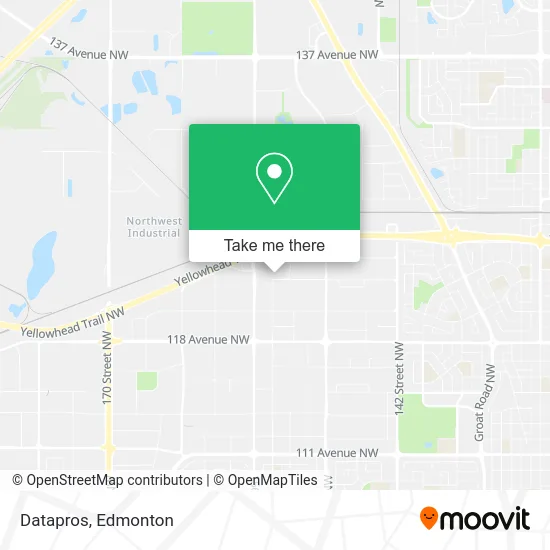
See Datapros, Edmonton, on the map
Public Transit to Datapros in Edmonton
Wondering how to get to Datapros in Edmonton? Moovit helps you find the best way to get to Datapros with step-by-step directions from the nearest public transit station.
Moovit provides free maps and live directions to help you navigate through your city. View schedules, routes, timetables, and find out how long does it take to get to Datapros in real time.
Looking for the nearest stop or station to Datapros? Check out this list of stops closest to your destination: 154 Street & 123 Avenue; 154 Street & 118 Avenue; 156 Street & 118 Avenue.
Bus: 903, 905, 560, 906, 907, 205.
Want to see if there’s another route that gets you there at an earlier time? Moovit helps you find alternative routes or times. Get directions from and directions to Datapros easily from the Moovit App or Website.
We make riding to Datapros easy, which is why over 1.5 million users, including users in Edmonton, trust Moovit as the best app for public transit. You don’t need to download an individual bus app or train app, Moovit is your all-in-one transit app that helps you find the best bus time or train time available.
For information on prices of bus and light rail, costs and ride fares to Datapros, please check the Moovit app.
Use the app to navigate to popular places including to the airport, hospital, stadium, grocery store, mall, coffee shop, school, college, and university.
Datapros Address: 15330 123 Ave NW Edmonton, AB T5V street in Edmonton
- Alpine Drywall (Northern),
- Velocitune Enterprises,
- Trias Contracting Inc,
- Guitar Brando,
- Rightride,
- Whitby Nurse Collision,
- LMB Automobile,
- CPA Insurance Plans West,
- Liuna Local 92 Training Centre,
- Pearl Showroom,
- Casino Yellowhead,
- Pure Casino Yellowhead,
- Sharp Oilfield Services LTD,
- Eaton,
- Kindersley Transport,
- Parkwest Business Centre - Lot #110,
- Tetra Tech Eba,
- Edmonton Frame & Suspension,
- Edmonton Marketing Office,
- PETRO-CANADA
Places Near Datapros (Edmonton)
- Whyte Avenue, Edmonton,
- Northgate Centre, Edmonton,
- Edmonton EXPO Centre, Edmonton,
- Rogers Place, Edmonton,
- Edmonton VIA Rail Station, Edmonton,
- Canada Place Service Canada Centre, Edmonton,
- Cross Cancer Institute, Edmonton,
- Londonderry Mall, Edmonton,
- Kaye Edmonton Clinic, Edmonton,
- West Edmonton Mall, Edmonton,
- Fort Edmonton Park, Edmonton,
- Kingsway Mall, Edmonton,
- Borden Park, Edmonton,
- Grey Nuns Community Hospital, Edmonton,
- Edmonton Commonwealth Stadium, Edmonton,
- University of Alberta, Edmonton,
- Edmonton Valley Zoo, Edmonton,
- Royal Alexandra Hospital, Edmonton,
- Alberta Legislature Building, Edmonton,
- MacEwan University, Edmonton
How to get to popular places in Edmonton with public transit
Get around Edmonton by public transit!
Traveling around Edmonton has never been so easy. See step by step directions as you travel to any attraction, street or major public transit station. View bus and train schedules, arrival times, service alerts and detailed routes on a map, so you know exactly how to get to anywhere in Edmonton.
When traveling to any destination around Edmonton use Moovit's Live Directions with Get Off Notifications to know exactly where and how far to walk, how long to wait for your line, and how many stops are left. Moovit will alert you when it's time to get off — no need to constantly re-check whether yours is the next stop.
Wondering how to use public transit in Edmonton or how to pay for public transit in Edmonton? Moovit public transit app can help you navigate your way with public transit easily, and at minimum cost. It includes public transit fees, ticket prices, and costs. Looking for a map of Edmonton public transit lines? Moovit public transit app shows all public transit maps in Edmonton with all Bus and Light Rail routes and stops on an interactive map.
Edmonton has 2 transit type(s), including: Bus and Light Rail, operated by several transit agencies, including ETS LRT, ETS, Strathcona County Transit, St. Albert Transit, Spruce Grove Transit, Fort Saskatchewan Transit, Beaumont Transit and Leduc Transit