How to get to David Jr Demolition by bus?
Click on the bus route to see step by step directions with maps, line arrival times and updated time schedules.
From Department of State SA 34, Fairfax County
265 minFrom Lorton, VA, Fairfax County
243 minFrom Potomac Mills Mall, Prince William County
234 minFrom Busch Gardens Williamsburg (Employee Parking Lot), James City County
175 minFrom Lorton, VA - Amtrak Auto Train Station (LOR), Fairfax County
249 minFrom Rose Gaming Resort, Prince William County
259 minFrom UVA Hospital Medical Center, Charlottesville
323 minFrom Woodbridge, VA, Prince William County
178 min
Bus stops near David Jr Demolition in Richmond
Train station near David Jr Demolition in Richmond
- Pathrichmond Main Street Amtrak Station, 63 min walk,VIEW
Bus lines to David Jr Demolition in Richmond
What are the closest stations to David Jr Demolition?
The closest stations to David Jr Demolition are:
- Royall + Krouse is 207 yards away, 3 min walk.
- Richmond Hwy + 1500 is 314 yards away, 4 min walk.
- Harwood & Richmond Hwy is 674 yards away, 8 min walk.
- Pathrichmond Main Street Amtrak Station is 5367 yards away, 63 min walk.
Which bus lines stop near David Jr Demolition?
These bus lines stop near David Jr Demolition: 1A, 3B, 87.
What’s the nearest bus station to David Jr Demolition in Richmond?
The nearest bus station to David Jr Demolition in Richmond is Royall + Krouse. It’s a 3 min walk away.
What time is the first train to David Jr Demolition in Richmond?
The NORTHEAST REGIONAL is the first train that goes to David Jr Demolition in Richmond. It stops nearby at 5:19 AM.
What time is the last train to David Jr Demolition in Richmond?
The NORTHEAST REGIONAL is the last train that goes to David Jr Demolition in Richmond. It stops nearby at 6:52 PM.
What time is the first bus to David Jr Demolition in Richmond?
The 3A is the first bus that goes to David Jr Demolition in Richmond. It stops nearby at 5:32 AM.
What time is the last bus to David Jr Demolition in Richmond?
The 3C is the last bus that goes to David Jr Demolition in Richmond. It stops nearby at 12:56 AM.
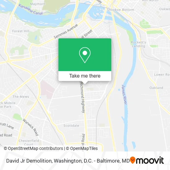
See David Jr Demolition, Richmond, on the map
Public Transit to David Jr Demolition in Richmond
Wondering how to get to David Jr Demolition in Richmond? Moovit helps you find the best way to get to David Jr Demolition with step-by-step directions from the nearest public transit station.
Moovit provides free maps and live directions to help you navigate through your city. View schedules, routes, timetables, and find out how long does it take to get to David Jr Demolition in real time.
Looking for the nearest stop or station to David Jr Demolition? Check out this list of stops closest to your destination: Royall + Krouse; Richmond Hwy + 1500; Harwood & Richmond Hwy; Pathrichmond Main Street Amtrak Station.
Bus: 1A, 3B, 87, 3C, 3A.Train: NORTHEAST REGIONAL.
Want to see if there’s another route that gets you there at an earlier time? Moovit helps you find alternative routes or times. Get directions from and directions to David Jr Demolition easily from the Moovit App or Website.
We make riding to David Jr Demolition easy, which is why over 1.5 million users, including users in Richmond, trust Moovit as the best app for public transit. You don’t need to download an individual bus app or train app, Moovit is your all-in-one transit app that helps you find the best bus time or train time available.
For information on prices of bus and train, costs and ride fares to David Jr Demolition, please check the Moovit app.
Use the app to navigate to popular places including to the airport, hospital, stadium, grocery store, mall, coffee shop, school, college, and university.
David Jr Demolition Address: 1600 Columbia St Richmond, VA 23224 street in Richmond
- Safety First Company of VA,
- Especially Yours,
- Healing Hearts for Eterni,
- Copa Mundo Auto,
- Oakland Church,
- Immanuel Pentecostal Church,
- Community Care Assisted Living of Virginia,
- James River Apartments,
- Richmond's Best Auto Sales,
- Consolidated Delivery Company,
- Alchemco Academy,
- Faith Gospel Family Worship Center,
- S & S Food Mart,
- Aspen Products,
- Builders Insulation,
- Capital Warehouse,
- Full Service Enterprise,
- Sunrise Carpet & Vinyl Depot,
- Werner Drop Yard,
- Oak Grove / Bellemeade Elementary
Places Near David Jr Demolition (Richmond)
- Capital One Arena, Washington,
- Washington DC VA Medical Center, Washington,
- The Anthem, Washington,
- Westfield Montgomery Mall, Montgomery County,
- Sibley Memorial Hospital, Washington,
- Georgetown, Washington,
- Camden Yards, Baltimore,
- Amazon Hq2, Arlington County,
- Rock Creek Tennis Center, Washington,
- National Mall, Washington,
- Warner Theatre, Washington,
- Pennsylvania Ave NW (3rd st and pennsylvania), Washington,
- Marriott Marquis Washington, DC, Washington,
- Museum Of The Bible, Washington,
- National Zoo, Washington,
- Basilica of the National Shrine, Washington,
- Washington National Cathedral, Washington,
- M&T Bank Stadium, Baltimore,
- PG Mall, Prince George's County,
- National Museum of African American History and Culture, Washington
How to get to popular places in Washington, D.C. - Baltimore, MD with public transit
Get around Richmond by public transit!
Traveling around Richmond has never been so easy. See step by step directions as you travel to any attraction, street or major public transit station. View bus and train schedules, arrival times, service alerts and detailed routes on a map, so you know exactly how to get to anywhere in Richmond.
When traveling to any destination around Richmond use Moovit's Live Directions with Get Off Notifications to know exactly where and how far to walk, how long to wait for your line, and how many stops are left. Moovit will alert you when it's time to get off — no need to constantly re-check whether yours is the next stop.
Wondering how to use public transit in Richmond or how to pay for public transit in Richmond? Moovit public transit app can help you navigate your way with public transit easily, and at minimum cost. It includes public transit fees, ticket prices, and costs. Looking for a map of Richmond public transit lines? Moovit public transit app shows all public transit maps in Richmond with all Bus, Train, Metro, Light Rail and Ferry routes and stops on an interactive map.
Washington, D.C. - Baltimore, MD has 5 transit type(s), including: Bus, Train, Metro, Light Rail and Ferry, operated by several transit agencies, including WMATA, Montgomery County Ride On, Fairfax Connector, TheBus, PRTC, DASH - Alexandria, Arlington Transit (ART), RTA of Central Maryland, MDOT MTA, MDOT MTA Light RailLink, MDOT MTA Commuter Bus, MDOT MTA Local Bus, FXBGO!, Virginia Railway Express (VRE) and MARC