How to get to Davids Check Cashing Dcc #16 by bus?
Click on the bus route to see step by step directions with maps, line arrival times and updated time schedules.
From Studio 54, Manhattan
102 minFrom Shubert Theatre, Manhattan
92 minFrom Riu Plaza Times Square Hotel, Manhattan
106 minFrom New York Athletic Club, Manhattan
92 minFrom Hammerstein Ballroom, Manhattan
94 minFrom Frick Collection, Manhattan
94 minFrom Chelsea Piers, Manhattan
98 minFrom Lunt-Fontanne Theatre, Manhattan
93 minFrom The Shed, Manhattan
127 minFrom 55 Water, Manhattan
83 min
How to get to Davids Check Cashing Dcc #16 by train?
Click on the train route to see step by step directions with maps, line arrival times and updated time schedules.
From Studio 54, Manhattan
84 minFrom Shubert Theatre, Manhattan
74 minFrom Riu Plaza Times Square Hotel, Manhattan
83 minFrom New York Athletic Club, Manhattan
93 minFrom Hammerstein Ballroom, Manhattan
67 minFrom Frick Collection, Manhattan
97 minFrom Chelsea Piers, Manhattan
84 minFrom Lunt-Fontanne Theatre, Manhattan
80 minFrom The Shed, Manhattan
70 min
How to get to Davids Check Cashing Dcc #16 by subway?
Click on the subway route to see step by step directions with maps, line arrival times and updated time schedules.
From Studio 54, Manhattan
46 minFrom Shubert Theatre, Manhattan
46 minFrom Riu Plaza Times Square Hotel, Manhattan
47 minFrom New York Athletic Club, Manhattan
45 minFrom Hammerstein Ballroom, Manhattan
48 minFrom Frick Collection, Manhattan
59 minFrom Chelsea Piers, Manhattan
56 minFrom Lunt-Fontanne Theatre, Manhattan
47 minFrom The Shed, Manhattan
56 minFrom 55 Water, Manhattan
38 min
Bus stops near Davids Check Cashing Dcc #16 in New York - New Jersey
Subway stations near Davids Check Cashing Dcc #16 in New York - New Jersey
Bus lines to Davids Check Cashing Dcc #16 in New York - New Jersey
What are the closest stations to Davids Check Cashing Dcc #16?
The closest stations to Davids Check Cashing Dcc #16 are:
- Broadway/Madison St is 43 yards away, 1 min walk.
- Gates Av/Broadway is 290 yards away, 4 min walk.
- Ralph Av is 373 yards away, 5 min walk.
- Saratoga Av/Halsey St is 410 yards away, 6 min walk.
- Ralph Av/Putnam Av is 436 yards away, 6 min walk.
- Kosciuszko St is 953 yards away, 12 min walk.
- Chauncey St is 1004 yards away, 13 min walk.
Which bus lines stop near Davids Check Cashing Dcc #16?
These bus lines stop near Davids Check Cashing Dcc #16: B20, B26, B46, Q24.
Which train lines stop near Davids Check Cashing Dcc #16?
These train lines stop near Davids Check Cashing Dcc #16: CITY TERMINAL ZONE, HEMPSTEAD BRANCH.
Which subway line stops near Davids Check Cashing Dcc #16?
J (Queens)
What’s the nearest subway station to Davids Check Cashing Dcc #16 in New York - New Jersey?
The nearest subway station to Davids Check Cashing Dcc #16 in New York - New Jersey is Ralph Av. It’s a 5 min walk away.
What’s the nearest bus station to Davids Check Cashing Dcc #16 in New York - New Jersey?
The nearest bus station to Davids Check Cashing Dcc #16 in New York - New Jersey is Broadway/Madison St. It’s a 1 min walk away.
What time is the first subway to Davids Check Cashing Dcc #16 in New York - New Jersey?
The J is the first subway that goes to Davids Check Cashing Dcc #16 in New York - New Jersey. It stops nearby at 3:00 AM.
What time is the last subway to Davids Check Cashing Dcc #16 in New York - New Jersey?
The A is the last subway that goes to Davids Check Cashing Dcc #16 in New York - New Jersey. It stops nearby at 3:58 AM.
What time is the first bus to Davids Check Cashing Dcc #16 in New York - New Jersey?
The Q24 is the first bus that goes to Davids Check Cashing Dcc #16 in New York - New Jersey. It stops nearby at 3:00 AM.
What time is the last bus to Davids Check Cashing Dcc #16 in New York - New Jersey?
The Q24 is the last bus that goes to Davids Check Cashing Dcc #16 in New York - New Jersey. It stops nearby at 3:00 AM.
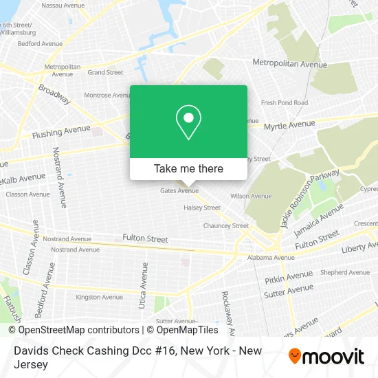
See Davids Check Cashing Dcc #16, New York - New Jersey, on the map
Public Transit to Davids Check Cashing Dcc #16 in New York - New Jersey
Wondering how to get to Davids Check Cashing Dcc #16 in New York - New Jersey? Moovit helps you find the best way to get to Davids Check Cashing Dcc #16 with step-by-step directions from the nearest public transit station.
Moovit provides free maps and live directions to help you navigate through your city. View schedules, routes, timetables, and find out how long does it take to get to Davids Check Cashing Dcc #16 in real time.
Looking for the nearest stop or station to Davids Check Cashing Dcc #16? Check out this list of stops closest to your destination: Broadway/Madison St; Gates Av/Broadway; Ralph Av; Saratoga Av/Halsey St; Ralph Av/Putnam Av; Kosciuszko St; Chauncey St.
Bus: B20, B26, B46, Q24, B52, B7.Train: CITY TERMINAL ZONE, HEMPSTEAD BRANCH.Subway: J, A, C, Z.
Want to see if there’s another route that gets you there at an earlier time? Moovit helps you find alternative routes or times. Get directions from and directions to Davids Check Cashing Dcc #16 easily from the Moovit App or Website.
We make riding to Davids Check Cashing Dcc #16 easy, which is why over 1.5 million users, including users in New York - New Jersey, trust Moovit as the best app for public transit. You don’t need to download an individual bus app or train app, Moovit is your all-in-one transit app that helps you find the best bus time or train time available.
For information on prices of subway, bus and train, costs and ride fares to Davids Check Cashing Dcc #16, please check the Moovit app.
Use the app to navigate to popular places including to the airport, hospital, stadium, grocery store, mall, coffee shop, school, college, and university.
Davids Check Cashing Dcc #16 Address: 1431 Broadway street in New York - New Jersey
- Ecoatm,
- Stuf Storage - Bushwick Brooklyn,
- Silverline Insurance,
- Vinted Go Parcel Shop,
- Brooklyn High School For Law and Technology,
- Red Planet Boxing,
- Dr Henry Sardar Md,
- Artist & Craftsman Supply,
- Madison Street Association,
- La Cabana,
- Continental Building,
- The Young Ladies' and Gentlemen's Club,
- My Sweet Angels Day Care,
- Michael Stewart Photo & Video,
- Flourish Event Space,
- Brooklyn North High Schools,
- Brooklyn High School For Law & Tech Apparel Store - Brooklyn, NY,
- Smart Start Head Start Daycare,
- Broadway (putnam and broadway),
- Global Farm Marketplace
Places Near Davids Check Cashing Dcc #16 (New York - New Jersey)
- Chinatown, Manhattan,
- Queens Center Mall, Queens,
- Bellevue Hospital, Manhattan,
- 3 Stone St, Manhattan,
- Rockefeller Center, Manhattan,
- SoHo, Manhattan,
- Katz's Deli, Manhattan,
- Pier 83, Manhattan,
- 376 Hudson Street, Manhattan,
- San Gennaro Feast, Manhattan,
- 1 Police Plaza, Manhattan,
- qqqq, Manhattan,
- 66 John Street, Manhattan,
- 111 Centre New York City Supreme Court, Manhattan,
- Wall Street, Manhattan,
- Hudson Yards, Manhattan,
- 911 Memorial, Manhattan,
- 26 Federal Plaza, Manhattan,
- Times Square, Manhattan,
- Mountainside Hospital, Glen Ridge
How to get to popular places in New York - New Jersey with public transit
Get around New York - New Jersey by public transit!
Traveling around New York - New Jersey has never been so easy. See step by step directions as you travel to any attraction, street or major public transit station. View bus and train schedules, arrival times, service alerts and detailed routes on a map, so you know exactly how to get to anywhere in New York - New Jersey.
When traveling to any destination around New York - New Jersey use Moovit's Live Directions with Get Off Notifications to know exactly where and how far to walk, how long to wait for your line, and how many stops are left. Moovit will alert you when it's time to get off — no need to constantly re-check whether yours is the next stop.
Wondering how to use public transit in New York - New Jersey or how to pay for public transit in New York - New Jersey? Moovit public transit app can help you navigate your way with public transit easily, and at minimum cost. It includes public transit fees, ticket prices, and costs. Looking for a map of New York - New Jersey public transit lines? Moovit public transit app shows all public transit maps in New York - New Jersey with all Bus, Train, Subway, Light Rail, Ferry and Cable Car routes and stops on an interactive map.
New York - New Jersey has 6 transit type(s), including: Bus, Train, Subway, Light Rail, Ferry and Cable Car, operated by several transit agencies, including MTA Subway, Metro-North Railroad, LIRR, PATH, MTA New York City Transit - Express routes, MTA Bus, NJ Transit, NYC Ferry, NICE bus, Bee-Line Bus, NJ Transit Rail, Norwalk Transit District, Hartford Line, River Valley Transit and HART