How to get to Davier by bus?
Click on the bus route to see step by step directions with maps, line arrival times and updated time schedules.
From Villecresnes, Villecresnes
187 minFrom Brie-Comte-Robert, Brie-Comte-Robert
120 minFrom Viry-Châtillon, Viry-Chatillon
65 minFrom Centre Hospitalier Villeneuve-Saint-Georges, Arrondissement de L'Haÿ-Les-Roses
120 minFrom Vert-Saint-Denis, Vert-Saint-Denis
48 minFrom Lisses, Lisses
52 minFrom Clinique de l'Essonne, Evry
68 minFrom Fleury-Mérogis, Fleury-Merogis
63 minFrom Morsang-sur-Orge, Morsang-Sur-Orge
98 minFrom IKEA Evry, Lisses
59 min
Bus stops near Davier in Saint-Germain-Les-Corbeil
Bus lines to Davier in Saint-Germain-Les-Corbeil
What are the closest stations to Davier?
The closest stations to Davier are:
- Le Golf is 186 meters away, 3 min walk.
- Pointe Ringale is 197 meters away, 3 min walk.
- Collège la Tuilerie is 1368 meters away, 18 min walk.
Which bus line stops near Davier?
TZEN1 (Gare de Corbeil-Essonnes)
What’s the nearest bus station to Davier in Saint-Germain-Les-Corbeil?
The nearest bus stations to Davier in Saint-Germain-Les-Corbeil are Le Golf and Pointe Ringale. The closest one is a 3 min walk away.
What time is the first bus to Davier in Saint-Germain-Les-Corbeil?
The TZEN1 is the first bus that goes to Davier in Saint-Germain-Les-Corbeil. It stops nearby at 5:05 AM.
What time is the last bus to Davier in Saint-Germain-Les-Corbeil?
The TZEN1 is the last bus that goes to Davier in Saint-Germain-Les-Corbeil. It stops nearby at 11:47 PM.
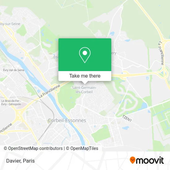
See Davier, Saint-Germain-Les-Corbeil, on the map
Public Transit to Davier in Saint-Germain-Les-Corbeil
Wondering how to get to Davier in Saint-Germain-Les-Corbeil? Moovit helps you find the best way to get to Davier with step-by-step directions from the nearest public transit station.
Moovit provides free maps and live directions to help you navigate through your city. View schedules, routes, timetables, and find out how long does it take to get to Davier in real time.
Looking for the nearest stop or station to Davier? Check out this list of stops closest to your destination: Le Golf; Pointe Ringale; Collège la Tuilerie.
Bus: TZEN1, 4231, 4271, 4276, 3703, 3775, 4275.
Want to see if there’s another route that gets you there at an earlier time? Moovit helps you find alternative routes or times. Get directions from and directions to Davier easily from the Moovit App or Website.
We make riding to Davier easy, which is why over 1.5 million users, including users in Saint-Germain-Les-Corbeil, trust Moovit as the best app for public transit. You don’t need to download an individual bus app or train app, Moovit is your all-in-one transit app that helps you find the best bus time or train time available.
For information on prices of bus and RER, costs and ride fares to Davier, please check the Moovit app.
Use the app to navigate to popular places including to the airport, hospital, stadium, grocery store, mall, coffee shop, school, college, and university.
Davier Address: 9 Rue Jean de La Fontaine 91250 Saint-Germain-lès-Corbeil street in Saint-Germain-Les-Corbeil
- Jorge Manuel,
- Le Golf,
- Lidl,
- Village St Germain,
- Lidl France SNC,
- Firat Dugun Salonu,
- 5 Allée Louis Tillet,
- Ecole Croix Verte,
- N104,
- Campanile Evry Est - Saint Germain Les Corbeil,
- 91250,
- La Croissanterie,
- Rue de Tigery,
- Saint-Germain-lès-Corbeil,
- Place Victor Hugo,
- Les Prés Hauts,
- La Gentry,
- Sg,
- Centre Technique Municipal,
- Auchan Supermarché Saint-Germain-les-Corbeil
Places Near Davier (Saint-Germain-Les-Corbeil)
- Fondation Louis Vuitton, Paris,
- Hôpital de la Pitié-Salpêtrière, Paris,
- Hôpital Necker, Paris,
- Centre Hospitalier des 15/20, Paris,
- Galeries Lafayette Haussmann, Paris,
- Hôpital Henri Mondor, Creteil,
- Marché Saint-Pierre, Paris,
- Atelier Des Lumieres, Paris,
- Galeries Lafayette, Paris,
- Gare Routière Flixbus, Paris,
- 29 Rue Manin, Paris,
- Institut Curie, Paris,
- Hôpital Cochin, Paris,
- Hôpital Beaujon, Clichy,
- Théâtre Mogador, Paris,
- Hopital Lariboisière, Paris,
- Hôpital Pitié Salpêtrière, Paris,
- Hôpital Saint-Joseph, Paris,
- Créteil Soleil, Creteil,
- Hopital Foch, Suresnes
How to get to popular places in Paris with public transit
Get around Saint-Germain-Les-Corbeil by public transit!
Traveling around Saint-Germain-Les-Corbeil has never been so easy. See step by step directions as you travel to any attraction, street or major public transit station. View bus and train schedules, arrival times, service alerts and detailed routes on a map, so you know exactly how to get to anywhere in Saint-Germain-Les-Corbeil.
When traveling to any destination around Saint-Germain-Les-Corbeil use Moovit's Live Directions with Get Off Notifications to know exactly where and how far to walk, how long to wait for your line, and how many stops are left. Moovit will alert you when it's time to get off — no need to constantly re-check whether yours is the next stop.
Wondering how to use public transit in Saint-Germain-Les-Corbeil or how to pay for public transit in Saint-Germain-Les-Corbeil? Moovit public transit app can help you navigate your way with public transit easily, and at minimum cost. It includes public transit fees, ticket prices, and costs. Looking for a map of Saint-Germain-Les-Corbeil public transit lines? Moovit public transit app shows all public transit maps in Saint-Germain-Les-Corbeil with all Bus, Train, Metro, Light Rail, RER, Funicular and Gondola routes and stops on an interactive map.
Paris has 7 transit type(s), including: Bus, Train, Metro, Light Rail, RER, Funicular and Gondola, operated by several transit agencies, including RATP, RER, RER Bus de remplacement, Train, Train Bus de remplacement, Tramway Bus de remplacement, TER, ADP, Magical Shuttle, Argenteuil - Boucles de Seine, Autocars Dominique, Bièvre, Brie et 2 Morin, Le Bus - C.C. du Clermontois and Cœur d’Essonne