How to get to Daystar Insurance by bus?
Click on the bus route to see step by step directions with maps, line arrival times and updated time schedules.
From Amazon Fulfillment Center-DMF3, Pompano Beach
97 minFrom Tri-Rail-Deerfield Beach Station, Deerfield Beach
73 minFrom Brazzers, Boca Raton
31 minFrom Intersection : N Andrews Ave & Sample Rd., Pompano Beach
83 minFrom Tri-Rail-Pompano Beach Station, Pompano Beach
82 minFrom Pretty in Palm Beach, Boynton Beach-Delray Beach
79 minFrom Sample Rd, Deerfield Beach
87 minFrom Ollie's Bargain Outlet, Boynton Beach-Delray Beach
60 min
How to get to Daystar Insurance by train?
Click on the train route to see step by step directions with maps, line arrival times and updated time schedules.
Bus stop near Daystar Insurance in Boca Raton
- FEDERAL HWY at GLADES RD, 9 min walk,VIEW
Train stations near Daystar Insurance in Boca Raton
What are the closest stations to Daystar Insurance?
The closest stations to Daystar Insurance are:
- FEDERAL HWY at GLADES RD is 717 yards away, 9 min walk.
- Boca Raton is 2542 yards away, 30 min walk.
- Boca Raton Station is 4940 yards away, 58 min walk.
Which bus lines stop near Daystar Insurance?
These bus lines stop near Daystar Insurance: 1, 91, 94.
Which train line stops near Daystar Insurance?
BLFM (Mco)
What’s the nearest train station to Daystar Insurance in Boca Raton?
The nearest train station to Daystar Insurance in Boca Raton is Boca Raton. It’s a 30 min walk away.
What’s the nearest bus station to Daystar Insurance in Boca Raton?
The nearest bus station to Daystar Insurance in Boca Raton is FEDERAL HWY at GLADES RD. It’s a 9 min walk away.
What time is the first train to Daystar Insurance in Boca Raton?
The TRIRAIL is the first train that goes to Daystar Insurance in Boca Raton. It stops nearby at 4:28 AM.
What time is the last train to Daystar Insurance in Boca Raton?
The BLFM is the last train that goes to Daystar Insurance in Boca Raton. It stops nearby at 11:53 PM.
What time is the first bus to Daystar Insurance in Boca Raton?
The 1 is the first bus that goes to Daystar Insurance in Boca Raton. It stops nearby at 6:09 AM.
What time is the last bus to Daystar Insurance in Boca Raton?
The 1 is the last bus that goes to Daystar Insurance in Boca Raton. It stops nearby at 9:46 PM.
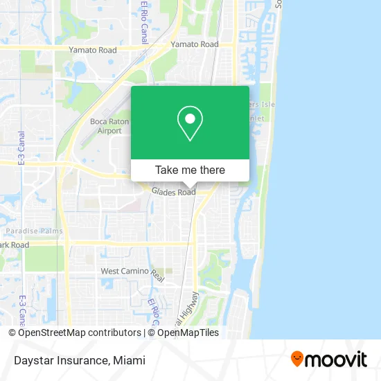
See Daystar Insurance, Boca Raton, on the map
Public Transit to Daystar Insurance in Boca Raton
Wondering how to get to Daystar Insurance in Boca Raton? Moovit helps you find the best way to get to Daystar Insurance with step-by-step directions from the nearest public transit station.
Moovit provides free maps and live directions to help you navigate through your city. View schedules, routes, timetables, and find out how long does it take to get to Daystar Insurance in real time.
Looking for the nearest stop or station to Daystar Insurance? Check out this list of stops closest to your destination: FEDERAL HWY at GLADES RD; Boca Raton; Boca Raton Station.
Bus: 1, 91, 94.Train: BLFM, TRIRAIL.
Want to see if there’s another route that gets you there at an earlier time? Moovit helps you find alternative routes or times. Get directions from and directions to Daystar Insurance easily from the Moovit App or Website.
We make riding to Daystar Insurance easy, which is why over 1.5 million users, including users in Boca Raton, trust Moovit as the best app for public transit. You don’t need to download an individual bus app or train app, Moovit is your all-in-one transit app that helps you find the best bus time or train time available.
For information on prices of bus and train, costs and ride fares to Daystar Insurance, please check the Moovit app.
Use the app to navigate to popular places including to the airport, hospital, stadium, grocery store, mall, coffee shop, school, college, and university.
Daystar Insurance Address: 77 Glades Rd Boca Raton, FL 33431 street in Boca Raton
- Building 105 Elevator,
- Ticketmaster Tollfree,
- Balfour Beatty Rail,
- Quiznos Sub,
- Florida Atlantic University,
- La Dan Design,
- FedEx Office,
- Luxury Auto Galleries,
- Commanding Your Care LLC,
- Sikes Financial Services,
- Sa Tech Engineering Consulting Group Pa,
- Ability Works,
- Quality Parking Systems,
- Med Connect Florida,
- Meena Rao LCSW,
- Med Connect Fl,
- Coastal Real Estate Professionals,
- Palm Beach County,
- USA CWS,
- Lids
Places Near Daystar Insurance (Boca Raton)
- Miami Design District, Miami,
- Bayside Marketplace, Miami,
- Zoo Miami, Miami,
- Aventura Mall, Miami Beach,
- Aventura Mall, Miami,
- Dolphin Mall Bus, Miami,
- Miami Freedom Park, Miami,
- Keiser University Flagship Campus, West Palm Beach,
- Richard E. Gerstein Justice Building, Miami,
- Dolphin Mall, Miami,
- Wynwood, Miami,
- Miami VA Hospital, Miami,
- Miami-Dade County Courthouse, Miami,
- Port of Miami Cruise Terminal, Miami,
- Brickell City Centre, Miami,
- Little Havana, Miami,
- Sawgrass Mall, Miami,
- Marlins Park, Miami,
- Sawgrass mall ( FL ), Miami Beach,
- Hard Rock Stadium, Miami Gardens
How to get to popular places in Miami with public transit
Get around Boca Raton by public transit!
Traveling around Boca Raton has never been so easy. See step by step directions as you travel to any attraction, street or major public transit station. View bus and train schedules, arrival times, service alerts and detailed routes on a map, so you know exactly how to get to anywhere in Boca Raton.
When traveling to any destination around Boca Raton use Moovit's Live Directions with Get Off Notifications to know exactly where and how far to walk, how long to wait for your line, and how many stops are left. Moovit will alert you when it's time to get off — no need to constantly re-check whether yours is the next stop.
Wondering how to use public transit in Boca Raton or how to pay for public transit in Boca Raton? Moovit public transit app can help you navigate your way with public transit easily, and at minimum cost. It includes public transit fees, ticket prices, and costs. Looking for a map of Boca Raton public transit lines? Moovit public transit app shows all public transit maps in Boca Raton with all Bus, Train, Light Rail and Ferry routes and stops on an interactive map.
Miami has 4 transit type(s), including: Bus, Train, Light Rail and Ferry, operated by several transit agencies, including Broward County Transit, Miami-Dade Transit, Metrorail, Palm Tran, Tri-Rail, Brightline, MARTY, City of Homestead Trolley, Key West Transit, Treasure Coast Connector, GoLine IRT, Amtrak, Greyhound-us, FlixBus-us and Aventura Express Shuttle Bus