How to get to Db Graphics by Colectivo?
Click on the Colectivo route to see step by step directions with maps, line arrival times and updated time schedules.
From San Miguel, Distrito Federal
62 minFrom Av. Belgrano y Av. Entre Ríos, Distrito Federal
53 minFrom Rincón 686, Distrito Federal
55 minFrom C5N, Distrito Federal
35 minFrom Facultad de Odontología (UBA), Distrito Federal
63 minFrom Parque Roca, Distrito Federal
69 minFrom Hospital Dr. Carlos Bocalandro, General San Martín
38 minFrom Chascomús, Distrito Federal
47 minFrom Avenida Córdoba, Distrito Federal
58 minFrom Avenida Belgrano 1700, Distrito Federal
53 min
How to get to Db Graphics by train?
Click on the train route to see step by step directions with maps, line arrival times and updated time schedules.
How to get to Db Graphics by Subte?
Click on the Subte route to see step by step directions with maps, line arrival times and updated time schedules.
From San Miguel, Distrito Federal
81 minFrom Av. Belgrano y Av. Entre Ríos, Distrito Federal
64 minFrom Rincón 686, Distrito Federal
72 minFrom C5N, Distrito Federal
59 minFrom Facultad de Odontología (UBA), Distrito Federal
70 minFrom Avenida Córdoba, Distrito Federal
67 minFrom Avenida Belgrano 1700, Distrito Federal
64 min
Colectivo stops near Db Graphics in Distrito Federal
Train stations near Db Graphics in Distrito Federal
Colectivo lines to Db Graphics in Distrito Federal
What are the closest stations to Db Graphics?
The closest stations to Db Graphics are:
- Avenida Salvador María Del Carril Y Condarco is 172 meters away, 3 min walk.
- Avenida Nazca Y Avenida Del Carril is 284 meters away, 4 min walk.
- Artigas Y Avenida Del Carril is 395 meters away, 6 min walk.
- Antonio Devoto is 1086 meters away, 14 min walk.
- Pueyrredón is 1730 meters away, 23 min walk.
- Villa Del Parque is 1774 meters away, 23 min walk.
Which Colectivo lines stop near Db Graphics?
These Colectivo lines stop near Db Graphics: 108, 123, 176.
Which train line stops near Db Graphics?
MITRE (Retiro (Mitre)→J. L. Suárez)
Which Subte line stops near Db Graphics?
B (Leandro N. Alem→Juan Manuel De Rosas)
What’s the nearest train station to Db Graphics in Distrito Federal?
The nearest train station to Db Graphics in Distrito Federal is Antonio Devoto. It’s a 14 min walk away.
What’s the nearest Colectivo station to Db Graphics in Distrito Federal?
The nearest Colectivo station to Db Graphics in Distrito Federal is Avenida Salvador María Del Carril Y Condarco. It’s a 3 min walk away.
What time is the first train to Db Graphics in Distrito Federal?
The URQUIZA is the first train that goes to Db Graphics in Distrito Federal. It stops nearby at 3:07 AM.
What time is the last train to Db Graphics in Distrito Federal?
The URQUIZA is the last train that goes to Db Graphics in Distrito Federal. It stops nearby at 3:12 AM.
What time is the first Colectivo to Db Graphics in Distrito Federal?
The 87 is the first Colectivo that goes to Db Graphics in Distrito Federal. It stops nearby at 3:04 AM.
What time is the last Colectivo to Db Graphics in Distrito Federal?
The 108 is the last Colectivo that goes to Db Graphics in Distrito Federal. It stops nearby at 3:38 AM.
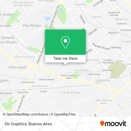
See Db Graphics, Distrito Federal, on the map
Public Transit to Db Graphics in Distrito Federal
Wondering how to get to Db Graphics in Distrito Federal? Moovit helps you find the best way to get to Db Graphics with step-by-step directions from the nearest public transit station.
Moovit provides free maps and live directions to help you navigate through your city. View schedules, routes, timetables, and find out how long does it take to get to Db Graphics in real time.
Looking for the nearest stop or station to Db Graphics? Check out this list of stops closest to your destination: Avenida Salvador María Del Carril Y Condarco; Avenida Nazca Y Avenida Del Carril; Artigas Y Avenida Del Carril; Antonio Devoto; Pueyrredón; Villa Del Parque.
Colectivo: 108, 123, 176, 110, 87.Train: MITRE, URQUIZA, SAN MARTÍN.Subte: B.
Want to see if there’s another route that gets you there at an earlier time? Moovit helps you find alternative routes or times. Get directions from and directions to Db Graphics easily from the Moovit App or Website.
We make riding to Db Graphics easy, which is why over 1.5 million users, including users in Distrito Federal, trust Moovit as the best app for public transit. You don’t need to download an individual bus app or train app, Moovit is your all-in-one transit app that helps you find the best bus time or train time available.
For information on prices of Colectivo, Subte and train, costs and ride fares to Db Graphics, please check the Moovit app.
Use the app to navigate to popular places including to the airport, hospital, stadium, grocery store, mall, coffee shop, school, college, and university.
Db Graphics Address: Pareja 2741, C1419GTM Ciudad de Buenos Aires street in Distrito Federal
- Condarco & Pareja,
- PASAJE FAMAILLA 2722,
- Terrada al 4200,
- Calzados Venta por Mayor o Fabricantes,
- Cientifica Terrada,
- Casa Mezquita (Reparación Y Repuestos De Cocinas, Termotanques, Estufas, Etc.),
- Condarco / Habana,
- Av Salvador Maria Del Carril al 2700,
- Terrada 4300,
- Pareja 2657,
- Del Carril Y Condarco,
- Hogares Buenos Aires,
- Librería Tinta Roja,
- La Casita de Angie,
- Avenida Salvador María del Carril 2638,
- Confitería Los Angelitos,
- NAZCA 4000,
- Acuario Deep Reef,
- Bolivia al 4200,
- Pareja / Nazca
Places Near Db Graphics (Distrito Federal)
- Dot Baires Shopping, Vicente López,
- Hospital Santa Lucia, Distrito Federal,
- Tecnópolis, Vicente López,
- Flores, Distrito Federal,
- La Plata, La Plata,
- Parque de la Ciudad, Distrito Federal,
- Aeropuerto Ezeiza, Distrito Federal,
- CABA, Distrito Federal,
- Abasto Shopping, Distrito Federal,
- Barrio Chino, Distrito Federal,
- Avellaneda, Avellaneda,
- La Plata, La Plata,
- Movistar Arena, Distrito Federal,
- Aeroparque Jorge Newbery,
- Jardín Japonés, Distrito Federal,
- Unicenter Shopping, San Isidro,
- Buenos Aires, Distrito Federal,
- Estadio Monumental (River Plate), Distrito Federal,
- Once, Distrito Federal,
- Facultad de Odontología (UBA), Distrito Federal
How to get to popular places in Buenos Aires with public transit
Get around Distrito Federal by public transit!
Traveling around Distrito Federal has never been so easy. See step by step directions as you travel to any attraction, street or major public transit station. View bus and train schedules, arrival times, service alerts and detailed routes on a map, so you know exactly how to get to anywhere in Distrito Federal.
When traveling to any destination around Distrito Federal use Moovit's Live Directions with Get Off Notifications to know exactly where and how far to walk, how long to wait for your line, and how many stops are left. Moovit will alert you when it's time to get off — no need to constantly re-check whether yours is the next stop.
Wondering how to use public transit in Distrito Federal or how to pay for public transit in Distrito Federal? Moovit public transit app can help you navigate your way with public transit easily, and at minimum cost. It includes public transit fees, ticket prices, and costs. Looking for a map of Distrito Federal public transit lines? Moovit public transit app shows all public transit maps in Distrito Federal with all Colectivo, Train, Subte, Light Rail and Ferry routes and stops on an interactive map.
Buenos Aires has 5 transit type(s), including: Colectivo, Train, Subte, Light Rail and Ferry, operated by several transit agencies, including Municipalidad Carmen de Areco, Trenes Argentinos, Ferrovías, Metrovías, Subte de Buenos Aires, Doscientos Ocho Transporte Automotor S.A., Empresa del Oeste, Empresa de Transportes Tratado del PIlar S.R.L., Transportes Veintidos de Septiembre, Sargento Cabral, Transportes Sesenta y Ocho, Transportes Quirno Costa, Transportes Santa Fe, Transportes Automotores Riachuelo and Transportes Atlantida