How to get to Dc Designbar by bus?
Click on the bus route to see step by step directions with maps, line arrival times and updated time schedules.
From Salamander Washington DC, Washington
120 minFrom Tidal Basin, Washington
126 minFrom State Department, Washington
112 minFrom Fogo de Chao, Washington
104 minFrom Anacostia Station, Washington
113 minFrom White House Visitor Center, Washington
98 minFrom 8th St SE A St, Washington
123 minFrom Smithsonian National Museum of Natural History, Washington
119 minFrom Hamilton's Bar & Grill, Washington
124 minFrom Russell Senate Office Building, Washington
122 min
How to get to Dc Designbar by train?
Click on the train route to see step by step directions with maps, line arrival times and updated time schedules.
From Salamander Washington DC, Washington
57 minFrom Tidal Basin, Washington
66 minFrom Fogo de Chao, Washington
70 minFrom White House Visitor Center, Washington
69 minFrom 8th St SE A St, Washington
66 minFrom Smithsonian National Museum of Natural History, Washington
71 minFrom Russell Senate Office Building, Washington
54 minFrom Hamilton's Bar & Grill, Washington
56 min
How to get to Dc Designbar by metro?
Click on the metro route to see step by step directions with maps, line arrival times and updated time schedules.
From Salamander Washington DC, Washington
55 minFrom Tidal Basin, Washington
64 minFrom State Department, Washington
58 minFrom Fogo de Chao, Washington
56 minFrom Anacostia Station, Washington
57 minFrom White House Visitor Center, Washington
59 minFrom 8th St SE A St, Washington
67 minFrom Smithsonian National Museum of Natural History, Washington
54 minFrom Russell Senate Office Building, Washington
65 minFrom Hamilton's Bar & Grill, Washington
59 min
Bus stops near Dc Designbar in Alexandria
Metro station near Dc Designbar in Alexandria
- King Street-Old Town, 19 min walk,VIEW
Train station near Dc Designbar in Alexandria
- Alexandria, 21 min walk,VIEW
Bus lines to Dc Designbar in Alexandria
What are the closest stations to Dc Designbar?
The closest stations to Dc Designbar are:
- King St + S Pitt St is 39 yards away, 1 min walk.
- Washington St & Queen St is 180 yards away, 3 min walk.
- City Hall / Market Sq is 232 yards away, 3 min walk.
- King Street-Old Town is 1546 yards away, 19 min walk.
- Alexandria is 1755 yards away, 21 min walk.
Which bus lines stop near Dc Designbar?
These bus lines stop near Dc Designbar: 30, 31, 34, A11, P90.
Which train lines stop near Dc Designbar?
These train lines stop near Dc Designbar: MANASSAS LINE, PALMETTO.
Which metro lines stop near Dc Designbar?
These metro lines stop near Dc Designbar: BLUE, YELLOW.
What’s the nearest metro station to Dc Designbar in Alexandria?
The nearest metro station to Dc Designbar in Alexandria is King Street-Old Town. It’s a 19 min walk away.
What’s the nearest train station to Dc Designbar in Alexandria?
The nearest train station to Dc Designbar in Alexandria is Alexandria. It’s a 21 min walk away.
What’s the nearest bus station to Dc Designbar in Alexandria?
The nearest bus station to Dc Designbar in Alexandria is King St + S Pitt St. It’s a 1 min walk away.
What time is the first metro to Dc Designbar in Alexandria?
The YELLOW is the first metro that goes to Dc Designbar in Alexandria. It stops nearby at 5:02 AM.
What time is the last metro to Dc Designbar in Alexandria?
The YELLOW is the last metro that goes to Dc Designbar in Alexandria. It stops nearby at 12:37 AM.
What time is the first train to Dc Designbar in Alexandria?
The SILVER METEOR is the first train that goes to Dc Designbar in Alexandria. It stops nearby at 5:54 AM.
What time is the last train to Dc Designbar in Alexandria?
The SILVER METEOR is the last train that goes to Dc Designbar in Alexandria. It stops nearby at 5:54 AM.
What time is the first bus to Dc Designbar in Alexandria?
The A11 is the first bus that goes to Dc Designbar in Alexandria. It stops nearby at 4:39 AM.
What time is the last bus to Dc Designbar in Alexandria?
The 30 is the last bus that goes to Dc Designbar in Alexandria. It stops nearby at 1:54 AM.
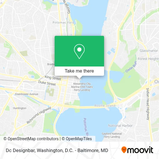
See Dc Designbar, Alexandria, on the map
Public Transit to Dc Designbar in Alexandria
Wondering how to get to Dc Designbar in Alexandria? Moovit helps you find the best way to get to Dc Designbar with step-by-step directions from the nearest public transit station.
Moovit provides free maps and live directions to help you navigate through your city. View schedules, routes, timetables, and find out how long does it take to get to Dc Designbar in real time.
Looking for the nearest stop or station to Dc Designbar? Check out this list of stops closest to your destination: King St + S Pitt St; Washington St & Queen St; City Hall / Market Sq; King Street-Old Town; Alexandria.
Bus: 30, 31, 34, A11, P90, KST, A12, F19.Train: MANASSAS LINE, PALMETTO, CARDINAL, CAROLINIAN, CRESCENT, FLORIDIAN, NORTHEAST REGIONAL.Metro: BLUE, YELLOW.
Want to see if there’s another route that gets you there at an earlier time? Moovit helps you find alternative routes or times. Get directions from and directions to Dc Designbar easily from the Moovit App or Website.
We make riding to Dc Designbar easy, which is why over 1.7 million users, including users in Alexandria, trust Moovit as the best app for public transit. You don’t need to download an individual bus app or train app, Moovit is your all-in-one transit app that helps you find the best bus time or train time available.
For information on prices of bus, metro and train, costs and ride fares to Dc Designbar, please check the Moovit app.
Use the app to navigate to popular places including to the airport, hospital, stadium, grocery store, mall, coffee shop, school, college, and university.
Dc Designbar Address: 201 N Union St street in Alexandria
- Blackwall Hitch,
- Old Town Waterfront,
- Torpedo Factory Art Center,
- Alexandria-National Harbor Water Taxi,
- Alexandria City Marina (Old Town) Ferry Landing,
- Founders Park,
- Fish Market,
- Mai Thai (Mia Thai Restaurant Old Town),
- Daniel O'Connell's Irish Restaurant & Bar,
- Carlyle House Historic Park,
- Waterfront Park (Old Town Waterfront),
- Alexandria City Government (Alexandria City Hall),
- Javelin,
- Gadsby's Tavern,
- Alexandria, Virginia,
- Hotel Indigo Old Town Alexandria an IHG Hotel,
- Hotel Indigo,
- The Alexandrian, Autograph Collection,
- Alexandria Courthouse,
- St. Mary Catholic Church
Places Near Dc Designbar (Alexandria)
- Washington National Cathedral, Washington,
- The Anthem, Washington,
- Museum Of The Bible, Washington,
- Warner Theatre, Washington,
- Basilica of the National Shrine, Washington,
- National Theatre, Washington,
- Pennsylvania Ave NW (3rd st and pennsylvania), Washington,
- Georgetown, Washington,
- National Museum of African American History and Culture, Washington,
- PG Mall, Prince George's County,
- Westfield Montgomery Mall, Montgomery County,
- M&T Bank Stadium, Baltimore,
- Rock Creek Tennis Center, Washington,
- Washington DC VA Medical Center, Washington,
- Capital One Arena, Washington,
- Camden Yards, Baltimore,
- Amazon Hq2, Arlington County,
- Marriott Marquis Washington, DC, Washington,
- Sibley Memorial Hospital, Washington,
- National Zoo, Washington
How to get to popular places in Washington, D.C. - Baltimore, MD with public transit
Get around Alexandria by public transit!
Traveling around Alexandria has never been so easy. See step by step directions as you travel to any attraction, street or major public transit station. View bus and train schedules, arrival times, service alerts and detailed routes on a map, so you know exactly how to get to anywhere in Alexandria.
When traveling to any destination around Alexandria use Moovit's Live Directions with Get Off Notifications to know exactly where and how far to walk, how long to wait for your line, and how many stops are left. Moovit will alert you when it's time to get off — no need to constantly re-check whether yours is the next stop.
Wondering how to use public transit in Alexandria or how to pay for public transit in Alexandria? Moovit public transit app can help you navigate your way with public transit easily, and at minimum cost. It includes public transit fees, ticket prices, and costs. Looking for a map of Alexandria public transit lines? Moovit public transit app shows all public transit maps in Alexandria with all Bus, Train, Metro, Light Rail and Ferry routes and stops on an interactive map.
Washington, D.C. - Baltimore, MD has 5 transit type(s), including: Bus, Train, Metro, Light Rail and Ferry, operated by several transit agencies, including WMATA, Montgomery County Ride On, Fairfax Connector, TheBus, PRTC, DASH - Alexandria, Arlington Transit (ART), RTA of Central Maryland, MDOT MTA, MDOT MTA Light RailLink, MDOT MTA Commuter Bus, MDOT MTA Local Bus, FXBGO!, Virginia Railway Express (VRE) and MARC