How to get to Dcap Freeport by bus?
Click on the bus route to see step by step directions with maps, line arrival times and updated time schedules.
How to get to Dcap Freeport by train?
Click on the train route to see step by step directions with maps, line arrival times and updated time schedules.
Bus stops near Dcap Freeport
Train station near Dcap Freeport
- Merrick, 9 min walk,VIEW
Bus lines to Dcap Freeport
What are the closest stations to Dcap Freeport?
The closest stations to Dcap Freeport are:
- N Main St + Broadway is 227 yards away, 3 min walk.
- Broadway + N Main St is 242 yards away, 3 min walk.
- Freeport Sta / South Bay 2 is 401 yards away, 5 min walk.
- S Main St / Merrick is 435 yards away, 6 min walk.
- Merrick is 728 yards away, 9 min walk.
Which bus lines stop near Dcap Freeport?
These bus lines stop near Dcap Freeport: N4, N40, N43, N43X, N4X.
Which train line stops near Dcap Freeport?
BABYLON BRANCH (Babylon)
What’s the nearest train station to Dcap Freeport?
The nearest train station to Dcap Freeport is Merrick. It’s a 9 min walk away.
What’s the nearest bus station to Dcap Freeport?
The nearest bus stations to Dcap Freeport are N Main St + Broadway and Broadway + N Main St. The closest one is a 3 min walk away.
What time is the first train to Dcap Freeport?
The BABYLON BRANCH is the first train that goes to Dcap Freeport. It stops nearby at 3:26 AM.
What time is the last train to Dcap Freeport?
The BABYLON BRANCH is the last train that goes to Dcap Freeport. It stops nearby at 3:35 AM.
What time is the first bus to Dcap Freeport?
The N4 is the first bus that goes to Dcap Freeport. It stops nearby at 3:25 AM.
What time is the last bus to Dcap Freeport?
The N4 is the last bus that goes to Dcap Freeport. It stops nearby at 3:25 AM.
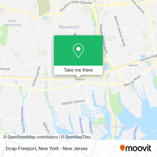
See Dcap Freeport on the map
Public Transportation to Dcap Freeport
Wondering how to get to Dcap Freeport? Moovit helps you find the best way to get to Dcap Freeport with step-by-step directions from the nearest public transit station.
Moovit provides free maps and live directions to help you navigate through your city. View schedules, routes, timetables, and find out how long does it take to get to Dcap Freeport in real time.
Looking for the nearest stop or station to Dcap Freeport? Check out this list of stops closest to your destination: N Main St + Broadway; Broadway + N Main St; Freeport Sta / South Bay 2; S Main St / Merrick; Merrick.
Bus: N4, N40, N43, N43X, N4X, N41, N19, N19X, N88X.Train: BABYLON BRANCH.
Want to see if there’s another route that gets you there at an earlier time? Moovit helps you find alternative routes or times. Get directions from and directions to Dcap Freeport easily from the Moovit App or Website.
We make riding to Dcap Freeport easy, which is why over 1.5 million users, including users in Freeport, trust Moovit as the best app for public transit. You don’t need to download an individual bus app or train app, Moovit is your all-in-one transit app that helps you find the best bus time or train time available.
For information on prices of bus and train, costs and ride fares to Dcap Freeport, please check the Moovit app.
Use the app to navigate to popular places including to the airport, hospital, stadium, grocery store, mall, coffee shop, school, college, and university.
Dcap Freeport Address: 17 W Sunrise Hwy street in Freeport
- Clarke and Associates,
- Ashley Store,
- Sophie Hair Braiding,
- Plus Spa,
- The Tax Zone,
- Legal Shield - New York Success Center,
- Clarke & Associates, Long Island Immigration Attorneys,
- Warren Warren & Appolon Llp,
- Ed Walker,
- Nizo Motorsports Freeport,
- Version Performance,
- Unlimited Auto Sales & Rentals,
- Tgauto Spa,
- The New Generation Barber Shop,
- Jaquelin's Unisex Beauty Salon,
- Ls Tax Services,
- Andrew Davis Amra and Associates Realty,
- Quality Caregivers,
- It Solutions Jovel Corp,
- Quality Cleaning & Maintenance Service Corp
Places Near Dcap Freeport
- Katz's Deli, Manhattan,
- 26 Federal Plaza, Manhattan,
- 1 Police Plaza, Manhattan,
- 376 Hudson Street, Manhattan,
- 3 Stone St, Manhattan,
- Mountainside Hospital, Glen Ridge,
- qqqq, Manhattan,
- Hudson Yards, Manhattan,
- Chinatown, Manhattan,
- Wall Street, Manhattan,
- Bellevue Hospital, Manhattan,
- Queens Center Mall, Queens,
- Pier 83, Manhattan,
- Rockefeller Center, Manhattan,
- 911 Memorial, Manhattan,
- Times Square, Manhattan,
- 66 John Street, Manhattan,
- San Gennaro Feast, Manhattan,
- SoHo, Manhattan,
- 111 Centre New York City Supreme Court, Manhattan
How to get to popular places in New York - New Jersey with public transit
Get around Freeport by public transit!
Traveling around Freeport has never been so easy. See step by step directions as you travel to any attraction, street or major public transit station. View bus and train schedules, arrival times, service alerts and detailed routes on a map, so you know exactly how to get to anywhere in Freeport.
When traveling to any destination around Freeport use Moovit's Live Directions with Get Off Notifications to know exactly where and how far to walk, how long to wait for your line, and how many stops are left. Moovit will alert you when it's time to get off — no need to constantly re-check whether yours is the next stop.
Wondering how to use public transit in Freeport or how to pay for public transit in Freeport? Moovit public transit app can help you navigate your way with public transit easily, and at minimum cost. It includes public transit fees, ticket prices, and costs. Looking for a map of Freeport public transit lines? Moovit public transit app shows all public transit maps in Freeport with all Bus, Train, Subway, Light Rail, Ferry and Cable Car routes and stops on an interactive map.
New York - New Jersey has 6 transit type(s), including: Bus, Train, Subway, Light Rail, Ferry and Cable Car, operated by several transit agencies, including MTA Subway, Metro-North Railroad, LIRR, PATH, MTA New York City Transit - Express routes, MTA Bus, NJ Transit, NYC Ferry, NICE bus, Bee-Line Bus, NJ Transit Rail, Norwalk Transit District, Hartford Line, River Valley Transit and HART