How to get to Dcap Insurance by bus?
Click on the bus route to see step by step directions with maps, line arrival times and updated time schedules.
How to get to Dcap Insurance by subway?
Click on the subway route to see step by step directions with maps, line arrival times and updated time schedules.
Bus stops near Dcap Insurance in New York - New Jersey
Subway stations near Dcap Insurance in New York - New Jersey
- Avenue U, 1 min walk,VIEW
Bus lines to Dcap Insurance in New York - New Jersey
What are the closest stations to Dcap Insurance?
The closest stations to Dcap Insurance are:
- Avenue U/Mcdonald Av is 43 yards away, 1 min walk.
- Avenue U is 70 yards away, 1 min walk.
- 86 St/Van Sicklen St is 766 yards away, 10 min walk.
Which bus lines stop near Dcap Insurance?
These bus lines stop near Dcap Insurance: B1, B3, B4, B82-SBS.
Which subway lines stop near Dcap Insurance?
These subway lines stop near Dcap Insurance: F, N.
What’s the nearest subway station to Dcap Insurance in New York - New Jersey?
The nearest subway station to Dcap Insurance in New York - New Jersey is Avenue U. It’s a 1 min walk away.
What’s the nearest bus station to Dcap Insurance in New York - New Jersey?
The nearest bus station to Dcap Insurance in New York - New Jersey is Avenue U/Mcdonald Av. It’s a 1 min walk away.
What time is the first subway to Dcap Insurance in New York - New Jersey?
The N is the first subway that goes to Dcap Insurance in New York - New Jersey. It stops nearby at 3:00 AM.
What time is the last subway to Dcap Insurance in New York - New Jersey?
The F is the last subway that goes to Dcap Insurance in New York - New Jersey. It stops nearby at 4:45 AM.
What time is the first bus to Dcap Insurance in New York - New Jersey?
The B3 is the first bus that goes to Dcap Insurance in New York - New Jersey. It stops nearby at 3:06 AM.
What time is the last bus to Dcap Insurance in New York - New Jersey?
The B1 is the last bus that goes to Dcap Insurance in New York - New Jersey. It stops nearby at 3:16 AM.
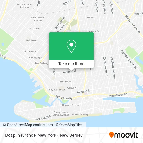
See Dcap Insurance, New York - New Jersey, on the map
Public Transit to Dcap Insurance in New York - New Jersey
Wondering how to get to Dcap Insurance in New York - New Jersey? Moovit helps you find the best way to get to Dcap Insurance with step-by-step directions from the nearest public transit station.
Moovit provides free maps and live directions to help you navigate through your city. View schedules, routes, timetables, and find out how long does it take to get to Dcap Insurance in real time.
Looking for the nearest stop or station to Dcap Insurance? Check out this list of stops closest to your destination: Avenue U/Mcdonald Av; Avenue U; 86 St/Van Sicklen St.
Bus: B1, B3, B4, B82-SBS.Subway: F, N, FX, W.
Want to see if there’s another route that gets you there at an earlier time? Moovit helps you find alternative routes or times. Get directions from and directions to Dcap Insurance easily from the Moovit App or Website.
We make riding to Dcap Insurance easy, which is why over 1.5 million users, including users in New York - New Jersey, trust Moovit as the best app for public transit. You don’t need to download an individual bus app or train app, Moovit is your all-in-one transit app that helps you find the best bus time or train time available.
For information on prices of subway, bus and ferry, costs and ride fares to Dcap Insurance, please check the Moovit app.
Use the app to navigate to popular places including to the airport, hospital, stadium, grocery store, mall, coffee shop, school, college, and university.
Dcap Insurance Address: 28 Village Rd N Ste 2R street in New York - New Jersey
- Rpk Professional Group Llc,
- Toughcomp,
- Elegant Direct Dental Supply,
- P.S. 95 - The Gravesend School,
- The Color Bar,
- Radiant Dental Design,
- Huarache Artesanal Tusita,
- Highland Stickers,
- Omni Health Food and Organic Juice Bar,
- Dents In Or Out,
- Ups Authorized Shipping Outlet,
- Cave,
- Alena's Beauty Studio,
- Pozvonok,
- Generation Judo,
- Messiah's Congregation,
- Covenant Ballet Theatre Of Brooklyn,
- Endlessbeauty,
- Extra Crispy Pizzeria & Restaurant,
- Great Lovely Perfect Nails
Places Near Dcap Insurance (New York - New Jersey)
- qqqq, Manhattan,
- Rockefeller Center, Manhattan,
- Chinatown, Manhattan,
- Mountainside Hospital, Glen Ridge,
- 66 John Street, Manhattan,
- Hudson Yards, Manhattan,
- SoHo, Manhattan,
- Katz's Deli, Manhattan,
- San Gennaro Feast, Manhattan,
- 3 Stone St, Manhattan,
- 911 Memorial, Manhattan,
- 376 Hudson Street, Manhattan,
- Bellevue Hospital, Manhattan,
- Wall Street, Manhattan,
- Queens Center Mall, Queens,
- Pier 83, Manhattan,
- 1 Police Plaza, Manhattan,
- Times Square, Manhattan,
- 111 Centre New York City Supreme Court, Manhattan,
- 26 Federal Plaza, Manhattan
How to get to popular places in New York - New Jersey with public transit
Get around New York - New Jersey by public transit!
Traveling around New York - New Jersey has never been so easy. See step by step directions as you travel to any attraction, street or major public transit station. View bus and train schedules, arrival times, service alerts and detailed routes on a map, so you know exactly how to get to anywhere in New York - New Jersey.
When traveling to any destination around New York - New Jersey use Moovit's Live Directions with Get Off Notifications to know exactly where and how far to walk, how long to wait for your line, and how many stops are left. Moovit will alert you when it's time to get off — no need to constantly re-check whether yours is the next stop.
Wondering how to use public transit in New York - New Jersey or how to pay for public transit in New York - New Jersey? Moovit public transit app can help you navigate your way with public transit easily, and at minimum cost. It includes public transit fees, ticket prices, and costs. Looking for a map of New York - New Jersey public transit lines? Moovit public transit app shows all public transit maps in New York - New Jersey with all Bus, Train, Subway, Light Rail, Ferry and Cable Car routes and stops on an interactive map.
New York - New Jersey has 6 transit type(s), including: Bus, Train, Subway, Light Rail, Ferry and Cable Car, operated by several transit agencies, including MTA Subway, Metro-North Railroad, LIRR, PATH, MTA New York City Transit - Express routes, MTA Bus, NJ Transit, NYC Ferry, NICE bus, Bee-Line Bus, NJ Transit Rail, Norwalk Transit District, Hartford Line, River Valley Transit and HART