How to get to Dcap Insurance by bus?
Click on the bus route to see step by step directions with maps, line arrival times and updated time schedules.
From Valley Stream, NY, Valley Stream
50 minFrom Roosevelt Field Mall Bus Terminal, East Garden City
46 minFrom Plattduetsche Park, Franklin Square
64 minFrom Westbury, NY, Westbury
58 minFrom Uniondale, NY, Uniondale
31 minFrom Green Acres Mall, South Valley Stream
66 minFrom East Meadow, NY, East Meadow
57 minFrom Garden City, NY, Garden City
38 minFrom Mercy Hospital, Rockville Centre
65 minFrom Walmart, Valley Stream
60 min
How to get to Dcap Insurance by train?
Click on the train route to see step by step directions with maps, line arrival times and updated time schedules.
From Valley Stream, NY, Valley Stream
55 minFrom Roosevelt Field Mall Bus Terminal, East Garden City
78 minFrom Plattduetsche Park, Franklin Square
73 minFrom Westbury, NY, Westbury
61 minFrom Green Acres Mall, South Valley Stream
63 minFrom Garden City, NY, Garden City
66 minFrom Walmart, Valley Stream
56 min
Bus stops near Dcap Insurance in Freeport
Train station near Dcap Insurance in Freeport
- Freeport, 20 min walk,VIEW
Bus lines to Dcap Insurance in Freeport
What are the closest stations to Dcap Insurance?
The closest stations to Dcap Insurance are:
- Freeport Sta / North Bay 2 is 417 yards away, 6 min walk.
- Freeport Sta / South Bay 2 is 425 yards away, 6 min walk.
- Freeport Sta / South Bay 1 is 477 yards away, 6 min walk.
- Freeport Sta / Henry is 515 yards away, 7 min walk.
- Freeport is 1681 yards away, 20 min walk.
Which bus lines stop near Dcap Insurance?
These bus lines stop near Dcap Insurance: N4, N40, N40X, N43, N4X.
Which train line stops near Dcap Insurance?
BABYLON BRANCH (Babylon)
What’s the nearest train station to Dcap Insurance in Freeport?
The nearest train station to Dcap Insurance in Freeport is Freeport. It’s a 20 min walk away.
What’s the nearest bus station to Dcap Insurance in Freeport?
The nearest bus stations to Dcap Insurance in Freeport are Freeport Sta / North Bay 2, Freeport Sta / South Bay 2 and Freeport Sta / South Bay 1. The closest one is a 6 min walk away.
What time is the first train to Dcap Insurance in Freeport?
The BABYLON BRANCH is the first train that goes to Dcap Insurance in Freeport. It stops nearby at 3:26 AM.
What time is the last train to Dcap Insurance in Freeport?
The BABYLON BRANCH is the last train that goes to Dcap Insurance in Freeport. It stops nearby at 3:35 AM.
What time is the first bus to Dcap Insurance in Freeport?
The N4 is the first bus that goes to Dcap Insurance in Freeport. It stops nearby at 3:25 AM.
What time is the last bus to Dcap Insurance in Freeport?
The N4 is the last bus that goes to Dcap Insurance in Freeport. It stops nearby at 3:26 AM.
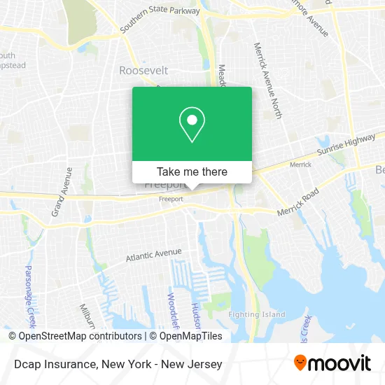
See Dcap Insurance, Freeport, on the map
Public Transit to Dcap Insurance in Freeport
Wondering how to get to Dcap Insurance in Freeport? Moovit helps you find the best way to get to Dcap Insurance with step-by-step directions from the nearest public transit station.
Moovit provides free maps and live directions to help you navigate through your city. View schedules, routes, timetables, and find out how long does it take to get to Dcap Insurance in real time.
Looking for the nearest stop or station to Dcap Insurance? Check out this list of stops closest to your destination: Freeport Sta / North Bay 2; Freeport Sta / South Bay 2; Freeport Sta / South Bay 1; Freeport Sta / Henry; Freeport.
Bus: N4, N40, N40X, N43, N4X, N88X, N19, N19X, N41, N43X.Train: BABYLON BRANCH.
Want to see if there’s another route that gets you there at an earlier time? Moovit helps you find alternative routes or times. Get directions from and directions to Dcap Insurance easily from the Moovit App or Website.
We make riding to Dcap Insurance easy, which is why over 1.5 million users, including users in Freeport, trust Moovit as the best app for public transit. You don’t need to download an individual bus app or train app, Moovit is your all-in-one transit app that helps you find the best bus time or train time available.
For information on prices of bus and train, costs and ride fares to Dcap Insurance, please check the Moovit app.
Use the app to navigate to popular places including to the airport, hospital, stadium, grocery store, mall, coffee shop, school, college, and university.
Dcap Insurance Address: 123 E Sunrise Hwy street in Freeport
- All About Cats Rescue,
- Proactive Home Services,
- Spicy Tips Llc,
- Minute Key,
- Ups Access Point Location,
- Experts Garage Door Repair Installation Process,
- Levl6,
- Home Services at the Home Depot,
- Ferguson Hvac Supply,
- Ll Flooring,
- Amazon Locker - Almino,
- Foreveh Lit Cosmetics L L C,
- Amazon Locker - Almino,
- Freeport Commons,
- Clean Cruisin' Auto Spa & Mobile Detailing,
- Party City,
- n62 freeport loop Bus Stop,
- Cjmotors Mechanic and Body Shop,
- L & M Crane and Rigging Corp.,
- Homeplumbing.Com
Places Near Dcap Insurance (Freeport)
- 26 Federal Plaza, Manhattan,
- Queens Center Mall, Queens,
- Katz's Deli, Manhattan,
- Pier 83, Manhattan,
- Chinatown, Manhattan,
- Mountainside Hospital, Glen Ridge,
- Bellevue Hospital, Manhattan,
- 3 Stone St, Manhattan,
- 1 Police Plaza, Manhattan,
- Rockefeller Center, Manhattan,
- 66 John Street, Manhattan,
- Times Square, Manhattan,
- Wall Street, Manhattan,
- Hudson Yards, Manhattan,
- qqqq, Manhattan,
- 376 Hudson Street, Manhattan,
- SoHo, Manhattan,
- San Gennaro Feast, Manhattan,
- 111 Centre New York City Supreme Court, Manhattan,
- 911 Memorial, Manhattan
How to get to popular places in New York - New Jersey with public transit
Get around Freeport by public transit!
Traveling around Freeport has never been so easy. See step by step directions as you travel to any attraction, street or major public transit station. View bus and train schedules, arrival times, service alerts and detailed routes on a map, so you know exactly how to get to anywhere in Freeport.
When traveling to any destination around Freeport use Moovit's Live Directions with Get Off Notifications to know exactly where and how far to walk, how long to wait for your line, and how many stops are left. Moovit will alert you when it's time to get off — no need to constantly re-check whether yours is the next stop.
Wondering how to use public transit in Freeport or how to pay for public transit in Freeport? Moovit public transit app can help you navigate your way with public transit easily, and at minimum cost. It includes public transit fees, ticket prices, and costs. Looking for a map of Freeport public transit lines? Moovit public transit app shows all public transit maps in Freeport with all Bus, Train, Subway, Light Rail, Ferry and Cable Car routes and stops on an interactive map.
New York - New Jersey has 6 transit type(s), including: Bus, Train, Subway, Light Rail, Ferry and Cable Car, operated by several transit agencies, including MTA Subway, Metro-North Railroad, LIRR, PATH, MTA New York City Transit - Express routes, MTA Bus, NJ Transit, NYC Ferry, NICE bus, Bee-Line Bus, NJ Transit Rail, Norwalk Transit District, Hartford Line, River Valley Transit and HART