Directions to Dcap Medford with public transportation
The following transit lines have routes that pass near Dcap Medford
 Bus: 52B, 55.
- Train: GREENPORT SERVICE.
How to get to Dcap Medford by bus?
Click on the bus route to see step by step directions with maps, line arrival times and updated time schedules.
From Good Samaritan Hospital Medical Center
107 minFrom Hauppauge ny
71 minFrom Splish Splash Waterpark
83 minFrom Tanger Outlets, Deer Park
147 minFrom Baxter Pavillion @ Good Sam
92 minFrom Paramount
165 minFrom Tanger Outlets
145 minFrom Brentwood, NY
95 minFrom Jake's 58 Casino
68 minFrom Tanger Outlets, Riverhead
88 min
How to get to Dcap Medford by train?
Click on the train route to see step by step directions with maps, line arrival times and updated time schedules.
Bus stop near Dcap Medford
- Nys 112/Horseblock Rd, 3 min walk,VIEW
Train station near Dcap Medford
- Medford, 53 min walk,VIEW
Bus lines to Dcap Medford
- 55, Port Jefferson Station,VIEW
What are the closest stations to Dcap Medford?
The closest stations to Dcap Medford are:
- Nys 112/Horseblock Rd is 195 yards away, 3 min walk.
- Medford is 4523 yards away, 53 min walk.
Which bus lines stop near Dcap Medford?
These bus lines stop near Dcap Medford: 52B, 55.
Which train line stops near Dcap Medford?
GREENPORT SERVICE (Greenport)
What’s the nearest bus station to Dcap Medford?
The nearest bus station to Dcap Medford is Nys 112/Horseblock Rd. It’s a 3 min walk away.
What time is the first train to Dcap Medford?
The GREENPORT SERVICE is the first train that goes to Dcap Medford. It stops nearby at 6:33 AM.
What time is the last train to Dcap Medford?
The GREENPORT SERVICE is the last train that goes to Dcap Medford. It stops nearby at 10:06 PM.
What time is the first bus to Dcap Medford?
The 55 is the first bus that goes to Dcap Medford. It stops nearby at 5:21 AM.
What time is the last bus to Dcap Medford?
The 55 is the last bus that goes to Dcap Medford. It stops nearby at 10:38 PM.
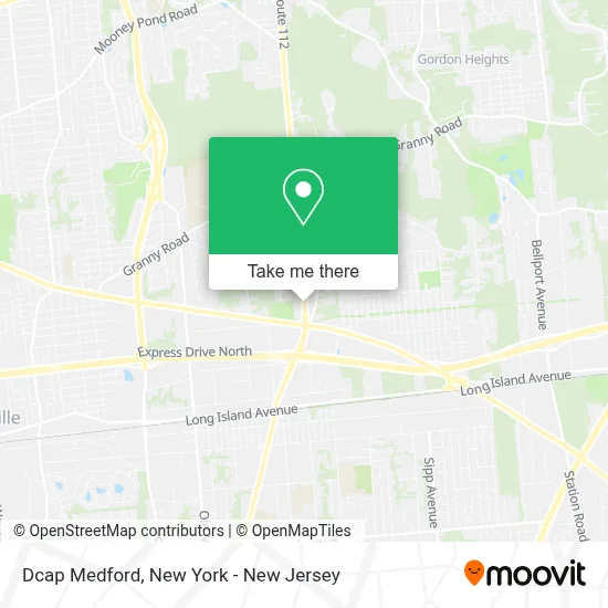
See Dcap Medford on the map
Public Transportation to Dcap Medford
Wondering how to get to Dcap Medford? Moovit helps you find the best way to get to Dcap Medford with step-by-step directions from the nearest public transit station.
Moovit provides free maps and live directions to help you navigate through your city. View schedules, routes, timetables, and find out how long does it take to get to Dcap Medford in real time.
Looking for the nearest stop or station to Dcap Medford? Check out this list of stops closest to your destination: Nys 112/Horseblock Rd; Medford.
Bus: 52B, 55.Train: GREENPORT SERVICE.
Want to see if there’s another route that gets you there at an earlier time? Moovit helps you find alternative routes or times. Get directions from and directions to Dcap Medford easily from the Moovit App or Website.
We make riding to Dcap Medford easy, which is why over 1.5 million users, including users in Medford, trust Moovit as the best app for public transit. You don’t need to download an individual bus app or train app, Moovit is your all-in-one transit app that helps you find the best bus time or train time available.
For information on prices of bus and train, costs and ride fares to Dcap Medford, please check the Moovit app.
Get to Dcap Medford with public transit and pay for the ride in the Moovit app. In addition to all info you may need for your trip to Dcap Medford, including live directions, real-time arrivals and fare prices, you can also buy public transit passes for your rides. No need for cash or paper tickets to get to Dcap Medford - everything you need is accessible in the app with a click of the button.
Use the app to navigate to popular places including to the airport, hospital, stadium, grocery store, mall, coffee shop, school, college, and university.
Dcap Medford Address: 2890 Rte 112 Unit 1 street in Medford
- Axis Cafe,
- Flatroof,
- Rbr Restoration,
- Medford Fire District,
- Sofia Auto Salon,
- Western Union,
- Libertyx Bitcoin Atm,
- Walgreens Pharmacy,
- Labcorp at Walgreens,
- Labcorp,
- Atm Walgreens,
- Walgreens #11209,
- Soundview Driveways & Patios,
- Dip It Hot,
- Fedex,
- Sonlight Journey,
- Goodfellas Automobile Repair,
- Royal Rangers Outpost 276,
- Prime Discount Tire,
- Cosmoprof
Places Near Dcap Medford
- 111 Centre New York City Supreme Court, Manhattan,
- 376 Hudson Street, Manhattan,
- Wall Street, Manhattan,
- 1 Police Plaza, Manhattan,
- Katz's Deli, Manhattan,
- Rockefeller Center, Manhattan,
- 26 Federal Plaza, Manhattan,
- 911 Memorial, Manhattan,
- Queens Center Mall, Queens,
- San Gennaro Feast, Manhattan,
- 66 John Street, Manhattan,
- SoHo, Manhattan,
- Bellevue Hospital, Manhattan,
- Chinatown, Manhattan,
- 3 Stone St, Manhattan,
- Hudson Yards, Manhattan,
- qqqq, Manhattan,
- Mountainside Hospital, Glen Ridge,
- Pier 83, Manhattan,
- Times Square, Manhattan
How to get to popular places in New York - New Jersey with public transit
Get around Medford by public transit!
Traveling around Medford has never been so easy. See step by step directions as you travel to any attraction, street or major public transit station. View bus and train schedules, arrival times, service alerts and detailed routes on a map, so you know exactly how to get to anywhere in Medford.
When traveling to any destination around Medford use Moovit's Live Directions with Get Off Notifications to know exactly where and how far to walk, how long to wait for your line, and how many stops are left. Moovit will alert you when it's time to get off — no need to constantly re-check whether yours is the next stop.
Wondering how to use public transit in Medford or how to pay for public transit in Medford? Moovit public transit app can help you navigate your way with public transit easily, and at minimum cost. It includes public transit fees, ticket prices, and costs. Looking for a map of Medford public transit lines? Moovit public transit app shows all public transit maps in Medford with all Bus, Train, Subway, Light Rail, Ferry and Cable Car routes and stops on an interactive map.
New York - New Jersey has 6 transit type(s), including: Bus, Train, Subway, Light Rail, Ferry and Cable Car, operated by several transit agencies, including MTA Subway, Metro-North Railroad, LIRR, PATH, MTA New York City Transit - Express routes, MTA Bus, NJ Transit, NYC Ferry, NICE bus, Bee-Line Bus, NJ Transit Rail, Norwalk Transit District, Hartford Line, River Valley Transit and HART