De Ferrari/Dell'Acqua stop - Monday schedule
| Line | Direction | Time |
|---|---|---|
| 057 | Grotte Celoni | 5:27 AM |
| 057 | Grotte Celoni | 5:44 AM |
| 057 | Grotte Celoni | 6:01 AM |
| 057 | Grotte Celoni | 6:19 AM |
| 057 | Grotte Celoni | 6:34 AM |
| 057 | Grotte Celoni | 6:49 AM |
| 057 | Grotte Celoni | 7:06 AM |
| 057 | Grotte Celoni | 7:24 AM |
| 057 | Grotte Celoni | 7:41 AM |
| 057 | Grotte Celoni | 8:02 AM |
| 057 | Grotte Celoni | 8:15 AM |
| 057 | Grotte Celoni | 8:31 AM |
| 057 | Grotte Celoni | 8:47 AM |
| 057 | Grotte Celoni | 9:03 AM |
| 057 | Grotte Celoni | 9:22 AM |
| 057 | Grotte Celoni | 9:36 AM |
| 057 | Grotte Celoni | 9:55 AM |
| 057 | Grotte Celoni | 10:11 AM |
| 057 | Grotte Celoni | 10:26 AM |
| 057 | Grotte Celoni | 10:43 AM |
| 057 | Grotte Celoni | 10:58 AM |
| 057 | Grotte Celoni | 11:13 AM |
| 057 | Grotte Celoni | 11:32 AM |
| 057 | Grotte Celoni | 11:54 AM |
| 057 | Grotte Celoni | 12:14 PM |
Directions to De Ferrari/Dell'Acqua stop (Roma) with public transit
The following transit lines have routes that pass near De Ferrari/Dell'Acqua
 Bus: 051, 106, C9, COTRAL, 057.
- Metro: C.
How to get to De Ferrari/Dell'Acqua stop by bus?
Click on the bus route to see step by step directions with maps, line arrival times and updated time schedules.
How to get to De Ferrari/Dell'Acqua stop by metro?
Click on the metro route to see step by step directions with maps, line arrival times and updated time schedules.
Bus stops near De Ferrari/Dell'Acqua stop in Roma
- Salemi/De Ferrari, 3 min walk,
- Casilina/Chain Bridge, 6 min walk,
- Degas/Millet, 9 min walk,
- Grotte Celoni, 9 min walk,
Metro stations near De Ferrari/Dell'Acqua station in Roma
- Grotte Celoni, 7 min walk,
Bus lines to De Ferrari/Dell'Acqua stop in Roma
- 057, Grotte Celoni,
- NMC, Piazza Venezia,
- C9, Romanisti/Marforio,
- 045, Ortona Dei Marsi via Montenerodomo,
- 107, Mondavio,
- 051, Grotte Celoni,
- 053, Marelli/Necchi,
- COTRAL, Genazzano via Castello Colonna,
- COTRAL, Roiate | Liberty Square,
- COTRAL, Colleferro | Railway Station,
- COTRAL, Rocca Santo Stefano via Casale,
- COTRAL, Fiuggi | I.P.S.S.E.O.A. Buonarroti,
- COTRAL, San Vito | Viale Piave,
- COTRAL, Bellegra | Via Roma Via San Francesco,
- COTRAL, Colleferro | Largo Oberdan,
- COTRAL, Carpineto San Sebastiano,
- COTRAL, Olevano | Via Koch (Terminal),
- A05, Tor Sapienza Depot - Grotte Celoni (MC),
- N11, Grotte Celoni (Metro C) - Termini (Metro A-B-Rail) - Piazza Venezia,
- A50, Grotte Celoni (MC) - Tor Sapienza Depot,
What are the closest stations to De Ferrari/Dell'Acqua?
The closest stations to De Ferrari/Dell'Acqua are:
- Salemi/De Ferrari stop is 209 meters away, 3 min walk.
- Casilina/Chain Bridge stop is 446 meters away, 6 min walk.
- Grotte Celoni station is 461 meters away, 7 min walk.
- Degas/Millet stop is 646 meters away, 9 min walk.
- Grotte Celoni stop is 683 meters away, 9 min walk.
Which bus lines stop near De Ferrari/Dell'Acqua?
These bus lines stop near De Ferrari/Dell'Acqua: 051, 106, C9, COTRAL.
Which metro line stops near De Ferrari/Dell'Acqua?
C (Monte Compatri-Pantano)
What’s the nearest metro station to De Ferrari/Dell'Acqua in Roma?
The nearest metro station to De Ferrari/Dell'Acqua in Roma is Grotte Celoni. It’s a 7 min walk away.
What’s the nearest bus station to De Ferrari/Dell'Acqua in Roma?
The nearest bus station to De Ferrari/Dell'Acqua in Roma is Salemi/De Ferrari. It’s a 3 min walk away.
What time is the first metro to De Ferrari/Dell'Acqua in Roma?
The C is the first metro that goes to De Ferrari/Dell'Acqua in Roma. It stops nearby at 5:37 AM.
What time is the last metro to De Ferrari/Dell'Acqua in Roma?
The C is the last metro that goes to De Ferrari/Dell'Acqua in Roma. It stops nearby at 12:00 AM.
What time is the first bus to De Ferrari/Dell'Acqua in Roma?
The NMC is the first bus that goes to De Ferrari/Dell'Acqua in Roma. It stops nearby at 3:02 AM.
What time is the last bus to De Ferrari/Dell'Acqua in Roma?
The N11 is the last bus that goes to De Ferrari/Dell'Acqua in Roma. It stops nearby at 3:53 AM.
De Ferrari/Dell'Acqua station
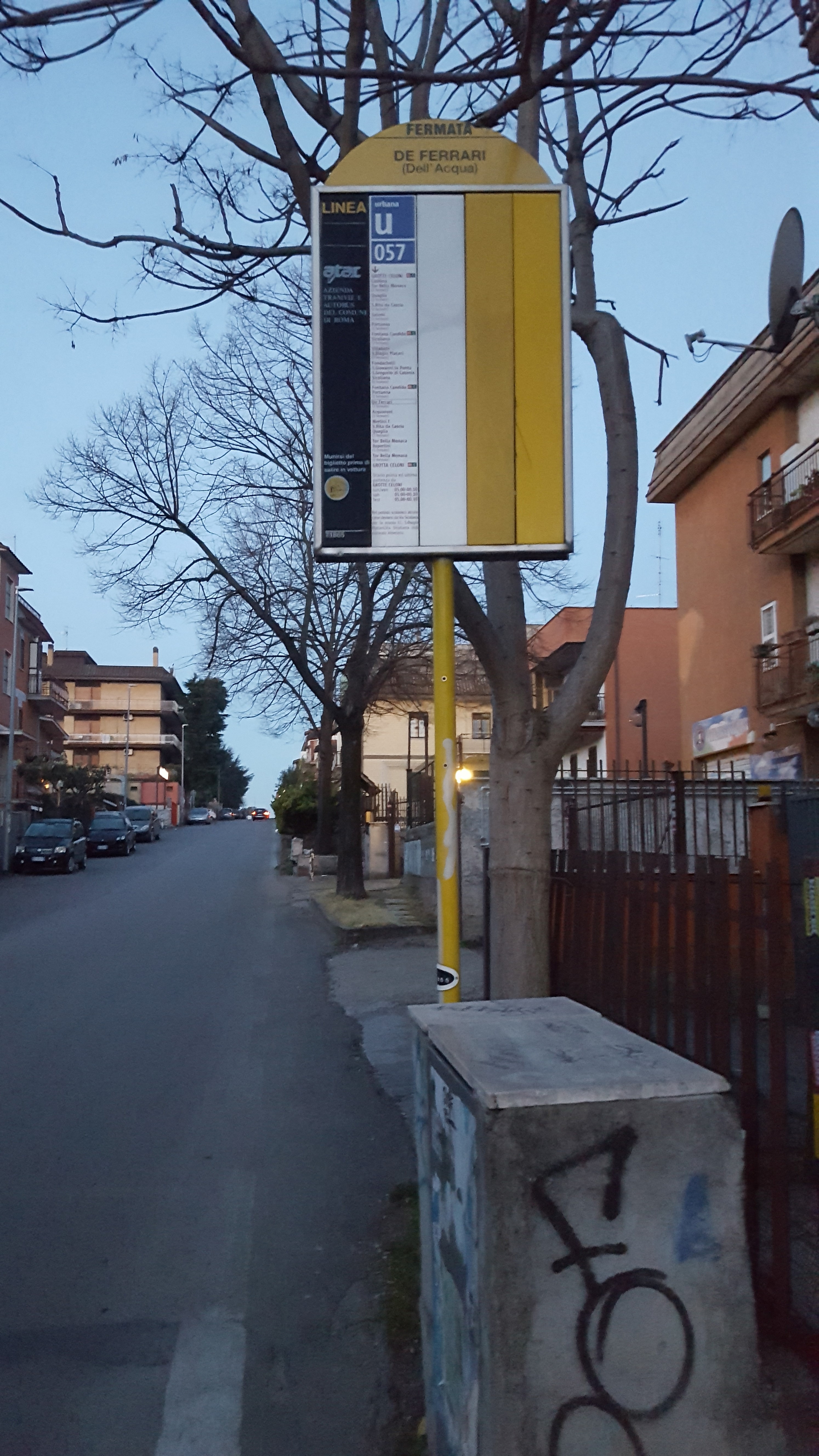 Taken by Priscilla C.
See De Ferrari/Dell'Acqua stop, Roma, on the map
Public transit to De Ferrari/Dell'Acqua stop (ID: 71865) in Roma
Looking for directions to De Ferrari/Dell'Acqua in Roma, Italy?
Download the Moovit App to find the current schedule and step-by-step directions for Bus or Metro routes that pass through De Ferrari/Dell'Acqua.
Looking for the nearest stops closest to De Ferrari/Dell'Acqua ? Check out this list of closest stops to your destination: Salemi/De Ferrari; Casilina/Chain Bridge; Grotte Celoni; Degas/Millet; Grotte Celoni.
Bus: 051, 106, C9, COTRAL, 057, NMC, 045, 107, 053, A05, N11, A50.Metro: C.
We make riding on public transit to De Ferrari/Dell'Acqua easy, which is why over 1.7 billion users, including users in Roma trust Moovit as the best app for public transit.
Use the app to navigate to popular places including to the airport, hospital, stadium, grocery store, mall, coffee shop, school, college, and university.
De Ferrari/Dell'Acqua stop’s code is 71865
The first line to this stop is 057, at 5:27 AM, and the last line is 057 at 12:36 AM.
This stop serves Troiani Transportation Services’s lines
- Salemi/De Ferrari,
- Casilina/Chain Bridge,
- Degas/Millet,
- Grotte Celoni
Bus stops near De Ferrari/Dell'Acqua stop
- Grotte Celoni
Metro station near De Ferrari/Dell'Acqua station
- Alessandrino,
- Labicana,
- Monte Petrella/Monte Petroso,
- De Bosis/Tennis Stadium,
- Roma Termini (East Platforms),
- Pomezia | Pontina Street Castelli Street,
- Carsoli | Tufo Alto,
- Siacci/Mercalli,
- Appia/Fourth Mile,
- Monte Compatri | Via Casilina Metro C,
- Rome Cornelia Via Tardini,
- Val Di Lanzo,
- Plebiscite Square,
- Boccea/Casalotti,
- Torre Gaia,
- Cecchina Station,
- Bissolati,
- Roma Anagnina (Platform 11 Cotral Departures),
- Lungotevere Testaccio/Franklin,
- Bufalotta/School
Popular public transit stations in Roma
Get around Roma by public transit!
Traveling around Roma has never been so easy. See step by step directions as you travel to any attraction, street or major public transit station. View bus and train schedules, arrival times, service alerts and detailed routes on a map, so you know exactly how to get to anywhere in Roma.
When traveling to any destination around Roma use Moovit's Live Directions with Get Off Notifications to know exactly where and how far to walk, how long to wait for your line, and how many stops are left. Moovit will alert you when it's time to get off — no need to constantly re-check whether yours is the next stop.
Wondering how to use public transit in Roma or how to pay for public transit in Roma? Moovit public transit app can help you navigate your way with public transit easily, and at minimum cost. It includes public transit fees, ticket prices, and costs. Looking for a map of Roma public transit lines? Moovit public transit app shows all public transit maps in Roma with all Bus, Train, Metro, Light Rail, Ferry, Funicular and Gondola routes and stops on an interactive map.
Rome and Lazio has 7 transit type(s), including: Bus, Train, Metro, Light Rail, Ferry, Funicular and Gondola, operated by several transit agencies, including ATAC, Cotral, Trenitalia, Troiani Transportation Services, BIS, ATR Mobility, Tuscia, Shuttle, Seatour, Troiani Bus Lines, CSC Mobility, Terravision, ATRAL, Tambus and Sitbus