How to get to De-Signbar by bus?
Click on the bus route to see step by step directions with maps, line arrival times and updated time schedules.
From Stadtwerke Villingen-Schwenningen GmbH, Villingen-Schwenningen
69 minFrom Bauhaus Villingen-Schwenningen, Villingen-Schwenningen
85 minFrom Aachbad Singen, Verwaltungsgemeinschaft Singen (Hohentwiel)
200 minFrom D 78333 Stockach, Verwaltungsgemeinschaft Stockach
79 minFrom Waldeck Spa, Bad Dürrheim
58 minFrom Antiquariat Trenkle, Aach
159 minFrom Helios Klinik Rottweil-Notaufnahme, Rottweil
125 min
How to get to De-Signbar by train?
Click on the train route to see step by step directions with maps, line arrival times and updated time schedules.
Bus stops near De-Signbar in Verwaltungsgemeinschaft Trossingen
Train stations near De-Signbar in Verwaltungsgemeinschaft Trossingen
Bus lines to De-Signbar in Verwaltungsgemeinschaft Trossingen
- 115, Trossingen Stadtbahnhof - Trossingen Stadtbahnhof,VIEW
- 140, Aldingen Bahnhof - Trossingen Stadtbahnhof,VIEW
- 142, Trossingen Schulzentrum - Aldingen Bahnhof,VIEW
- 147, Spaichingen Bahnhof - Aldingen Gewerbegebiet Nagelsee,VIEW
- 160, Trossingen Stadtbahnhof - Aixheim Rathaus,VIEW
- 120, Trossingen Stadtbahnhof - Tuttlingen ZOB Stadtmitte Bstg G,VIEW
- 122, Wurmlingen Am alten Sportplatz - Oberflacht Brühl,VIEW
- 110, Tuttlingen Zob Stadtmitte,VIEW
- 117, Talheim Schule,VIEW
- 130, Gunningen Rathausstraße,VIEW
- 132, Trossingen Stadtbahnhof,VIEW
What are the closest stations to De-Signbar?
The closest stations to De-Signbar are:
- Trossingen Hauptstraße is 376 meters away, 6 min walk.
- Trossingen Ernst-Haller-Straße is 399 meters away, 6 min walk.
- Trossingen Stadtbahnhof is 465 meters away, 7 min walk.
- Trossingen Bahnhof is 3351 meters away, 43 min walk.
Which train line stops near De-Signbar?
RB 42A (Trossingen Stadtbahnhof)
Which bus lines stop near De-Signbar?
These bus lines stop near De-Signbar: 117, 120, 122, 140.
What’s the nearest train station to De-Signbar in Verwaltungsgemeinschaft Trossingen?
The nearest train station to De-Signbar in Verwaltungsgemeinschaft Trossingen is Trossingen Stadtbahnhof. It’s a 7 min walk away.
What’s the nearest bus station to De-Signbar in Verwaltungsgemeinschaft Trossingen?
The nearest bus stations to De-Signbar in Verwaltungsgemeinschaft Trossingen are Trossingen Hauptstraße and Trossingen Ernst-Haller-Straße. The closest one is a 6 min walk away.
What time is the first train to De-Signbar in Verwaltungsgemeinschaft Trossingen?
The RB42A is the first train that goes to De-Signbar in Verwaltungsgemeinschaft Trossingen. It stops nearby at 5:09 AM.
What time is the last train to De-Signbar in Verwaltungsgemeinschaft Trossingen?
The RB42A is the last train that goes to De-Signbar in Verwaltungsgemeinschaft Trossingen. It stops nearby at 12:19 AM.
What time is the first bus to De-Signbar in Verwaltungsgemeinschaft Trossingen?
The 115 is the first bus that goes to De-Signbar in Verwaltungsgemeinschaft Trossingen. It stops nearby at 4:49 AM.
What time is the last bus to De-Signbar in Verwaltungsgemeinschaft Trossingen?
The 130 is the last bus that goes to De-Signbar in Verwaltungsgemeinschaft Trossingen. It stops nearby at 9:09 PM.
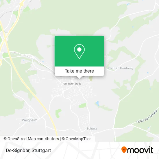
See De-Signbar, Verwaltungsgemeinschaft Trossingen, on the map
Public Transit to De-Signbar in Verwaltungsgemeinschaft Trossingen
Wondering how to get to De-Signbar in Verwaltungsgemeinschaft Trossingen? Moovit helps you find the best way to get to De-Signbar with step-by-step directions from the nearest public transit station.
Moovit provides free maps and live directions to help you navigate through your city. View schedules, routes, timetables, and find out how long does it take to get to De-Signbar in real time.
Looking for the nearest stop or station to De-Signbar? Check out this list of stops closest to your destination: Trossingen Hauptstraße; Trossingen Ernst-Haller-Straße; Trossingen Stadtbahnhof; Trossingen Bahnhof.
Train: RB 42A, SEV, RB42A, RB42, RB42, RE42, 770, 775, RB 42.Bus: 117, 120, 122, 140, 115, 142, 147, 160.
Want to see if there’s another route that gets you there at an earlier time? Moovit helps you find alternative routes or times. Get directions from and directions to De-Signbar easily from the Moovit App or Website.
We make riding to De-Signbar easy, which is why over 1.5 million users, including users in Verwaltungsgemeinschaft Trossingen, trust Moovit as the best app for public transit. You don’t need to download an individual bus app or train app, Moovit is your all-in-one transit app that helps you find the best bus time or train time available.
For information on prices of train and bus, costs and ride fares to De-Signbar, please check the Moovit app.
Use the app to navigate to popular places including to the airport, hospital, stadium, grocery store, mall, coffee shop, school, college, and university.
De-Signbar Address: Hohnerstraße 8/2 78647 Trossingen street in Verwaltungsgemeinschaft Trossingen
- Susanne Benkler Mediendesignerin,
- Dorothee Pfeifer Künstlerin,
- Die-Echecker,
- Efg Deutschland,
- Frank Pahnke,
- Gsellinger Ingenieurbüro,
- Möller Klockow Scherlitz Freie Architekten,
- Klockow Andreas Architekt,
- Badmeisterei,
- Biosthetiksaln Jacobsen,
- Hans Rosehalm,
- Bundesmusikverband Chor & Orchester,
- Spielmannsvereinigung Schleswig Holstein,
- Kunstwerk B,
- Christiane Barthel,
- Bundesvereinigung Deutscher Orchesterverbände,
- Praxis Bernd Duffner,
- Mediation & Konfliktberatung,
- Hohner Verlag,
- Konzertpianist, Komponist
Places Near De-Signbar (Verwaltungsgemeinschaft Trossingen)
- Mettingen Eros-Center Puff Laufhaus, Esslingen Am Neckar,
- Waldfriedhof, Degerloch,
- Schleyerhalle, Bad Cannstatt,
- Hanns-Martin-Schleyer-Halle, Bad Cannstatt,
- Geilhaus Haus 33a, Reutlingen-Betzingen,
- SI-Centrum, Möhringen,
- FlixBus Haltestelle, Stuttgart,
- Marmorsaal Im Weissenburgpark, Stuttgart-Süd,
- Mercedes-Benz Museum (Mercedes Museum Stuttgart), Bad Cannstatt,
- Mercedes-Benz Museum, Bad Cannstatt,
- Porsche-Arena, Bad Cannstatt,
- Wilhelma (U-Bahn Wilhelma), Bad Cannstatt,
- Hauptbahnhof Stuttgart, Stuttgart-Mitte,
- Gasometer Pforzheim, Pforzheim,
- Klinikum Stuttgart - Katharinenhospital, Stuttgart-Mitte,
- Pariser Platz Stuttgart, Stuttgart-Mitte,
- Im Wizemann (Halle), Bad Cannstatt,
- Gleis 101/102 (tief), Stuttgart-Mitte,
- Porsche Museum, Zuffenhausen,
- Hanns-Martin-Schleyer-Halle (Stuttgart Hans-Martin-Schleyerhalle), Bad Cannstatt
How to get to popular places in Stuttgart with public transit
Get around Verwaltungsgemeinschaft Trossingen by public transit!
Traveling around Verwaltungsgemeinschaft Trossingen has never been so easy. See step by step directions as you travel to any attraction, street or major public transit station. View bus and train schedules, arrival times, service alerts and detailed routes on a map, so you know exactly how to get to anywhere in Verwaltungsgemeinschaft Trossingen.
When traveling to any destination around Verwaltungsgemeinschaft Trossingen use Moovit's Live Directions with Get Off Notifications to know exactly where and how far to walk, how long to wait for your line, and how many stops are left. Moovit will alert you when it's time to get off — no need to constantly re-check whether yours is the next stop.
Wondering how to use public transit in Verwaltungsgemeinschaft Trossingen or how to pay for public transit in Verwaltungsgemeinschaft Trossingen? Moovit public transit app can help you navigate your way with public transit easily, and at minimum cost. It includes public transit fees, ticket prices, and costs. Looking for a map of Verwaltungsgemeinschaft Trossingen public transit lines? Moovit public transit app shows all public transit maps in Verwaltungsgemeinschaft Trossingen with all Bus, Train, Subway, Light Rail, Ferry, S-Bahn and Funicular routes and stops on an interactive map.
Stuttgart has 7 transit type(s), including: Bus, Train, Subway, Light Rail, Ferry, S-Bahn and Funicular, operated by several transit agencies, including SSB - Stadtbahn, SSB, SSB - Seilbahn / Zacke, S-Bahn Stuttgart, Rhein-Neckar-Verkehr GmbH (rnv), Karlsruher Verkehrsverbund, DB AG, DB Regiobus BW, Arverio Baden-Württemberg GmbH, DB RegioNetz Verkehrs GmbH Westfrankenbahn, DB Regio AG Baden-Württemberg, Südwestdeutsche Verkehrs-AG, DB Regio AG Mitte Region Hessen, DB and Bodensee-Oberschwaben-Bahn