Directions to Deborah Allen: Allstate Insurance (Queens) with public transportation
The following transit lines have routes that pass near Deborah Allen: Allstate Insurance
 Bus: N4, N4X, Q87, Q5, QM63.
- Train: FAR ROCKAWAY BRANCH, LONG BEACH BRANCH, BABYLON BRANCH, WEST HEMPSTEAD BRANCH.
How to get to Deborah Allen: Allstate Insurance by bus?
Click on the bus route to see step by step directions with maps, line arrival times and updated time schedules.
From Jamaica Hospital Medical Center, Queens
50 minFrom Jamaica, Queens
35 minFrom St John's University, Queens
67 minFrom OZONE PARK, Queens
62 minFrom Queens, NY, Queens
77 minFrom Liberty Ave, Queens
53 minFrom Queens County Civil Court, Queens
44 minFrom JFK Building 141, Queens
59 minFrom Townsend Harris High School, Queens
64 minFrom Garden City, NY, Garden City
81 min
How to get to Deborah Allen: Allstate Insurance by train?
Click on the train route to see step by step directions with maps, line arrival times and updated time schedules.
Bus stops near Deborah Allen: Allstate Insurance in Queens
Train stations near Deborah Allen: Allstate Insurance in Queens
Bus lines to Deborah Allen: Allstate Insurance in Queens
What are the closest stations to Deborah Allen: Allstate Insurance?
The closest stations to Deborah Allen: Allstate Insurance are:
- Merrick Bl/243 St is 14 yards away, 1 min walk.
- Brookville Blvd/Merrick Blvd is 226 yards away, 3 min walk.
- Merrick Rd + Ocean Ave Cityline is 313 yards away, 4 min walk.
- St.Albans is 621 yards away, 8 min walk.
- Merrick Blvd/233 St is 645 yards away, 8 min walk.
- Valley Stream is 2283 yards away, 27 min walk.
Which bus lines stop near Deborah Allen: Allstate Insurance?
These bus lines stop near Deborah Allen: Allstate Insurance: N4, N4X, Q87.
Which train lines stop near Deborah Allen: Allstate Insurance?
These train lines stop near Deborah Allen: Allstate Insurance: FAR ROCKAWAY BRANCH, LONG BEACH BRANCH.
What’s the nearest train station to Deborah Allen: Allstate Insurance in Queens?
The nearest train station to Deborah Allen: Allstate Insurance in Queens is St.Albans. It’s a 8 min walk away.
What’s the nearest bus station to Deborah Allen: Allstate Insurance in Queens?
The nearest bus station to Deborah Allen: Allstate Insurance in Queens is Merrick Bl/243 St. It’s a 1 min walk away.
What time is the first train to Deborah Allen: Allstate Insurance in Queens?
The FAR ROCKAWAY BRANCH is the first train that goes to Deborah Allen: Allstate Insurance in Queens. It stops nearby at 3:22 AM.
What time is the last train to Deborah Allen: Allstate Insurance in Queens?
The FAR ROCKAWAY BRANCH is the last train that goes to Deborah Allen: Allstate Insurance in Queens. It stops nearby at 2:59 AM.
What time is the first bus to Deborah Allen: Allstate Insurance in Queens?
The N4 is the first bus that goes to Deborah Allen: Allstate Insurance in Queens. It stops nearby at 3:07 AM.
What time is the last bus to Deborah Allen: Allstate Insurance in Queens?
The Q5 is the last bus that goes to Deborah Allen: Allstate Insurance in Queens. It stops nearby at 3:21 AM.
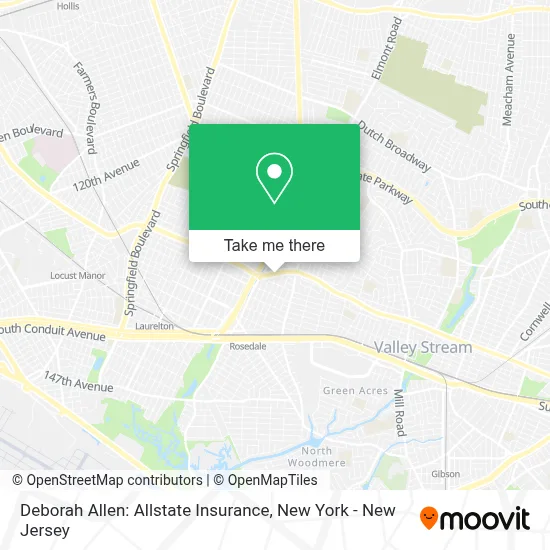
See Deborah Allen: Allstate Insurance, Queens, on the map
Public Transit to Deborah Allen: Allstate Insurance in Queens
Wondering how to get to Deborah Allen: Allstate Insurance in Queens? Moovit helps you find the best way to get to Deborah Allen: Allstate Insurance with step-by-step directions from the nearest public transit station.
Moovit provides free maps and live directions to help you navigate through your city. View schedules, routes, timetables, and find out how long does it take to get to Deborah Allen: Allstate Insurance in real time.
Looking for the nearest stop or station to Deborah Allen: Allstate Insurance? Check out this list of stops closest to your destination: Merrick Bl/243 St; Brookville Blvd/Merrick Blvd; Merrick Rd + Ocean Ave Cityline; St.Albans; Merrick Blvd/233 St; Valley Stream.
Bus: N4, N4X, Q87, Q5, QM63, Q86, QM65.Train: FAR ROCKAWAY BRANCH, LONG BEACH BRANCH, BABYLON BRANCH, WEST HEMPSTEAD BRANCH.
Want to see if there’s another route that gets you there at an earlier time? Moovit helps you find alternative routes or times. Get directions from and directions to Deborah Allen: Allstate Insurance easily from the Moovit App or Website.
We make riding to Deborah Allen: Allstate Insurance easy, which is why over 1.5 million users, including users in Queens, trust Moovit as the best app for public transit. You don’t need to download an individual bus app or train app, Moovit is your all-in-one transit app that helps you find the best bus time or train time available.
For information on prices of bus, train and subway, costs and ride fares to Deborah Allen: Allstate Insurance, please check the Moovit app.
Use the app to navigate to popular places including to the airport, hospital, stadium, grocery store, mall, coffee shop, school, college, and university.
Deborah Allen: Allstate Insurance Address: 24214A Merrick Blvd street in Queens
- Hendley Martin, Homesmart Crossisland,
- Kady Homes Listings,
- Yvette Plummer, Homesmart Crossisland,
- Team Jamaica Bickle,
- 242nd St (merrick blvd & 242nd street),
- 242 St & Merrick Blvd,
- Caribbean American Society Of New York,
- Derek Lionel Scott, Bankers Life Agent,
- Adam Missry,
- Aj Developers Group Llc,
- The Real Estate Authorities,
- Del Sol Abogados,
- 21st Century Security,
- Twin Thumb Promotions,
- Delmar International (Ny) Inc.,
- Jose Morales: Primerica - Financial Services,
- Christian Agbavor: Primerica - Financial Services,
- Financial Institution,
- Michele Blagrove Bankers Life Agent,
- Mannix Gordon Bankers Life Agent
Places Near Deborah Allen: Allstate Insurance (Queens)
- Katz's Deli, Manhattan,
- Mountainside Hospital, Glen Ridge,
- 1 Police Plaza, Manhattan,
- 376 Hudson Street, Manhattan,
- Times Square, Manhattan,
- Hudson Yards, Manhattan,
- Queens Center Mall, Queens,
- Rockefeller Center, Manhattan,
- qqqq, Manhattan,
- San Gennaro Feast, Manhattan,
- Bellevue Hospital, Manhattan,
- 911 Memorial, Manhattan,
- Chinatown, Manhattan,
- Pier 83, Manhattan,
- 111 Centre New York City Supreme Court, Manhattan,
- Wall Street, Manhattan,
- 26 Federal Plaza, Manhattan,
- SoHo, Manhattan,
- 3 Stone St, Manhattan,
- 66 John Street, Manhattan
How to get to popular places in New York - New Jersey with public transit
Get around Queens by public transit!
Traveling around Queens has never been so easy. See step by step directions as you travel to any attraction, street or major public transit station. View bus and train schedules, arrival times, service alerts and detailed routes on a map, so you know exactly how to get to anywhere in Queens.
When traveling to any destination around Queens use Moovit's Live Directions with Get Off Notifications to know exactly where and how far to walk, how long to wait for your line, and how many stops are left. Moovit will alert you when it's time to get off — no need to constantly re-check whether yours is the next stop.
Wondering how to use public transit in Queens or how to pay for public transit in Queens? Moovit public transit app can help you navigate your way with public transit easily, and at minimum cost. It includes public transit fees, ticket prices, and costs. Looking for a map of Queens public transit lines? Moovit public transit app shows all public transit maps in Queens with all Bus, Train, Subway, Light Rail, Ferry and Cable Car routes and stops on an interactive map.
New York - New Jersey has 6 transit type(s), including: Bus, Train, Subway, Light Rail, Ferry and Cable Car, operated by several transit agencies, including MTA Subway, Metro-North Railroad, LIRR, PATH, MTA New York City Transit - Express routes, MTA Bus, NJ Transit, NYC Ferry, NICE bus, Bee-Line Bus, NJ Transit Rail, Norwalk Transit District, Hartford Line, River Valley Transit and HART