Directions to Decalcor IND e Com de Decalques (Campo) with public transportation
The following transit lines have routes that pass near Decalcor IND e Com de Decalques
How to get to Decalcor IND e Com de Decalques by bus?
Click on the bus route to see step by step directions with maps, line arrival times and updated time schedules.
From Campo Magro, Campo Magro
69 minFrom City Center Shopping & Outlet, Campo
50 minFrom Colônia Cristina, Araucária
229 minFrom Teatro Positivo, Cic
68 minFrom Universidade Positivo (UP), Cic
67 minFrom universidade positivo campus ecovile, Cic
68 minFrom Avenida Juscelino Kubitschek de Oliveira 2600, Cic
76 minFrom Orleans, Orleans
44 minFrom Rua Professor Pedro Viriato Parigot de Souza 5300, Cic
66 minFrom Volvo do Brasil, Cic
65 min
Bus stops near Decalcor IND e Com de Decalques in Campo
Bus lines to Decalcor IND e Com de Decalques in Campo
- 117 RONDINHA, Cercadinho → Terminal Urbano Campo Largo,VIEW
- J62 CAMPO LARGO / GUADALUPE, Garagem / Terminal Campo Largo → Terminal Guadalupe,VIEW
- 111 PAPELAO HORLLE, Papelão Horlle → Terminal Urbano Campo Largo,VIEW
- 121 FERRARIA, Ferraria → Terminal Urbano Campo Largo (via Cercadinho),VIEW
- 114 MIQUELETO, Miqueleto → Terminal Urbano Campo Largo,VIEW
What are the closest stations to Decalcor IND e Com de Decalques?
The closest stations to Decalcor IND e Com de Decalques are:
- R. Alcides Valentino Zanella, 650 is 131 meters away, 2 min walk.
- Rod. BR-277 (Passarela Rondinha) is 257 meters away, 4 min walk.
- Avenida Gianni Agnelli 1012 is 1646 meters away, 22 min walk.
Which bus lines stop near Decalcor IND e Com de Decalques?
These bus lines stop near Decalcor IND e Com de Decalques: 121 FERRARIA, J62 CAMPO LARGO / GUADALUPE.
What’s the nearest bus station to Decalcor IND e Com de Decalques in Campo?
The nearest bus station to Decalcor IND e Com de Decalques in Campo is R. Alcides Valentino Zanella, 650. It’s a 2 min walk away.
What time is the first bus to Decalcor IND e Com de Decalques in Campo?
The J62 CAMPO LARGO / GUADALUPE is the first bus that goes to Decalcor IND e Com de Decalques in Campo. It stops nearby at 4:38 AM.
What time is the last bus to Decalcor IND e Com de Decalques in Campo?
The 121 FERRARIA is the last bus that goes to Decalcor IND e Com de Decalques in Campo. It stops nearby at 12:48 AM.
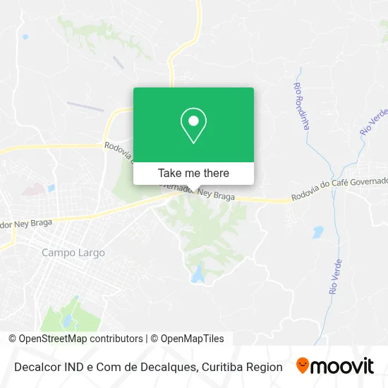
See Decalcor IND e Com de Decalques, Campo, on the map
Public Transit to Decalcor IND e Com de Decalques in Campo
Wondering how to get to Decalcor IND e Com de Decalques in Campo? Moovit helps you find the best way to get to Decalcor IND e Com de Decalques with step-by-step directions from the nearest public transit station.
Moovit provides free maps and live directions to help you navigate through your city. View schedules, routes, timetables, and find out how long does it take to get to Decalcor IND e Com de Decalques in real time.
Looking for the nearest stop or station to Decalcor IND e Com de Decalques? Check out this list of stops closest to your destination: R. Alcides Valentino Zanella; Rod. BR-277 (Passarela Rondinha); Avenida Gianni Agnelli 1012.
Bus: 121 FERRARIA, J62 CAMPO LARGO / GUADALUPE, 117 RONDINHA, 111 PAPELAO HORLLE, 114 MIQUELETO.
Want to see if there’s another route that gets you there at an earlier time? Moovit helps you find alternative routes or times. Get directions from and directions to Decalcor IND e Com de Decalques easily from the Moovit App or Website.
We make riding to Decalcor IND e Com de Decalques easy, which is why over 1.5 million users, including users in Campo, trust Moovit as the best app for public transit. You don’t need to download an individual bus app or train app, Moovit is your all-in-one transit app that helps you find the best bus time or train time available.
For information on prices of bus, costs and ride fares to Decalcor IND e Com de Decalques, please check the Moovit app.
Use the app to navigate to popular places including to the airport, hospital, stadium, grocery store, mall, coffee shop, school, college, and university.
Decalcor IND e Com de Decalques Address: BR-277, 114 Campo Largo Campo Largo-PR street in Campo
- Marmoraria Benato,
- Casa de Retiro São Francisco de Assis,
- Impropel-Indústria de Produtos de Pecuária Ltda,
- Paróquia De São Sebastião De Rondinha,
- Rua Padre Alcides Zanella 46,
- Enterprise Esquadrias de Alumínio,
- Escola Estadual João XXIII,
- Colisa Artefatos de Papel,
- Wiskeria da G,
- Jusita Sucos Cafés & Lanches,
- Jusita Lanches - Campo Largo,
- Projeção Administradora e Incorporadora de Bens,
- Shows e Bailes Em Campo Largo,
- Polentão,
- BR-277,
- Jusita,
- Coraçao do Murillo,
- Ponto da Porcelana,
- Dolce Empório Gastronomia E Café Colonial,
- Germer Loja da Fábrica
Places Near Decalcor IND e Com de Decalques (Campo)
- Hospital Nossa Senhora Das Graças, Mercês,
- Hospital de Clínicas (HC - UFPR), Centro,
- Hospital Erasto Gaertner, Jardim Das Américas,
- Shopping Estação, Rebouças,
- Rua General Mário Tourinho, Campina Do Siqueira,
- Jockey Plaza Shopping Center, Tarumã,
- Hhhhh, Fazendinha,
- Pontifícia Universidade Católica do Paraná (PUCPR), Prado Velho,
- Parque Barigui, Mercês,
- Hospital Angelina Caron, Campina Grande Do Sul,
- Arena Da Baixada - Curitiba,
- Hospital Da Cruz Vermelha, Batel,
- Rua Martim Afonso 558, Mercês,
- Hospital do Rocio, Campo,
- Jardim Botânico de Curitiba PR, Centro,
- Park Shopping Barigüi, Mossunguê,
- Shopping Palladium, Portão,
- Hospital Universitário Evangélico de Curitiba, Bigorrilho,
- Hospital Madalena Sofia, Bairro Alto,
- Campo Largo, Campo
How to get to popular places in Curitiba Region with public transit
Get around Campo by public transit!
Traveling around Campo has never been so easy. See step by step directions as you travel to any attraction, street or major public transit station. View bus and train schedules, arrival times, service alerts and detailed routes on a map, so you know exactly how to get to anywhere in Campo.
When traveling to any destination around Campo use Moovit's Live Directions with Get Off Notifications to know exactly where and how far to walk, how long to wait for your line, and how many stops are left. Moovit will alert you when it's time to get off — no need to constantly re-check whether yours is the next stop.
Wondering how to use public transit in Campo or how to pay for public transit in Campo? Moovit public transit app can help you navigate your way with public transit easily, and at minimum cost. It includes public transit fees, ticket prices, and costs. Looking for a map of Campo public transit lines? Moovit public transit app shows all public transit maps in Campo with all Bus and Cable Car routes and stops on an interactive map.
Curitiba Region has 2 transit type(s), including: Bus and Cable Car, operated by several transit agencies, including Sistema Integrado de Mobilidade (URBS), Sistema Integrado de Mobilidade (AMEP), URBS (Cartões bancários e Dinheiro), URBS (Cartões bancários / Cartão URBS), AMEP (Cartões bancários / Cartão MetroCard), AMEP (Cartões bancários / Cartão MetroCard / Dinheiro), Viação Colombo (Dinheiro), TRIAR (Cartão TRIAR / Dinheiro), Empresa Curitiba Cerro Azul (Dinheiro), Expresso Nossa Senhora da Penha (Dinheiro), Empresa Campo Alto Tijucas (Dinheiro), Auto Viação São José (Cartão VEM / Dinheiro), BRT S/A (Cartão VEM / Dinheiro), TransPiedade (Cartão Cidadão / Dinheiro) and Oceânica Sul (Cartão Transporte / Dinheiro)