Del Mar Station station - Saturday schedule
| Line | Direction | Time |
|---|---|---|
| K LINE | Southbound - Westchester | 4:30 AM |
| K LINE | Northbound - Expo/Crenshaw | 4:36 AM |
| K LINE | Southbound - Westchester | 4:50 AM |
| K LINE | Northbound - Expo/Crenshaw | 4:56 AM |
| K LINE | Southbound - Westchester | 5:10 AM |
| K LINE | Northbound - Expo/Crenshaw | 5:16 AM |
| K LINE | Southbound - Westchester | 5:30 AM |
| K LINE | Northbound - Expo/Crenshaw | 5:36 AM |
| K LINE | Southbound - Westchester | 5:47 AM |
| K LINE | Northbound - Expo/Crenshaw | 5:56 AM |
| K LINE | Southbound - Westchester | 6:00 AM |
| K LINE | Northbound - Expo/Crenshaw | 6:02 AM |
| K LINE | Southbound - Westchester | 6:10 AM |
| K LINE | Southbound - Westchester | 6:20 AM |
| K LINE | Northbound - Expo/Crenshaw | 6:22 AM |
| K LINE | Southbound - Westchester | 6:30 AM |
| K LINE | Southbound - Westchester | 6:40 AM |
| K LINE | Northbound - Expo/Crenshaw | 6:42 AM |
| K LINE | Southbound - Westchester | 6:50 AM |
| K LINE | Southbound - Westchester | 7:00 AM |
| K LINE | Northbound - Expo/Crenshaw | 7:02 AM |
| K LINE | Northbound - Expo/Crenshaw | 7:10 AM |
| K LINE | Southbound - Westchester | 7:10 AM |
| K LINE | Southbound - Westchester | 7:20 AM |
| K LINE | Northbound - Expo/Crenshaw | 7:22 AM |
Directions to Del Mar Station (Pasadena) with public transportation
The following transit lines have routes that pass near Del Mar Station
 Bus: 180, 260/261, 501, 267, 662.
- Light Rail: A LINE.
How to get to Del Mar Station by bus?
Click on the bus route to see step by step directions with maps, line arrival times and updated time schedules.
Bus stops near Del Mar Station in Pasadena
- Raymond / Del Mar, 1 min walk,
- Raymond Ave & Del Mar Blvd, 1 min walk,
- Fair Oaks / Del Mar, 3 min walk,
- Raymond Ave & Green St, 4 min walk,
- Green St and Raymond Ave E, 4 min walk,
- Green St & Arroyo Pkwy, 6 min walk,
Light Rail stations near Del Mar Station in Pasadena
- South Pasadena Station, 7 min walk,
Bus lines to Del Mar Station in Pasadena
- 267, El Monte Station,
- 662, Del Mar Station,
- 20CC, Fair Oaks & Woodbury,
- 51, Mountain & Fair Oaks,
- 53, JPL,
- 501, Pasadena via 134 Fwy,
- 660, Fair Oaks / Woodbury,
- 260/261, Artesia Station,
- 20CW, Lake & Fair Oaks,
- 52, Art Center,
- 187, East: Azusa,
- 40, Old Pasadena,
What are the closest stations to Del Mar Station?
The closest stations to Del Mar Station are:
- Raymond / Del Mar is 21 yards away, 1 min walk.
- Raymond Ave & Del Mar Blvd is 38 yards away, 1 min walk.
- Fair Oaks / Del Mar is 229 yards away, 3 min walk.
- Raymond Ave & Green St is 329 yards away, 4 min walk.
- Green St and Raymond Ave E is 332 yards away, 4 min walk.
- Green St & Arroyo Pkwy is 424 yards away, 6 min walk.
- South Pasadena Station is 583 yards away, 7 min walk.
Which bus lines stop near Del Mar Station?
These bus lines stop near Del Mar Station: 180, 260/261, 501.
Which light rail line stops near Del Mar Station?
A LINE (Northbound to Azusa)
What’s the nearest light rail station to Del Mar Station in Pasadena?
The nearest light rail station to Del Mar Station in Pasadena is South Pasadena Station. It’s a 7 min walk away.
What’s the nearest bus station to Del Mar Station in Pasadena?
The nearest bus stations to Del Mar Station in Pasadena are Raymond / Del Mar and Raymond Ave & Del Mar Blvd. The closest one is a 1 min walk away.
What time is the first light rail to Del Mar Station in Pasadena?
The A LINE is the first light rail that goes to Del Mar Station in Pasadena. It stops nearby at 3:45 AM.
What time is the last light rail to Del Mar Station in Pasadena?
The A LINE is the last light rail that goes to Del Mar Station in Pasadena. It stops nearby at 1:20 AM.
What time is the first bus to Del Mar Station in Pasadena?
The 260/261 is the first bus that goes to Del Mar Station in Pasadena. It stops nearby at 4:18 AM.
What time is the last bus to Del Mar Station in Pasadena?
The 660 is the last bus that goes to Del Mar Station in Pasadena. It stops nearby at 12:57 AM.
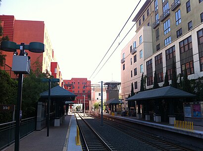
Del Mar Station station
 Taken by David P.
See Del Mar Station, Pasadena, on the map
Public transit to Del Mar Station station (ID: 80417S) in Pasadena
Looking for directions to Del Mar Station in Pasadena, United States?
Download the Moovit App to find the current schedule and step-by-step directions for Bus or Light Rail routes that pass through Del Mar Station.
Looking for the nearest stops closest to Del Mar Station ? Check out this list of closest stops to your destination: Raymond / Del Mar; Raymond Ave & Del Mar Blvd; Fair Oaks / Del Mar; Raymond Ave & Green St; Green St and Raymond Ave E; Green St & Arroyo Pkwy; South Pasadena Station.
Bus: 180, 260/261, 501, 267, 662, 20CC, 51, 53, 660, 187, 20CW, 52.Light Rail: A LINE.
We make riding on public transit to Del Mar Station easy, which is why over 1.5 million users, including users in Pasadena trust Moovit as the best app for public transit.
Use the app to navigate to popular places including to the airport, hospital, stadium, grocery store, mall, coffee shop, school, college, and university.
The station has the following entrances: S. Raymond Ave and S. Arroyo Pkwy
Del Mar Station station’s code is 80417S
The first line to this station is K LINE, at 4:30 AM, and the last line is K LINE at 4:23 AM.
202 S Raymond Ave, Pasadena, CA, USA
This station serves Metro - Los Angeles’s lines
Popular routes from Del Mar Station, Pasadena
- Raymond / Del Mar,
- Raymond Ave & Del Mar Blvd,
- Fair Oaks / Del Mar,
- Raymond Ave & Green St,
- Green St and Raymond Ave E,
- Green St & Arroyo Pkwy
Bus stops near Del Mar Station
- South Pasadena Station
Light Rail station near Del Mar Station
- Van Nuys Flyaway Terminal - 7610 Woodley Ave,
- Santa Monica / Westwood,
- Brand / Lomita,
- Moorpark Rd. & Hillcrest Dr.,
- Los Angeles St & 8th St,
- Roscoe / Van Nuys,
- Jefferson / LA Cienega,
- Nth Spring St & STH Spring St,
- Balboa & Roscoe,
- 41st & Compton Ave. (CW),
- Woodley / Parthenia,
- Sierra Madre Villa Station,
- Vanowen / Lankershim,
- Saticoy / Haskell,
- Pacific Coast Highway / Hawthorne,
- Manchester / San Pedro,
- Atlantic / Carlin,
- Figueroa / Slauson,
- Lake Ave & California Blvd,
- Sherman Way / Winnetka
Popular public transit stations in Pasadena
Get around Pasadena by public transit!
Traveling around Pasadena has never been so easy. See step by step directions as you travel to any attraction, street or major public transit station. View bus and train schedules, arrival times, service alerts and detailed routes on a map, so you know exactly how to get to anywhere in Pasadena.
When traveling to any destination around Pasadena use Moovit's Live Directions with Get Off Notifications to know exactly where and how far to walk, how long to wait for your line, and how many stops are left. Moovit will alert you when it's time to get off — no need to constantly re-check whether yours is the next stop.
Wondering how to use public transit in Pasadena or how to pay for public transit in Pasadena? Moovit public transit app can help you navigate your way with public transit easily, and at minimum cost. It includes public transit fees, ticket prices, and costs. Looking for a map of Pasadena public transit lines? Moovit public transit app shows all public transit maps in Pasadena with all Bus, Train, Subway, Light Rail, Ferry and Funicular routes and stops on an interactive map.
Los Angeles has 6 transit type(s), including: Bus, Train, Subway, Light Rail, Ferry and Funicular, operated by several transit agencies, including Metro - Los Angeles, Metrolink Trains, METRO, Long Beach Transit, LADOT, OCTA, Big Blue Bus, Riverside Transit Agency, LAX FlyAway, Airporter Shuttle, Playa Vista Shuttle, Amtrak, OMNITRANS, Pasadena Transit and TORRANCE TRANSIT SYSTEM