How to get to Delicious Kitchen by bus?
Click on the bus route to see step by step directions with maps, line arrival times and updated time schedules.
From Miramar, FL, Miramar-Pembroke Pines
69 minFrom Miami Station Amtrak, Miami
73 minFrom MIAMI hurricanes Game, Miami
39 minFrom Flanagan High School, Miramar-Pembroke Pines
129 minFrom Social Security Administration Office Hialeah Branch, Hialeah
79 minFrom West Park, Florida, Hallandale Beach
59 minFrom NW 95th St / NW 17th Ave, Miami
48 minFrom West Little River, Miami
52 minFrom Omega Maintenance Services, Miramar-Pembroke Pines
87 minFrom Broward/Miami-Dade County Border, Miami Gardens
46 min
Bus stops near Delicious Kitchen in Miami Gardens
Bus lines to Delicious Kitchen in Miami Gardens
What are the closest stations to Delicious Kitchen?
The closest stations to Delicious Kitchen are:
- Nw 183 St & Nw 47 Ave is 173 yards away, 3 min walk.
- Nw 183 St & Nw 49 Av is 264 yards away, 4 min walk.
- Nw 47 Av & Nw 183 St is 429 yards away, 6 min walk.
Which bus line stops near Delicious Kitchen?
183 (183 - Okeechobee Station)
What’s the nearest bus station to Delicious Kitchen in Miami Gardens?
The nearest bus station to Delicious Kitchen in Miami Gardens is Nw 183 St & Nw 47 Ave. It’s a 3 min walk away.
What time is the first bus to Delicious Kitchen in Miami Gardens?
The 183 is the first bus that goes to Delicious Kitchen in Miami Gardens. It stops nearby at 4:51 AM.
What time is the last bus to Delicious Kitchen in Miami Gardens?
The 32 is the last bus that goes to Delicious Kitchen in Miami Gardens. It stops nearby at 12:15 AM.
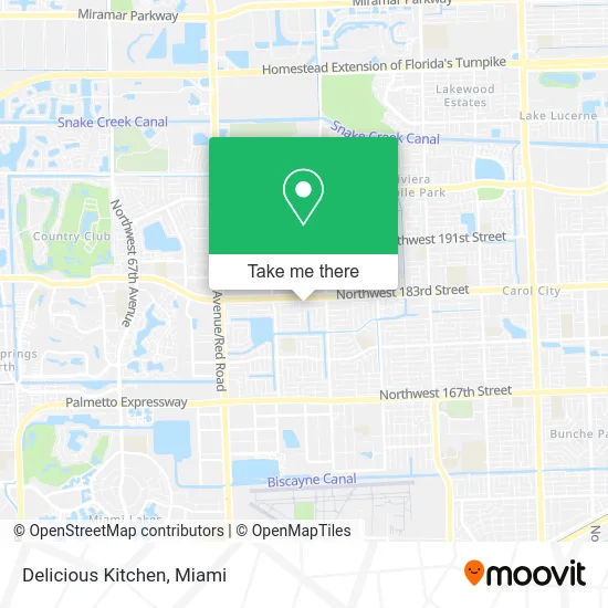
See Delicious Kitchen, Miami Gardens, on the map
Public Transit to Delicious Kitchen in Miami Gardens
Wondering how to get to Delicious Kitchen in Miami Gardens? Moovit helps you find the best way to get to Delicious Kitchen with step-by-step directions from the nearest public transit station.
Moovit provides free maps and live directions to help you navigate through your city. View schedules, routes, timetables, and find out how long does it take to get to Delicious Kitchen in real time.
Looking for the nearest stop or station to Delicious Kitchen? Check out this list of stops closest to your destination: Nw 183 St & Nw 47 Ave; Nw 183 St & Nw 49 Av; Nw 47 Av & Nw 183 St.
Bus: 183, 95, 32.
Want to see if there’s another route that gets you there at an earlier time? Moovit helps you find alternative routes or times. Get directions from and directions to Delicious Kitchen easily from the Moovit App or Website.
We make riding to Delicious Kitchen easy, which is why over 1.5 million users, including users in Miami Gardens, trust Moovit as the best app for public transit. You don’t need to download an individual bus app or train app, Moovit is your all-in-one transit app that helps you find the best bus time or train time available.
For information on prices of bus and train, costs and ride fares to Delicious Kitchen, please check the Moovit app.
Use the app to navigate to popular places including to the airport, hospital, stadium, grocery store, mall, coffee shop, school, college, and university.
Delicious Kitchen Address: 4888 NW 183rd St Opa-Locka, FL 33055 street in Miami Gardens
- Aguajea Burger,
- Montessori School of Miami Gardens,
- Mamuchi Cafe,
- Chezz Grill,
- Curbsyde Cuisine,
- Antojitos El Mono,
- Takitows,
- Sabor Seijo,
- State of Florida Tec of South Fl,
- Gardens Smoke Shop,
- TACO BELL,
- Laundry VIP,
- Living Word Christian Center International,
- Professionals Income Tax,
- Allstar Caribbean Travel,
- Garden's Fish & Chicken,
- Smarten Sports Academy,
- World Famous Theo's Seafood and Pasta,
- Centrum Health,
- Modern Shop Furniture
Places Near Delicious Kitchen (Miami Gardens)
- Zoo Miami, Miami,
- Brickell City Centre, Miami,
- Sawgrass Mall, Miami,
- Miami VA Hospital, Miami,
- Wynwood, Miami,
- Hard Rock Stadium, Miami Gardens,
- Miami-Dade County Courthouse, Miami,
- Dolphin Mall, Miami,
- Richard E. Gerstein Justice Building, Miami,
- Bayside Marketplace, Miami,
- Keiser University Flagship Campus, West Palm Beach,
- Aventura Mall, Miami,
- Miami Freedom Park, Miami,
- Port of Miami Cruise Terminal, Miami,
- Miami Design District, Miami,
- Sawgrass mall ( FL ), Miami Beach,
- Little Havana, Miami,
- Aventura Mall, Miami Beach,
- Marlins Park, Miami,
- Dolphin Mall Bus, Miami
How to get to popular places in Miami with public transit
Get around Miami Gardens by public transit!
Traveling around Miami Gardens has never been so easy. See step by step directions as you travel to any attraction, street or major public transit station. View bus and train schedules, arrival times, service alerts and detailed routes on a map, so you know exactly how to get to anywhere in Miami Gardens.
When traveling to any destination around Miami Gardens use Moovit's Live Directions with Get Off Notifications to know exactly where and how far to walk, how long to wait for your line, and how many stops are left. Moovit will alert you when it's time to get off — no need to constantly re-check whether yours is the next stop.
Wondering how to use public transit in Miami Gardens or how to pay for public transit in Miami Gardens? Moovit public transit app can help you navigate your way with public transit easily, and at minimum cost. It includes public transit fees, ticket prices, and costs. Looking for a map of Miami Gardens public transit lines? Moovit public transit app shows all public transit maps in Miami Gardens with all Bus, Train, Light Rail and Ferry routes and stops on an interactive map.
Miami has 4 transit type(s), including: Bus, Train, Light Rail and Ferry, operated by several transit agencies, including Broward County Transit, Miami-Dade Transit, Metrorail, Palm Tran, Tri-Rail, Brightline, MARTY, City of Homestead Trolley, Key West Transit, Treasure Coast Connector, GoLine IRT, Amtrak, Greyhound-us, FlixBus-us and Aventura Express Shuttle Bus