How to get to Dema's Auto Body by bus?
Click on the bus route to see step by step directions with maps, line arrival times and updated time schedules.
Bus stops near Dema's Auto Body in Staten Island
Subway station near Dema's Auto Body in Staten Island
- Clifton, 8 min walk,VIEW
Ferry station near Dema's Auto Body in Staten Island
- St. George Ferry Terminal, 20 min walk,VIEW
Bus lines to Dema's Auto Body in Staten Island
What are the closest stations to Dema's Auto Body?
The closest stations to Dema's Auto Body are:
- Bay St/Grant St is 60 yards away, 1 min walk.
- Van Duzer St/Baltic St is 218 yards away, 3 min walk.
- Clifton is 682 yards away, 8 min walk.
- St. George Ferry Terminal is 1640 yards away, 20 min walk.
Which bus lines stop near Dema's Auto Body?
These bus lines stop near Dema's Auto Body: S51, S74, S76, S78.
What’s the nearest subway station to Dema's Auto Body in Staten Island?
The nearest subway station to Dema's Auto Body in Staten Island is Clifton. It’s a 8 min walk away.
What’s the nearest bus station to Dema's Auto Body in Staten Island?
The nearest bus station to Dema's Auto Body in Staten Island is Bay St/Grant St. It’s a 1 min walk away.
What’s the nearest ferry station to Dema's Auto Body in Staten Island?
The nearest ferry station to Dema's Auto Body in Staten Island is St. George Ferry Terminal. It’s a 20 min walk away.
What time is the first subway to Dema's Auto Body in Staten Island?
The SIR is the first subway that goes to Dema's Auto Body in Staten Island. It stops nearby at 3:06 AM.
What time is the last subway to Dema's Auto Body in Staten Island?
The SIR is the last subway that goes to Dema's Auto Body in Staten Island. It stops nearby at 3:13 AM.
What time is the first bus to Dema's Auto Body in Staten Island?
The S74 is the first bus that goes to Dema's Auto Body in Staten Island. It stops nearby at 3:01 AM.
What time is the last bus to Dema's Auto Body in Staten Island?
The S78 is the last bus that goes to Dema's Auto Body in Staten Island. It stops nearby at 3:48 AM.
What time is the first ferry to Dema's Auto Body in Staten Island?
The STATEN ISLAND FERRY is the first ferry that goes to Dema's Auto Body in Staten Island. It stops nearby at 3:00 AM.
What time is the last ferry to Dema's Auto Body in Staten Island?
The STATEN ISLAND FERRY is the last ferry that goes to Dema's Auto Body in Staten Island. It stops nearby at 2:55 AM.
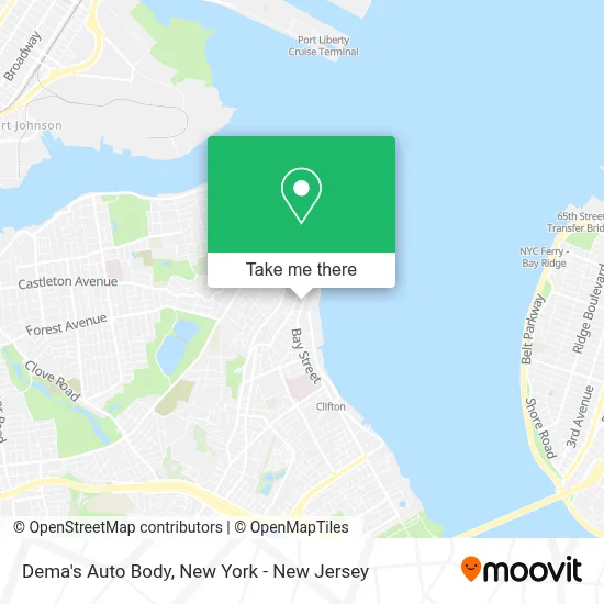
See Dema's Auto Body, Staten Island, on the map
Public Transit to Dema's Auto Body in Staten Island
Wondering how to get to Dema's Auto Body in Staten Island? Moovit helps you find the best way to get to Dema's Auto Body with step-by-step directions from the nearest public transit station.
Moovit provides free maps and live directions to help you navigate through your city. View schedules, routes, timetables, and find out how long does it take to get to Dema's Auto Body in real time.
Looking for the nearest stop or station to Dema's Auto Body? Check out this list of stops closest to your destination: Bay St/Grant St; Van Duzer St/Baltic St; Clifton; St. George Ferry Terminal.
Bus: S51, S74, S76, S78.Subway: SIR.Ferry: STATEN ISLAND FERRY.
Want to see if there’s another route that gets you there at an earlier time? Moovit helps you find alternative routes or times. Get directions from and directions to Dema's Auto Body easily from the Moovit App or Website.
We make riding to Dema's Auto Body easy, which is why over 1.5 million users, including users in Staten Island, trust Moovit as the best app for public transit. You don’t need to download an individual bus app or train app, Moovit is your all-in-one transit app that helps you find the best bus time or train time available.
For information on prices of bus, ferry and subway, costs and ride fares to Dema's Auto Body, please check the Moovit app.
Use the app to navigate to popular places including to the airport, hospital, stadium, grocery store, mall, coffee shop, school, college, and university.
Dema's Auto Body Address: 396 Bay St street in Staten Island
- Aliento De Vida Staten Island,
- Wr Brothers Barbershop Inc,
- Harvest Intercontinental Church-Si,
- Georgies Bistro,
- Sandy's Half Price Muffler, Llc,
- Eliot Leibowitz Insurance,
- Sandy's Half Price Muffler,
- Western Union,
- Kingzofcars,
- Reliable Car-N-Care,
- Western Beef,
- Abco Refrigeration | Staten Island,
- Iglesia Misionera El Shaddai,
- Keyme Locksmiths,
- Enterprise Rent-A-Car,
- Crunch Fitness - Staten Island,
- Domino's Pizza,
- Us Marine Corps Recruiting Station Staten Island,
- Charity,
- Staten Island Recruiting Station
Places Near Dema's Auto Body (Staten Island)
- SoHo, Manhattan,
- Rockefeller Center, Manhattan,
- 3 Stone St, Manhattan,
- 911 Memorial, Manhattan,
- Mountainside Hospital, Glen Ridge,
- 1 Police Plaza, Manhattan,
- Katz's Deli, Manhattan,
- Times Square, Manhattan,
- San Gennaro Feast, Manhattan,
- Wall Street, Manhattan,
- 66 John Street, Manhattan,
- Chinatown, Manhattan,
- 26 Federal Plaza, Manhattan,
- 376 Hudson Street, Manhattan,
- Bellevue Hospital, Manhattan,
- 111 Centre New York City Supreme Court, Manhattan,
- qqqq, Manhattan,
- Pier 83, Manhattan,
- Queens Center Mall, Queens,
- Hudson Yards, Manhattan
How to get to popular places in New York - New Jersey with public transit
Get around Staten Island by public transit!
Traveling around Staten Island has never been so easy. See step by step directions as you travel to any attraction, street or major public transit station. View bus and train schedules, arrival times, service alerts and detailed routes on a map, so you know exactly how to get to anywhere in Staten Island.
When traveling to any destination around Staten Island use Moovit's Live Directions with Get Off Notifications to know exactly where and how far to walk, how long to wait for your line, and how many stops are left. Moovit will alert you when it's time to get off — no need to constantly re-check whether yours is the next stop.
Wondering how to use public transit in Staten Island or how to pay for public transit in Staten Island? Moovit public transit app can help you navigate your way with public transit easily, and at minimum cost. It includes public transit fees, ticket prices, and costs. Looking for a map of Staten Island public transit lines? Moovit public transit app shows all public transit maps in Staten Island with all Bus, Train, Subway, Light Rail, Ferry and Cable Car routes and stops on an interactive map.
New York - New Jersey has 6 transit type(s), including: Bus, Train, Subway, Light Rail, Ferry and Cable Car, operated by several transit agencies, including MTA Subway, Metro-North Railroad, LIRR, PATH, MTA New York City Transit - Express routes, MTA Bus, NJ Transit, NYC Ferry, NICE bus, Bee-Line Bus, NJ Transit Rail, Norwalk Transit District, Hartford Line, River Valley Transit and HART