How to get to Demir OG by bus?
Click on the bus route to see step by step directions with maps, line arrival times and updated time schedules.
From Wildpark Feldkirch, Stadt Feldkirch
89 minFrom Landeskrankenhaus Feldkirch-Notaufnahme, Stadt Feldkirch
79 minFrom Xxxlutz Restaurant, Stadt Feldkirch
71 minFrom Ams Bregenz, Stadt Bregenz
65 minFrom Baywa, Marktgemeinde Lauterach
41 minFrom Bregenzer Festspiele, Stadt Bregenz
76 minFrom LKH Rankweil Valduna, Marktgemeinde Rankweil
80 min
How to get to Demir OG by train?
Click on the train route to see step by step directions with maps, line arrival times and updated time schedules.
From Mooserwirt, Gemeinde Sankt Anton am Arlberg
97 minFrom TUI Blue Montafon, Gemeinde Tschagguns
93 minFrom Wildpark Feldkirch, Stadt Feldkirch
63 minFrom Landeskrankenhaus Feldkirch-Notaufnahme, Stadt Feldkirch
79 minFrom Xxxlutz Restaurant, Stadt Feldkirch
82 minFrom Ams Bregenz, Stadt Bregenz
42 minFrom Baywa, Marktgemeinde Lauterach
54 minFrom Bregenzer Festspiele, Stadt Bregenz
53 minFrom LKH Rankweil Valduna, Marktgemeinde Rankweil
58 min
Bus stops near Demir OG in Stadt Hohenems
Train stations near Demir OG in Stadt Hohenems
Bus lines to Demir OG in Stadt Hohenems
- 180, Dornbirn-Hohenems-Götzis,VIEW
- 181, Dornbirn-Hohenems-Altach-Mäder-Koblach,VIEW
- 182, Dornbirn-Hohenems-Altach-Götzis,VIEW
- SK, Dornbirn Pongartgasse,VIEW
- SK, Hohenems Spielerstraße,VIEW
- SK, Schulbus Hohenems Spielerstraße-Unterklien,VIEW
- SK, Schulbus Hohenems Nibelungenstraße-Altach-Hohenems Unterklien,VIEW
- SK, Lustenau Bahnhof,VIEW
What are the closest stations to Demir OG?
The closest stations to Demir OG are:
- Hohenems H.-Büchele-Straße is 108 meters away, 2 min walk.
- Hohenems St.-Valentins-Weg is 597 meters away, 8 min walk.
- Hohenems Sohlstraße is 797 meters away, 11 min walk.
- Altach Bahnhof is 797 meters away, 11 min walk.
- Hohenems Bahnhof is 1907 meters away, 25 min walk.
Which train lines stop near Demir OG?
These train lines stop near Demir OG: REX1, S1.
Which bus lines stop near Demir OG?
These bus lines stop near Demir OG: 180, 181, 182.
What’s the nearest train station to Demir OG in Stadt Hohenems?
The nearest train station to Demir OG in Stadt Hohenems is Altach Bahnhof. It’s a 11 min walk away.
What’s the nearest bus station to Demir OG in Stadt Hohenems?
The nearest bus station to Demir OG in Stadt Hohenems is Hohenems H.-Büchele-Straße. It’s a 2 min walk away.
What time is the first train to Demir OG in Stadt Hohenems?
The S1 is the first train that goes to Demir OG in Stadt Hohenems. It stops nearby at 4:35 AM.
What time is the last train to Demir OG in Stadt Hohenems?
The A3 is the last train that goes to Demir OG in Stadt Hohenems. It stops nearby at 8:13 AM.
What time is the first bus to Demir OG in Stadt Hohenems?
The 181 is the first bus that goes to Demir OG in Stadt Hohenems. It stops nearby at 5:31 AM.
What time is the last bus to Demir OG in Stadt Hohenems?
The 181 is the last bus that goes to Demir OG in Stadt Hohenems. It stops nearby at 11:21 PM.
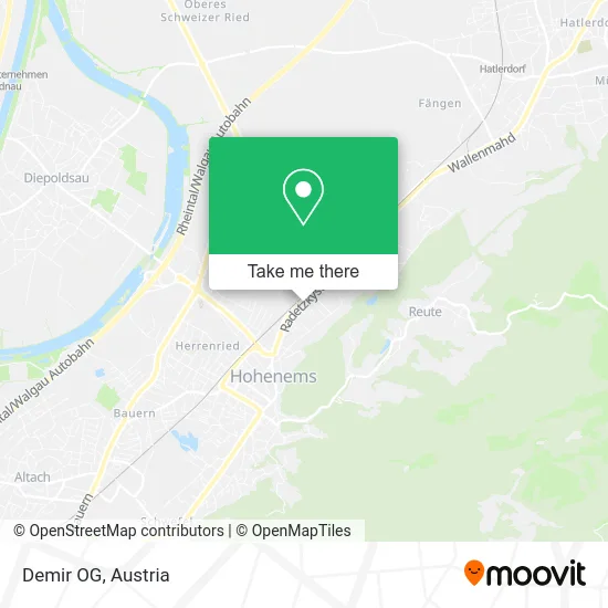
See Demir OG, Stadt Hohenems, on the map
Public Transit to Demir OG in Stadt Hohenems
Wondering how to get to Demir OG in Stadt Hohenems? Moovit helps you find the best way to get to Demir OG with step-by-step directions from the nearest public transit station.
Moovit provides free maps and live directions to help you navigate through your city. View schedules, routes, timetables, and find out how long does it take to get to Demir OG in real time.
Looking for the nearest stop or station to Demir OG? Check out this list of stops closest to your destination: Hohenems H.-Büchele-Straße; Hohenems St.-Valentins-Weg; Hohenems Sohlstraße; Altach Bahnhof; Hohenems Bahnhof.
Train: REX1, S1, 1, R1, R5, A3, A3, A3, A5, R5.Bus: 180, 181, 182, SK, SK, SK.
Want to see if there’s another route that gets you there at an earlier time? Moovit helps you find alternative routes or times. Get directions from and directions to Demir OG easily from the Moovit App or Website.
We make riding to Demir OG easy, which is why over 1.5 million users, including users in Stadt Hohenems, trust Moovit as the best app for public transit. You don’t need to download an individual bus app or train app, Moovit is your all-in-one transit app that helps you find the best bus time or train time available.
For information on prices of bus and train, costs and ride fares to Demir OG, please check the Moovit app.
Use the app to navigate to popular places including to the airport, hospital, stadium, grocery store, mall, coffee shop, school, college, and university.
Demir OG Address: Radetzkystraße 80 6845 Hohenems street in Stadt Hohenems
- Emser Stüble,
- Emser Hutte,
- Serife Kurt,
- Laila-Bar-Cafe,
- Typo-Grafic Meier,
- Mario Fleisch,
- Imbiss + Drive in,
- Marios XI Burger,
- Hohenems Hermann-Büchele-Straße,
- Ihr Haustischler Wolf Raimund,
- Kleber-Kaufmann Oeg,
- Friseursalon Jolie,
- Rudolf Sommer,
- Peter Roland GmbH,
- da emobil GmbH & Co KG,
- Baguette,
- Thomas Maierhofer,
- Peter Mathis P,
- ARGE-,
- Poolbau Tomo
Places Near Demir OG (Stadt Hohenems)
- Wien Rennbahn Freudenau, Leopoldstadt,
- Ronacher, 1., Innere Stadt,
- Feuerhalle Simmering, Simmering,
- Klinik Floridsdorf (Krankenhaus Nord), Floridsdorf,
- Leopoldauer Alm, Floridsdorf,
- 10er Marie, Ottakring,
- Schiffsanleger Wien-Nussdorf, Döbling,
- Raimund-Theater, Mariahilf,
- Mariahilfer Strasse, Mariahilf,
- Zentralfriedhof Halle 3, Simmering,
- Kabarett Simpl, 1., Innere Stadt,
- Donauzentrum, Donaustadt,
- Thomas-Klestil-Platz, Landstraße,
- Ghegastraße 3, Landstraße,
- Türkenschanzpark, Währing,
- Setagayapark, Döbling,
- Lugner City, Rudolfsheim-Fünfhaus,
- Auhof-Center, Penzing,
- Schweizerhaus (Karl Kolariks Schweizerhaus), Leopoldstadt,
- Strandbad Gänsehäufel, Donaustadt
How to get to popular places in Austria with public transit
Get around Stadt Hohenems by public transit!
Traveling around Stadt Hohenems has never been so easy. See step by step directions as you travel to any attraction, street or major public transit station. View bus and train schedules, arrival times, service alerts and detailed routes on a map, so you know exactly how to get to anywhere in Stadt Hohenems.
When traveling to any destination around Stadt Hohenems use Moovit's Live Directions with Get Off Notifications to know exactly where and how far to walk, how long to wait for your line, and how many stops are left. Moovit will alert you when it's time to get off — no need to constantly re-check whether yours is the next stop.
Wondering how to use public transit in Stadt Hohenems or how to pay for public transit in Stadt Hohenems? Moovit public transit app can help you navigate your way with public transit easily, and at minimum cost. It includes public transit fees, ticket prices, and costs. Looking for a map of Stadt Hohenems public transit lines? Moovit public transit app shows all public transit maps in Stadt Hohenems with all Bus, Train, Subway, Light Rail, Ferry and Funicular routes and stops on an interactive map.
Austria has 6 transit type(s), including: Bus, Train, Subway, Light Rail, Ferry and Funicular, operated by several transit agencies, including Wiener Linien GmbH & Co KG, Vienna Airport Lines, OEBB Personenverkehr AG Kundenservice, Wiener Lokalbahnen GmbH, City Air Terminal Betriebsgesellschaft m.b.H., CAT, Österreichische Postbus AG, VOR GmbH, Graz Linien, Graz-Köflacher Bahn und Busbetrieb GmbH, Steiermarkbahn und Bus GmbH, Linz Linien GmbH, Salzburg AG (Salzburger Lokalbahn), Salzburg AG (OBus) and KMG Klagenfurt Mobil GmbH