How to get to Desai Chia Architecture Pc by bus?
Click on the bus route to see step by step directions with maps, line arrival times and updated time schedules.
How to get to Desai Chia Architecture Pc by train?
Click on the train route to see step by step directions with maps, line arrival times and updated time schedules.
How to get to Desai Chia Architecture Pc by subway?
Click on the subway route to see step by step directions with maps, line arrival times and updated time schedules.
Subway stations near Desai Chia Architecture Pc in Manhattan
Bus stops near Desai Chia Architecture Pc in Manhattan
Train station near Desai Chia Architecture Pc in Manhattan
- 23rd Street, 4 min walk,VIEW
Bus lines to Desai Chia Architecture Pc in Manhattan
- GREENWICH, Midtown / W 39th Street - Midtown / W 39th Street,VIEW
- M1, Harlem - East Village,VIEW
- M2, Washington Heights - East Village,VIEW
- M3, Fort George - East Village,VIEW
- M55, W 44 St - South Ferry,VIEW
- DOWNTOWN LOCAL, W 23rd St & 6th Ave,VIEW
- M7, 14 St Via Columbus Via 7 Av,VIEW
- SHORTLINE HUDSON, Nanuet,VIEW
- SHORTLINE HUDSON, Circleville,VIEW
- M14A-SBS, Select Bus Abingdon Sq Via 14 St,VIEW
- M14D-SBS, Select Bus Chlsea Piers 11 Av Via 14 St,VIEW
- 28, 23rd St @ 5th Ave,VIEW
What are the closest stations to Desai Chia Architecture Pc?
The closest stations to Desai Chia Architecture Pc are:
- 14 St-Union Sq is 73 yards away, 1 min walk.
- 5th Ave & W 20th St is 167 yards away, 3 min walk.
- 6th Ave & W 18th St is 281 yards away, 4 min walk.
- 6 Av/W 18 St is 293 yards away, 4 min walk.
- 6th Ave & W 17th St is 330 yards away, 4 min walk.
- 23rd Street is 336 yards away, 4 min walk.
- W 14 St/5 Av is 379 yards away, 5 min walk.
- 23rd St @ 5th Ave is 394 yards away, 5 min walk.
- 14 St/6 Av is 490 yards away, 6 min walk.
Which bus lines stop near Desai Chia Architecture Pc?
These bus lines stop near Desai Chia Architecture Pc: 28, BM3, BM4, M1, M3, X37.
Which train lines stop near Desai Chia Architecture Pc?
These train lines stop near Desai Chia Architecture Pc: 1, BLU, YEL.
Which subway lines stop near Desai Chia Architecture Pc?
These subway lines stop near Desai Chia Architecture Pc: 1, 3, 5, M, N, W.
What’s the nearest subway station to Desai Chia Architecture Pc in Manhattan?
The nearest subway station to Desai Chia Architecture Pc in Manhattan is 14 St-Union Sq. It’s a 1 min walk away.
What’s the nearest train station to Desai Chia Architecture Pc in Manhattan?
The nearest train station to Desai Chia Architecture Pc in Manhattan is 23rd Street. It’s a 4 min walk away.
What’s the nearest bus station to Desai Chia Architecture Pc in Manhattan?
The nearest bus station to Desai Chia Architecture Pc in Manhattan is 5th Ave & W 20th St. It’s a 3 min walk away.
What time is the first subway to Desai Chia Architecture Pc in Manhattan?
The 6 is the first subway that goes to Desai Chia Architecture Pc in Manhattan. It stops nearby at 3:00 AM.
What time is the last subway to Desai Chia Architecture Pc in Manhattan?
The N is the last subway that goes to Desai Chia Architecture Pc in Manhattan. It stops nearby at 3:57 AM.
What time is the first train to Desai Chia Architecture Pc in Manhattan?
The ATW is the first train that goes to Desai Chia Architecture Pc in Manhattan. It stops nearby at 3:17 AM.
What time is the last train to Desai Chia Architecture Pc in Manhattan?
The ATW is the last train that goes to Desai Chia Architecture Pc in Manhattan. It stops nearby at 3:18 AM.
What time is the first bus to Desai Chia Architecture Pc in Manhattan?
The M14D-SBS is the first bus that goes to Desai Chia Architecture Pc in Manhattan. It stops nearby at 3:16 AM.
What time is the last bus to Desai Chia Architecture Pc in Manhattan?
The M7 is the last bus that goes to Desai Chia Architecture Pc in Manhattan. It stops nearby at 3:20 AM.
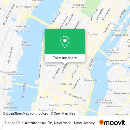
See Desai Chia Architecture Pc, Manhattan, on the map
Public Transit to Desai Chia Architecture Pc in Manhattan
Wondering how to get to Desai Chia Architecture Pc in Manhattan? Moovit helps you find the best way to get to Desai Chia Architecture Pc with step-by-step directions from the nearest public transit station.
Moovit provides free maps and live directions to help you navigate through your city. View schedules, routes, timetables, and find out how long does it take to get to Desai Chia Architecture Pc in real time.
Looking for the nearest stop or station to Desai Chia Architecture Pc? Check out this list of stops closest to your destination: 14 St-Union Sq; 5th Ave & W 20th St; 6th Ave & W 18th St; 6 Av/W 18 St; 6th Ave & W 17th St; 23rd Street; W 14 St/5 Av; 23rd St @ 5th Ave; 14 St/6 Av.
Bus: 28, BM3, BM4, M1, M3, X37, GREENWICH, M2, M55, DOWNTOWN LOCAL, M7.Train: 1, BLU, YEL, ATW.Subway: 1, 3, 5, M, N, W, L, Q, R, D, F, FX.
Want to see if there’s another route that gets you there at an earlier time? Moovit helps you find alternative routes or times. Get directions from and directions to Desai Chia Architecture Pc easily from the Moovit App or Website.
We make riding to Desai Chia Architecture Pc easy, which is why over 1.5 million users, including users in Manhattan, trust Moovit as the best app for public transit. You don’t need to download an individual bus app or train app, Moovit is your all-in-one transit app that helps you find the best bus time or train time available.
For information on prices of bus, subway, train and ferry, costs and ride fares to Desai Chia Architecture Pc, please check the Moovit app.
Use the app to navigate to popular places including to the airport, hospital, stadium, grocery store, mall, coffee shop, school, college, and university.
Desai Chia Architecture Pc Address: 3 W 18th St street in Manhattan
- Parham Santana Design,
- The City Bakery,
- Racket Club,
- Rabbit,
- Airbnb Nyc,
- Good Dog,
- John Gerard Griffith Hair,
- Ootoya Chelsea,
- Ootoya 大戸屋,
- Rebel Hotel Company,
- Stylistico,
- Trollworld,
- Kyma Flatiron,
- Welcome Enterprises,
- Thai Mis Delicias,
- Nda Disinfecting Cleaning Company,
- Fresh NY,
- Parsley Health | Functional Medicine,
- T-Mobile Corporate Office,
- Roberto Cabrera
Places Near Desai Chia Architecture Pc (Manhattan)
- Queens Center Mall, Queens,
- Wall Street, Manhattan,
- Chinatown, Manhattan,
- 26 Federal Plaza, Manhattan,
- 1 Police Plaza, Manhattan,
- 376 Hudson Street, Manhattan,
- 66 John Street, Manhattan,
- SoHo, Manhattan,
- qqqq, Manhattan,
- Bellevue Hospital, Manhattan,
- 3 Stone St, Manhattan,
- Mountainside Hospital, Glen Ridge,
- Katz's Deli, Manhattan,
- San Gennaro Feast, Manhattan,
- Hudson Yards, Manhattan,
- Times Square, Manhattan,
- 911 Memorial, Manhattan,
- 111 Centre New York City Supreme Court, Manhattan,
- Pier 83, Manhattan,
- Rockefeller Center, Manhattan
How to get to popular places in New York - New Jersey with public transit
Get around Manhattan by public transit!
Traveling around Manhattan has never been so easy. See step by step directions as you travel to any attraction, street or major public transit station. View bus and train schedules, arrival times, service alerts and detailed routes on a map, so you know exactly how to get to anywhere in Manhattan.
When traveling to any destination around Manhattan use Moovit's Live Directions with Get Off Notifications to know exactly where and how far to walk, how long to wait for your line, and how many stops are left. Moovit will alert you when it's time to get off — no need to constantly re-check whether yours is the next stop.
Wondering how to use public transit in Manhattan or how to pay for public transit in Manhattan? Moovit public transit app can help you navigate your way with public transit easily, and at minimum cost. It includes public transit fees, ticket prices, and costs. Looking for a map of Manhattan public transit lines? Moovit public transit app shows all public transit maps in Manhattan with all Bus, Train, Subway, Light Rail, Ferry and Cable Car routes and stops on an interactive map.
New York - New Jersey has 6 transit type(s), including: Bus, Train, Subway, Light Rail, Ferry and Cable Car, operated by several transit agencies, including MTA Subway, Metro-North Railroad, LIRR, PATH, MTA New York City Transit - Express routes, MTA Bus, NJ Transit, NYC Ferry, NICE bus, Bee-Line Bus, NJ Transit Rail, Norwalk Transit District, Hartford Line, River Valley Transit and HART