How to get to Design Group by bus?
Click on the bus route to see step by step directions with maps, line arrival times and updated time schedules.
From Us07, Miami Beach
56 minFrom Costco Wholesale, Miami
40 minFrom Miami Shores, Miami
67 minFrom Dania Pointe, Hollywood
98 minFrom Dania Beach, Hollywood
74 minFrom Opa-Locka, FL, Miami
97 minFrom Haulover Beach, Miami Beach
49 minFrom Hard Rock Stadium, Miami Gardens
63 minFrom Hollywood Beach, Hollywood
67 minFrom The Casino at Dania Beach (Dania Jai-alai), Hollywood
81 min
How to get to Design Group by train?
Click on the train route to see step by step directions with maps, line arrival times and updated time schedules.
Bus stops near Design Group in Miami
Train station near Design Group in Miami
- Aventura, 42 min walk,VIEW
Bus lines to Design Group in Miami
What are the closest stations to Design Group?
The closest stations to Design Group are:
- Ne 205 Te & Ne 15 Av is 486 yards away, 6 min walk.
- Ne 20 Av & Ne 202 St is 1510 yards away, 18 min walk.
- Aventura is 3587 yards away, 42 min walk.
Which bus line stops near Design Group?
199 (199 - Red Rd Transit Hub)
Which train line stops near Design Group?
BLFM (Mco)
What’s the nearest bus station to Design Group in Miami?
The nearest bus station to Design Group in Miami is Ne 205 Te & Ne 15 Av. It’s a 6 min walk away.
What time is the first train to Design Group in Miami?
The BLFM is the first train that goes to Design Group in Miami. It stops nearby at 6:09 AM.
What time is the last train to Design Group in Miami?
The BLFM is the last train that goes to Design Group in Miami. It stops nearby at 12:07 AM.
What time is the first bus to Design Group in Miami?
The 199 is the first bus that goes to Design Group in Miami. It stops nearby at 5:09 AM.
What time is the last bus to Design Group in Miami?
The 199 is the last bus that goes to Design Group in Miami. It stops nearby at 11:05 PM.
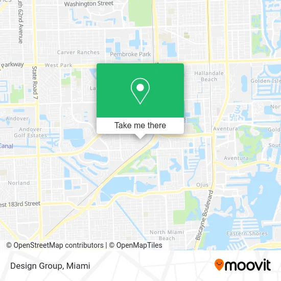
See Design Group, Miami, on the map
Public Transit to Design Group in Miami
Wondering how to get to Design Group in Miami? Moovit helps you find the best way to get to Design Group with step-by-step directions from the nearest public transit station.
Moovit provides free maps and live directions to help you navigate through your city. View schedules, routes, timetables, and find out how long does it take to get to Design Group in real time.
Looking for the nearest stop or station to Design Group? Check out this list of stops closest to your destination: Ne 205 Te & Ne 15 Av; Ne 20 Av & Ne 202 St; Aventura.
Bus: 199, 95.Train: BLFM.
Want to see if there’s another route that gets you there at an earlier time? Moovit helps you find alternative routes or times. Get directions from and directions to Design Group easily from the Moovit App or Website.
We make riding to Design Group easy, which is why over 1.5 million users, including users in Miami, trust Moovit as the best app for public transit. You don’t need to download an individual bus app or train app, Moovit is your all-in-one transit app that helps you find the best bus time or train time available.
For information on prices of bus and train, costs and ride fares to Design Group, please check the Moovit app.
Use the app to navigate to popular places including to the airport, hospital, stadium, grocery store, mall, coffee shop, school, college, and university.
Design Group Address: 20200 NE 15th Ct Miami, FL 33179 street in Miami
- Royal Rebels All Stars,
- Lifeforce - Wol,
- Summit Junk,
- Church Sinners Welcome,
- Taurus Telecommunications,
- Coco Cosmetics,
- My Miami Locksmith,
- Eco Pipe Lining,
- Grace Center Church,
- Perfume on Wheels,
- Veneto Fragrance Wholesale,
- All Saints Byzantine Catholic CH,
- Compass van Lines,
- Gopuff,
- ABC Liquidation LLC,
- Dna Transport,
- Rifbar,
- Credit Union 1,
- Amazon Locker-Wakim,
- Blessings Automotive Service
Places Near Design Group (Miami)
- Sawgrass mall ( FL ), Miami Beach,
- Miami Freedom Park, Miami,
- Sawgrass Mall, Miami,
- Keiser University Flagship Campus, West Palm Beach,
- Dolphin Mall Bus, Miami,
- Aventura Mall, Miami,
- Wynwood, Miami,
- Brickell City Centre, Miami,
- Miami-Dade County Courthouse, Miami,
- Hard Rock Stadium, Miami Gardens,
- Zoo Miami, Miami,
- Little Havana, Miami,
- Miami VA Hospital, Miami,
- Aventura Mall, Miami Beach,
- Port of Miami Cruise Terminal, Miami,
- Dolphin Mall, Miami,
- Marlins Park, Miami,
- Bayside Marketplace, Miami,
- Richard E. Gerstein Justice Building, Miami,
- Miami Design District, Miami
How to get to popular places in Miami with public transit
Get around Miami by public transit!
Traveling around Miami has never been so easy. See step by step directions as you travel to any attraction, street or major public transit station. View bus and train schedules, arrival times, service alerts and detailed routes on a map, so you know exactly how to get to anywhere in Miami.
When traveling to any destination around Miami use Moovit's Live Directions with Get Off Notifications to know exactly where and how far to walk, how long to wait for your line, and how many stops are left. Moovit will alert you when it's time to get off — no need to constantly re-check whether yours is the next stop.
Wondering how to use public transit in Miami or how to pay for public transit in Miami? Moovit public transit app can help you navigate your way with public transit easily, and at minimum cost. It includes public transit fees, ticket prices, and costs. Looking for a map of Miami public transit lines? Moovit public transit app shows all public transit maps in Miami with all Bus, Train, Light Rail and Ferry routes and stops on an interactive map.
Miami has 4 transit type(s), including: Bus, Train, Light Rail and Ferry, operated by several transit agencies, including Broward County Transit, Miami-Dade Transit, Metrorail, Palm Tran, Tri-Rail, Brightline, MARTY, City of Homestead Trolley, Key West Transit, Treasure Coast Connector, GoLine IRT, Amtrak, Greyhound-us, FlixBus-us and Aventura Express Shuttle Bus