Directions to Designatronics (North New Hyde Park) with public transportation
The following transit lines have routes that pass near Designatronics
 Bus: N24, N25, N25/58.
- Train: PORT JEFFERSON BRANCH, HEMPSTEAD BRANCH, RONKONKOMA BRANCH, MONTAUK BRANCH, OYSTER BAY BRANCH.
How to get to Designatronics by bus?
Click on the bus route to see step by step directions with maps, line arrival times and updated time schedules.
From St. John's University, Queens
61 minFrom Uniondale, NY, Uniondale
64 minFrom Fresh Meadows, Queens
56 minFrom Bayside High School, Queens
76 minFrom Mercy Hospital, Rockville Centre
79 minFrom Walmart, Queens
68 minFrom Roy Wilkins Park, Queens
81 minFrom Walmart, Queens
68 minFrom Green Acres Mall, South Valley Stream
73 minFrom Walmart, Valley Stream
69 min
How to get to Designatronics by train?
Click on the train route to see step by step directions with maps, line arrival times and updated time schedules.
Bus stops near Designatronics in North New Hyde Park
Train stations near Designatronics in North New Hyde Park
Bus lines to Designatronics in North New Hyde Park
What are the closest stations to Designatronics?
The closest stations to Designatronics are:
- Nassau Term Rd / Jericho is 281 yards away, 4 min walk.
- New Hyde Park Rd +2nd Ave is 931 yards away, 12 min walk.
- Stewart Manor is 1311 yards away, 16 min walk.
- Merillon Avenue is 2606 yards away, 31 min walk.
- Mineola is 3024 yards away, 36 min walk.
Which bus lines stop near Designatronics?
These bus lines stop near Designatronics: N24, N25.
Which train line stops near Designatronics?
PORT JEFFERSON BRANCH (Port Jefferson)
What’s the nearest train station to Designatronics in North New Hyde Park?
The nearest train station to Designatronics in North New Hyde Park is Stewart Manor. It’s a 16 min walk away.
What’s the nearest bus station to Designatronics in North New Hyde Park?
The nearest bus station to Designatronics in North New Hyde Park is Nassau Term Rd / Jericho. It’s a 4 min walk away.
What time is the first train to Designatronics in North New Hyde Park?
The HEMPSTEAD BRANCH is the first train that goes to Designatronics in North New Hyde Park. It stops nearby at 3:16 AM.
What time is the last train to Designatronics in North New Hyde Park?
The HEMPSTEAD BRANCH is the last train that goes to Designatronics in North New Hyde Park. It stops nearby at 3:19 AM.
What time is the first bus to Designatronics in North New Hyde Park?
The N24 is the first bus that goes to Designatronics in North New Hyde Park. It stops nearby at 3:59 AM.
What time is the last bus to Designatronics in North New Hyde Park?
The N24 is the last bus that goes to Designatronics in North New Hyde Park. It stops nearby at 12:49 AM.
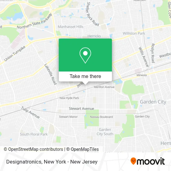
See Designatronics, North New Hyde Park, on the map
Public Transit to Designatronics in North New Hyde Park
Wondering how to get to Designatronics in North New Hyde Park? Moovit helps you find the best way to get to Designatronics with step-by-step directions from the nearest public transit station.
Moovit provides free maps and live directions to help you navigate through your city. View schedules, routes, timetables, and find out how long does it take to get to Designatronics in real time.
Looking for the nearest stop or station to Designatronics? Check out this list of stops closest to your destination: Nassau Term Rd / Jericho; New Hyde Park Rd +2nd Ave; Stewart Manor; Merillon Avenue; Mineola.
Bus: N24, N25, N25/58.Train: PORT JEFFERSON BRANCH, HEMPSTEAD BRANCH, RONKONKOMA BRANCH, MONTAUK BRANCH, OYSTER BAY BRANCH.
Want to see if there’s another route that gets you there at an earlier time? Moovit helps you find alternative routes or times. Get directions from and directions to Designatronics easily from the Moovit App or Website.
We make riding to Designatronics easy, which is why over 1.5 million users, including users in North New Hyde Park, trust Moovit as the best app for public transit. You don’t need to download an individual bus app or train app, Moovit is your all-in-one transit app that helps you find the best bus time or train time available.
For information on prices of bus and train, costs and ride fares to Designatronics, please check the Moovit app.
Use the app to navigate to popular places including to the airport, hospital, stadium, grocery store, mall, coffee shop, school, college, and university.
Designatronics Address: 125 Railroad Ave street in North New Hyde Park
- Keystone Electronics Corp,
- Universalfitclub,
- Sambucci Bros Auto Salvage,
- Tower Sign Awning & Glass Co.,
- Event Terminal,
- Tower Creations,
- Amerita Specialty Infusion Services - New York City,
- Customwheelchairs Usa,
- A-Spec Performance Llc,
- Metro Team Sports,
- Alfredo the Mechanic,
- Numotion,
- Virtair,
- Cora Refining,
- Woodcore Cabinetry,
- Alpha-Empiron Building Corporation,
- Gold Coast Bmw Motorcycles Of Great Neck,
- Daniel.Printedcustompackaging,
- Nationwide Auto Body,
- Statmd Urgent Care / Li Medical Group (Primary & Multi-Specialty Care)
Places Near Designatronics (North New Hyde Park)
- Rockefeller Center, Manhattan,
- Times Square, Manhattan,
- Bellevue Hospital, Manhattan,
- Wall Street, Manhattan,
- SoHo, Manhattan,
- Mountainside Hospital, Glen Ridge,
- 26 Federal Plaza, Manhattan,
- San Gennaro Feast, Manhattan,
- 1 Police Plaza, Manhattan,
- 66 John Street, Manhattan,
- Chinatown, Manhattan,
- 111 Centre New York City Supreme Court, Manhattan,
- Hudson Yards, Manhattan,
- Queens Center Mall, Queens,
- 911 Memorial, Manhattan,
- 3 Stone St, Manhattan,
- Pier 83, Manhattan,
- qqqq, Manhattan,
- 376 Hudson Street, Manhattan,
- Katz's Deli, Manhattan
How to get to popular places in New York - New Jersey with public transit
Get around North New Hyde Park by public transit!
Traveling around North New Hyde Park has never been so easy. See step by step directions as you travel to any attraction, street or major public transit station. View bus and train schedules, arrival times, service alerts and detailed routes on a map, so you know exactly how to get to anywhere in North New Hyde Park.
When traveling to any destination around North New Hyde Park use Moovit's Live Directions with Get Off Notifications to know exactly where and how far to walk, how long to wait for your line, and how many stops are left. Moovit will alert you when it's time to get off — no need to constantly re-check whether yours is the next stop.
Wondering how to use public transit in North New Hyde Park or how to pay for public transit in North New Hyde Park? Moovit public transit app can help you navigate your way with public transit easily, and at minimum cost. It includes public transit fees, ticket prices, and costs. Looking for a map of North New Hyde Park public transit lines? Moovit public transit app shows all public transit maps in North New Hyde Park with all Bus, Train, Subway, Light Rail, Ferry and Cable Car routes and stops on an interactive map.
New York - New Jersey has 6 transit type(s), including: Bus, Train, Subway, Light Rail, Ferry and Cable Car, operated by several transit agencies, including MTA Subway, Metro-North Railroad, LIRR, PATH, MTA New York City Transit - Express routes, MTA Bus, NJ Transit, NYC Ferry, NICE bus, Bee-Line Bus, NJ Transit Rail, Norwalk Transit District, Hartford Line, River Valley Transit and HART