Directions to Designer PC Systems (Indianapolis City (Balance)) with public transportation
The following transit lines have routes that pass near Designer PC Systems
 Bus: 19.
How to get to Designer PC Systems by bus?
Click on the bus route to see step by step directions with maps, line arrival times and updated time schedules.
From Tabernacle of Hope SDA Church, Indianapolis City (Balance)
97 minFrom 71st Street and Michigan Road, Indianapolis City (Balance)
104 minFrom 46th Street and Franklin Road, Lawrence
94 minFrom 21st an Emerson, Indianapolis City (Balance)
91 minFrom The Bier Brewery Lounge, Indianapolis City (Balance)
47 minFrom Dr. Ferguson, Chiropractor, Indianapolis City (Balance)
52 minFrom Childrens Museum, Indianapolis City (Balance)
52 minFrom St. Vincent Indianapolis Hospital, Indianapolis City (Balance)
58 minFrom 21st & Arlington Ave., Indianapolis City (Balance)
72 minFrom 42nd Street and Arlington Ave., Indianapolis City (Balance)
51 min
Which bus line stops near Designer PC Systems?
19
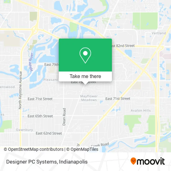
See Designer PC Systems, Indianapolis City (Balance), on the map
Public Transit to Designer PC Systems in Indianapolis City (Balance)
Wondering how to get to Designer PC Systems in Indianapolis City (Balance)? Moovit helps you find the best way to get to Designer PC Systems with step-by-step directions from the nearest public transit station.
Moovit provides free maps and live directions to help you navigate through your city. View schedules, routes, timetables, and find out how long does it take to get to Designer PC Systems in real time.
Bus: 19.
Want to see if there’s another route that gets you there at an earlier time? Moovit helps you find alternative routes or times. Get directions from and directions to Designer PC Systems easily from the Moovit App or Website.
We make riding to Designer PC Systems easy, which is why over 1.5 million users, including users in Indianapolis City (Balance), trust Moovit as the best app for public transit. You don’t need to download an individual bus app or train app, Moovit is your all-in-one transit app that helps you find the best bus time or train time available.
For information on prices of bus, costs and ride fares to Designer PC Systems, please check the Moovit app.
Use the app to navigate to popular places including to the airport, hospital, stadium, grocery store, mall, coffee shop, school, college, and university.
Designer PC Systems Address: 7472 Galloway Ct Indianapolis, IN 46250 street in Indianapolis City (Balance)
- Time Out Lounge,
- Fastest Locksmith,
- Storytelling Arts of Indiana,
- The Piano Merchant,
- Stiles,
- Louden Steel Detailg,
- Metropolitan Indianapolis Mls,
- Reliable Locksmith,
- Indiana Nazarene Clergy Association,
- Wil MCK,
- Custom Packaging,
- Odyssey Map Store,
- House Wash Indy,
- Cheveux Studio,
- Handiworks Unlimited,
- Allisonville Rd & 65th St,
- Maxxwell Group,
- Ted K Brauer,
- Marcus C Koepke,
- Miller's Towing and Transport
Places Near Designer PC Systems (Indianapolis City (Balance))
- 119 W 19th St Parking, Indianapolis City (Balance),
- St. Vincent Hospital - Indianapolis, Indianapolis City (Balance),
- Cotter's Massage Parlor With Happy Endings, Indianapolis City (Balance),
- St. Vincent entrance #1, Indianapolis City (Balance),
- Lilly Corporate Center (Eli Lilly & Co), Indianapolis City (Balance),
- Indianapolis Motor Speedway, Speedway,
- Methodist Hospital of Indianapolis, Indianapolis City (Balance),
- Gainbridge Fieldhouse, Indianapolis City (Balance),
- Train Ride At Castleton Mall, Indianapolis City (Balance),
- Plainfield, IN, Plainfield,
- I-465 / I-65 Interchange, Indianapolis City (Balance),
- Jersey Barn, Indianapolis City (Balance),
- THE BALT, Indianapolis City (Balance),
- Eskenazi Hospital, Indianapolis City (Balance),
- Indiana, Indianapolis City (Balance),
- Lucas Oil Stadium, Indianapolis City (Balance),
- Castleton Square Mall, Indianapolis,
- Indianapolis Airport Zone 2, Indianapolis City (Balance),
- I U Health Methodist Hospital, Indianapolis City (Balance),
- Indiana Convention Center, Indianapolis City (Balance)
How to get to popular places in Indianapolis with public transit
Get around Indianapolis City (Balance) by public transit!
Traveling around Indianapolis City (Balance) has never been so easy. See step by step directions as you travel to any attraction, street or major public transit station. View bus and train schedules, arrival times, service alerts and detailed routes on a map, so you know exactly how to get to anywhere in Indianapolis City (Balance).
When traveling to any destination around Indianapolis City (Balance) use Moovit's Live Directions with Get Off Notifications to know exactly where and how far to walk, how long to wait for your line, and how many stops are left. Moovit will alert you when it's time to get off — no need to constantly re-check whether yours is the next stop.
Wondering how to use public transit in Indianapolis City (Balance) or how to pay for public transit in Indianapolis City (Balance)? Moovit public transit app can help you navigate your way with public transit easily, and at minimum cost. It includes public transit fees, ticket prices, and costs. Looking for a map of Indianapolis City (Balance) public transit lines? Moovit public transit app shows all public transit maps in Indianapolis City (Balance) with all bus routes and stops on an interactive map.
Indianapolis has 1 transit type(s), including: bus, operated by several transit agencies, including IndyGo, FlixBus-us and Greyhound-us