How to get to Designing Systems by bus?
Click on the bus route to see step by step directions with maps, line arrival times and updated time schedules.
From Passaic, NJ, Passaic
42 minFrom IKEA Paramus, Paramus
49 minFrom Riverside Square Mall, Hackensack
63 minFrom Clifton, NJ, Clifton
58 minFrom Nutley, NJ, Nutley
58 minFrom Carlstadt, NJ, Carlstadt
62 minFrom Wayne, NJ, Wayne
56 minFrom Hackensack, NJ, Hackensack
64 minFrom Garden State Plaza, Paramus
53 minFrom Hackensack Hospital, Hackensack
51 min
How to get to Designing Systems by train?
Click on the train route to see step by step directions with maps, line arrival times and updated time schedules.
Bus stops near Designing Systems in Paterson
Train station near Designing Systems in Paterson
- Paterson, 11 min walk,VIEW
Bus lines to Designing Systems in Paterson
What are the closest stations to Designing Systems?
The closest stations to Designing Systems are:
- Belmont Ave at Cliff St is 79 yards away, 2 min walk.
- West Broadway at Belmont Ave is 388 yards away, 5 min walk.
- Paterson is 869 yards away, 11 min walk.
Which bus lines stop near Designing Systems?
These bus lines stop near Designing Systems: 171, 703, 748.
Which train line stops near Designing Systems?
MAIN (Port Jervis)
What’s the nearest train station to Designing Systems in Paterson?
The nearest train station to Designing Systems in Paterson is Paterson. It’s a 11 min walk away.
What’s the nearest bus station to Designing Systems in Paterson?
The nearest bus station to Designing Systems in Paterson is Belmont Ave at Cliff St. It’s a 2 min walk away.
What time is the first train to Designing Systems in Paterson?
The MAIN is the first train that goes to Designing Systems in Paterson. It stops nearby at 5:19 AM.
What time is the last train to Designing Systems in Paterson?
The MAIN is the last train that goes to Designing Systems in Paterson. It stops nearby at 2:10 AM.
What time is the first bus to Designing Systems in Paterson?
The 703 is the first bus that goes to Designing Systems in Paterson. It stops nearby at 5:27 AM.
What time is the last bus to Designing Systems in Paterson?
The 748 is the last bus that goes to Designing Systems in Paterson. It stops nearby at 11:00 PM.
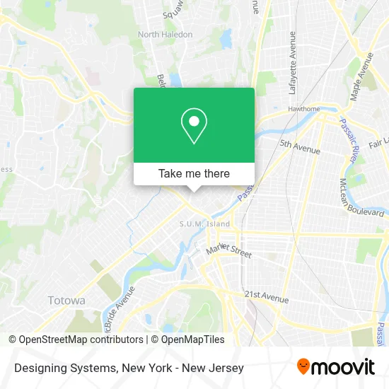
See Designing Systems, Paterson, on the map
Public Transit to Designing Systems in Paterson
Wondering how to get to Designing Systems in Paterson? Moovit helps you find the best way to get to Designing Systems with step-by-step directions from the nearest public transit station.
Moovit provides free maps and live directions to help you navigate through your city. View schedules, routes, timetables, and find out how long does it take to get to Designing Systems in real time.
Looking for the nearest stop or station to Designing Systems? Check out this list of stops closest to your destination: Belmont Ave at Cliff St; West Broadway at Belmont Ave; Paterson.
Bus: 171, 703, 748.Train: MAIN.
Want to see if there’s another route that gets you there at an earlier time? Moovit helps you find alternative routes or times. Get directions from and directions to Designing Systems easily from the Moovit App or Website.
We make riding to Designing Systems easy, which is why over 1.7 million users, including users in Paterson, trust Moovit as the best app for public transit. You don’t need to download an individual bus app or train app, Moovit is your all-in-one transit app that helps you find the best bus time or train time available.
For information on prices of bus and train, costs and ride fares to Designing Systems, please check the Moovit app.
Use the app to navigate to popular places including to the airport, hospital, stadium, grocery store, mall, coffee shop, school, college, and university.
Designing Systems Address: 114 Cliff St street in Paterson
- Service Behavioral Health Systems,
- Financial Planning,
- Billsbookclub,
- Paredes Auto Services Tire and More,
- Juan Valdez Multimedia,
- Real Brothers Trucking,
- J&M Secourier Delivery Services,
- Ceo Enterprise,
- Igelsia Amor Christinao,
- 1 Touch Sign Shop 813 E,
- Amazing Wireless,
- Windshield Camera Recalibration,
- Lovin Arms Daycare,
- Church Made Without Hands Ministries,
- Juan Plastic Display's,
- La Queen Latin's Food,
- From Street To Christ,
- El Camino Feliz Restaurant,
- Victor's Auto Repair & Autobody Shop,
- El Camino Restaurant
Places Near Designing Systems (Paterson)
- 111 Centre New York City Supreme Court, Manhattan,
- 911 Memorial, Manhattan,
- 376 Hudson Street, Manhattan,
- 26 Federal Plaza, Manhattan,
- Chinatown, Manhattan,
- San Gennaro Feast, Manhattan,
- Bellevue Hospital, Manhattan,
- Times Square, Manhattan,
- 66 John Street, Manhattan,
- Pier 83, Manhattan,
- Katz's Deli, Manhattan,
- Mountainside Hospital, Glen Ridge,
- Rockefeller Center, Manhattan,
- Queens Center Mall, Queens,
- SoHo, Manhattan,
- Wall Street, Manhattan,
- 3 Stone St, Manhattan,
- Hudson Yards, Manhattan,
- 1 Police Plaza, Manhattan,
- qqqq, Manhattan
How to get to popular places in New York - New Jersey with public transit
Get around Paterson by public transit!
Traveling around Paterson has never been so easy. See step by step directions as you travel to any attraction, street or major public transit station. View bus and train schedules, arrival times, service alerts and detailed routes on a map, so you know exactly how to get to anywhere in Paterson.
When traveling to any destination around Paterson use Moovit's Live Directions with Get Off Notifications to know exactly where and how far to walk, how long to wait for your line, and how many stops are left. Moovit will alert you when it's time to get off — no need to constantly re-check whether yours is the next stop.
Wondering how to use public transit in Paterson or how to pay for public transit in Paterson? Moovit public transit app can help you navigate your way with public transit easily, and at minimum cost. It includes public transit fees, ticket prices, and costs. Looking for a map of Paterson public transit lines? Moovit public transit app shows all public transit maps in Paterson with all Bus, Train, Subway, Light Rail, Ferry and Cable Car routes and stops on an interactive map.
New York - New Jersey has 6 transit type(s), including: Bus, Train, Subway, Light Rail, Ferry and Cable Car, operated by several transit agencies, including MTA Subway, Metro-North Railroad, LIRR, PATH, MTA New York City Transit - Express routes, MTA Bus, NJ Transit, NYC Ferry, NICE bus, Bee-Line Bus, NJ Transit Rail, Norwalk Transit District, Hartford Line, River Valley Transit and HART