How to get to Destiny Ramming-Re/Max Trends by bus?
Click on the bus route to see step by step directions with maps, line arrival times and updated time schedules.
From Made Whitlock, Villas
120 minFrom The River Church at Fort Myers, Villas
83 minFrom Help at Home Homecare Ft Myers, Iona
99 minFrom L.A.R.C.Inc, Fort Myers
72 minFrom CIRCLE K, Fort Myers
34 minFrom Harold B. Klite Truppman, P.A., Fort Myers
74 minFrom Tower Strong Services, Palmona Park
45 minFrom House of Spirits Mystical Botanika, Villas
48 minFrom Mission BBQ, Cape Coral
26 minFrom Santana, Jose Clean Up, Harlem Heights
93 min
Bus stops near Destiny Ramming-Re/Max Trends in Cape Coral
Bus lines to Destiny Ramming-Re/Max Trends in Cape Coral
What are the closest stations to Destiny Ramming-Re/Max Trends?
The closest stations to Destiny Ramming-Re/Max Trends are:
- Del Prado Blvd @ Starbucks is 521 yards away, 7 min walk.
- Coralwood Mall @ SE 22nd Ln is 544 yards away, 7 min walk.
Which bus lines stop near Destiny Ramming-Re/Max Trends?
These bus lines stop near Destiny Ramming-Re/Max Trends: 120, 70.
What’s the nearest bus station to Destiny Ramming-Re/Max Trends in Cape Coral?
The nearest bus stations to Destiny Ramming-Re/Max Trends in Cape Coral are Del Prado Blvd @ Starbucks and Coralwood Mall @ SE 22nd Ln. The closest one is a 7 min walk away.
What time is the first bus to Destiny Ramming-Re/Max Trends in Cape Coral?
The 70 is the first bus that goes to Destiny Ramming-Re/Max Trends in Cape Coral. It stops nearby at 5:24 AM.
What time is the last bus to Destiny Ramming-Re/Max Trends in Cape Coral?
The 70 is the last bus that goes to Destiny Ramming-Re/Max Trends in Cape Coral. It stops nearby at 10:05 PM.
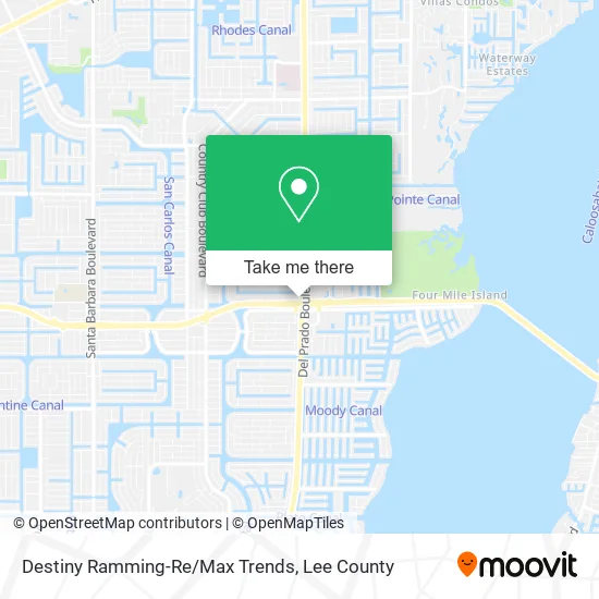
See Destiny Ramming-Re/Max Trends, Cape Coral, on the map
Public Transit to Destiny Ramming-Re/Max Trends in Cape Coral
Wondering how to get to Destiny Ramming-Re/Max Trends in Cape Coral? Moovit helps you find the best way to get to Destiny Ramming-Re/Max Trends with step-by-step directions from the nearest public transit station.
Moovit provides free maps and live directions to help you navigate through your city. View schedules, routes, timetables, and find out how long does it take to get to Destiny Ramming-Re/Max Trends in real time.
Looking for the nearest stop or station to Destiny Ramming-Re/Max Trends? Check out this list of stops closest to your destination: Del Prado Blvd @ Starbucks; Coralwood Mall @ SE 22nd Ln.
Bus: 120, 70, 40.
Want to see if there’s another route that gets you there at an earlier time? Moovit helps you find alternative routes or times. Get directions from and directions to Destiny Ramming-Re/Max Trends easily from the Moovit App or Website.
We make riding to Destiny Ramming-Re/Max Trends easy, which is why over 1.5 million users, including users in Cape Coral, trust Moovit as the best app for public transit. You don’t need to download an individual bus app or train app, Moovit is your all-in-one transit app that helps you find the best bus time or train time available.
For information on prices of bus, costs and ride fares to Destiny Ramming-Re/Max Trends, please check the Moovit app.
Use the app to navigate to popular places including to the airport, hospital, stadium, grocery store, mall, coffee shop, school, college, and university.
Destiny Ramming-Re/Max Trends Address: 2326 Del Prado Blvd S Cape Coral, FL 33990 street in Cape Coral
- Vickie Townes, Realtor,
- JLG Media Group,
- Deborah Cullen-Re / Max Realty Team,
- Realtor Judith Ann New,
- Paul Sanguinetti - Remax Realty Team,
- MVP Realty,
- Pierce Thomas,
- Southwest Florida,
- Amanda Kearney,
- The Florida Gulf Coast Multiple Listing Service,
- B & L Marine Elect,
- Twincutz Barbershop Cape Coral,
- Barberville,
- Haven Of Divine Love Nelson Residence,
- Puff and Stuff,
- Pandora,
- Mr Rooter Plumbing,
- Appliance Outfitters,
- Esporta Fitness,
- Oriental Rug Salon
Places Near Destiny Ramming-Re/Max Trends (Cape Coral)
- Edison Mall, Fort Myers,
- Miromar Outlets, Estero,
- Lehigh Acres, FL, Lehigh Acres,
- U.S.-41 / Colonial Blvd. Intersection, Fort Myers,
- Amazon Warehouse Rsw5,
- I-75 & Colonial (Exit 136), Fort Myers,
- Bonita Bay Private Beach Club, Bonita Springs,
- I-75 & MLK (Exit 138), Fort Myers,
- All About U Naples Escorts, Pine Ridge,
- Pelican Landing Beach Shuttle, Bonita Springs,
- Bonita Springs, FL, Bonita Springs,
- Walmart Supercenter, Fort Myers,
- Seminole Casino Hotel Immokalee,
- Rosa Parks Transportation Center, Fort Myers,
- Ft Myers Airport RSW,
- Flixbus, Fort Myers,
- Lee County Tax Collector, Cape Coral,
- US-41, Fort Myers,
- Bonita Beach, Bonita Springs,
- Matlacha Nude Beach, Matlacha Isles-Matlacha Shores
How to get to popular places in Lee County with public transit
Get around Cape Coral by public transit!
Traveling around Cape Coral has never been so easy. See step by step directions as you travel to any attraction, street or major public transit station. View bus and train schedules, arrival times, service alerts and detailed routes on a map, so you know exactly how to get to anywhere in Cape Coral.
When traveling to any destination around Cape Coral use Moovit's Live Directions with Get Off Notifications to know exactly where and how far to walk, how long to wait for your line, and how many stops are left. Moovit will alert you when it's time to get off — no need to constantly re-check whether yours is the next stop.
Wondering how to use public transit in Cape Coral or how to pay for public transit in Cape Coral? Moovit public transit app can help you navigate your way with public transit easily, and at minimum cost. It includes public transit fees, ticket prices, and costs. Looking for a map of Cape Coral public transit lines? Moovit public transit app shows all public transit maps in Cape Coral with all bus routes and stops on an interactive map.
Lee County has 1 transit type(s), including: bus, operated by several transit agencies, including LeeTran, CAT and FlixBus-us