Directions to Detallazo (Puebla) with public transportation
The following transit lines have routes that pass near Detallazo
 Bus: RUTA APANGO, LINEA 4, RUTA S86.
How to get to Detallazo by bus?
Click on the bus route to see step by step directions with maps, line arrival times and updated time schedules.
From Bugambilias, Puebla
33 minFrom Plazas Amalucan, Puebla
52 minFrom Boulevard Margaritas, Puebla
57 minFrom Base Ruta 8 Y 9 Alimentadora, Puebla
69 minFrom Centro de Salud Colonia 2 de Marzo, Vicente Guerrero
83 minFrom Guadalupe Victoria, Puebla
35 minFrom Puente La Maria Puebla, Puebla
70 minFrom Via Amalucan, Puebla
44 minFrom Apulco, Puebla
48 minFrom Avenida Juárez 2309, Puebla
42 min
Bus stops near Detallazo in Puebla
Bus lines to Detallazo in Puebla
What are the closest stations to Detallazo?
The closest stations to Detallazo are:
- Federal Puebla Tehuacán 1207 is 143 meters away, 2 min walk.
- Parada Metrobús Línea 4 is 377 meters away, 5 min walk.
- Calle 6 Sur, 111 is 829 meters away, 11 min walk.
Which bus line stops near Detallazo?
RUTA APANGO (Ramal 3, Tlaxco - Terminal Ruta Línea 3)
What’s the nearest bus station to Detallazo in Puebla?
The nearest bus station to Detallazo in Puebla is Federal Puebla Tehuacán 1207. It’s a 2 min walk away.
What time is the first bus to Detallazo in Puebla?
The LINEA 4 is the first bus that goes to Detallazo in Puebla. It stops nearby at 5:00 AM.
What time is the last bus to Detallazo in Puebla?
The RUTA APANGO is the last bus that goes to Detallazo in Puebla. It stops nearby at 12:02 AM.
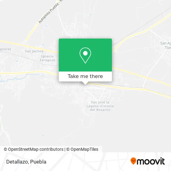
See Detallazo, Puebla, on the map
Public Transit to Detallazo in Puebla
Wondering how to get to Detallazo in Puebla? Moovit helps you find the best way to get to Detallazo with step-by-step directions from the nearest public transit station.
Moovit provides free maps and live directions to help you navigate through your city. View schedules, routes, timetables, and find out how long does it take to get to Detallazo in real time.
Looking for the nearest stop or station to Detallazo? Check out this list of stops closest to your destination: Federal Puebla Tehuacán 1207; Parada Metrobús Línea 4; Calle 6 Sur.
Bus: RUTA APANGO, LINEA 4, RUTA S86.
Want to see if there’s another route that gets you there at an earlier time? Moovit helps you find alternative routes or times. Get directions from and directions to Detallazo easily from the Moovit App or Website.
We make riding to Detallazo easy, which is why over 1.5 million users, including users in Puebla, trust Moovit as the best app for public transit. You don’t need to download an individual bus app or train app, Moovit is your all-in-one transit app that helps you find the best bus time or train time available.
For information on prices of bus, costs and ride fares to Detallazo, please check the Moovit app.
Use the app to navigate to popular places including to the airport, hospital, stadium, grocery store, mall, coffee shop, school, college, and university.
Detallazo Address: Detallazo, Calle 12 Sur, Barrio San José Victoria, 72980 Amozoc, Puebla street in Puebla
- Paraíso de los Volcanes,
- Capri Eventos,
- San José Victoria,
- REFACCIONARIA,
- Parada De Buenos Aires,
- Tse Xicohtencatl Amozoc,
- Iglesia de la Sagrada Familia,
- Dulces,
- Bachillerato Miguel Castulo Alatriste Castro,
- Fracc. Rinconadas de Amozoc,
- Notaria Pública N 15,
- UBR Amozoc,
- Carretera Federal a Amozoc Oriental Kilómetro-6.4,
- Rinconada de San Matias,
- Los Duraznos,
- San José de los Encinos,
- Montepio El Sol,
- Salón De Eventos Loli Bon,
- Pemex,
- Combustibles Milan E12678
Places Near Detallazo (Puebla)
- Parque Puebla, Puebla,
- Hospital Traumatología y Ortopedia de Puebla, San Pedro Cholula,
- Complejo Cultural Universitario, Ocoyucan,
- Hospital General Regional 36 IMSS San Alejandro, San Andrés Cholula,
- Plaza Dorada Centro Comercial, Puebla,
- Ciudad Judicial del Estado de Puebla, San Andrés Cholula,
- Centro Comercial Angelópolis, San Andrés Cholula,
- Tres Cruces, Puebla,
- Hospital Imss La Margarita, Puebla,
- Ciudad Universitaria, Puebla,
- Plaza Las Animas, Puebla,
- 25 Zona Militar, Puebla,
- Galerías Serdán, San Pedro Cholula,
- Centro de Desarrollo Comunitario Tres Cruces, Puebla,
- SAT, San Andrés Cholula,
- Estadio Cuauhtémoc, Puebla,
- Centro Integral de Servicios CIS, San Andrés Cholula,
- Parque Ecologico, Pue., San Andrés Cholula,
- Zona de los Fuertes, Puebla,
- Secretaria de Finanzas, Puebla
How to get to popular places in Puebla with public transit
Get around Puebla by public transit!
Traveling around Puebla has never been so easy. See step by step directions as you travel to any attraction, street or major public transit station. View bus and train schedules, arrival times, service alerts and detailed routes on a map, so you know exactly how to get to anywhere in Puebla.
When traveling to any destination around Puebla use Moovit's Live Directions with Get Off Notifications to know exactly where and how far to walk, how long to wait for your line, and how many stops are left. Moovit will alert you when it's time to get off — no need to constantly re-check whether yours is the next stop.
Wondering how to use public transit in Puebla or how to pay for public transit in Puebla? Moovit public transit app can help you navigate your way with public transit easily, and at minimum cost. It includes public transit fees, ticket prices, and costs. Looking for a map of Puebla public transit lines? Moovit public transit app shows all public transit maps in Puebla with all bus routes and stops on an interactive map.
Puebla has 1 transit type(s), including: bus, operated by several transit agencies, including RUTA, RUTA Alimentadoras, Rutas Convencionales and Líneas temporales