Directions to Dev4j Software Development (Novo Mundo) with public transportation
The following transit lines have routes that pass near Dev4j Software Development
How to get to Dev4j Software Development by bus?
Click on the bus route to see step by step directions with maps, line arrival times and updated time schedules.
From Hospital Veterinário, Cabral
52 minFrom São José Dos Pinhais, São José Dos Pinhais
53 minFrom Hospital Geral de Curitiba, Batel
25 minFrom Avenida das Torres, São José Dos Pinhais
79 minFrom Rua Desembargador Hugo Simas, Vista Alegre
50 minFrom Terminal Central de São José dos Pinhais, São José Dos Pinhais
50 minFrom Uberaba, Uberaba
57 minFrom Caiuá, Cic
40 minFrom Parque Barigui, Santo Inácio
50 minFrom UPA 24h - Unidade de Pronto Atendimento Cajuru, Cajuru
67 min
Bus stops near Dev4j Software Development in Novo Mundo
Bus lines to Dev4j Software Development in Novo Mundo
- X41 REFORÇO SABARÁ, Terminal Capão Raso → Sabará,VIEW
- 620 SANTA CRUZ, Senador Accioly Filho → Terminal Capão Raso,VIEW
- 622 RONDON, Rondon → Terminal Capão Raso,VIEW
- 627 BOSCH, Terminal Capão Raso → Bosch (Vila Verde),VIEW
- 628 CARBOMAFRA, Carbomafra → Terminal Capão Raso,VIEW
- 658 CAPÃO RASO / CAIUÁ, Terminal Capão Raso → Terminal Caiuá,VIEW
- 654 CAMPO ALEGRE, Terminal CIC → Terminal Capão Raso,VIEW
- 828 CAMPO COMPRIDO / CAPÃO RASO, Terminal Campo Comprido → Terminal Capão Raso,VIEW
- 831 FAZENDINHA / CAPÃO RASO, Terminal Fazendinha → Terminal Capão Raso,VIEW
- 623 PARQUE INDUSTRIAL, Parque Industrial → Terminal Capão Raso,VIEW
- F71 FAZENDA / GUADALUPE, Terminal Guadalupe → Terminal Fazenda,VIEW
- G72 AREIA BRANCA / GUADALUPE, Terminal Guadalupe → Areia Branca,VIEW
- G72 QUITANDINHA / GUADALUPE, Terminal Guadalupe → Quitandinha,VIEW
- 021 INTERBAIRROS II (ANTI-HORÁRIO), Campina do Siqueira → Capão Raso,VIEW
- 027 CAPÃO RASO / CAMPINA DO SIQUEIRA, Terminal Capão Raso → Terminal Campina Do Siqueira,VIEW
- 020 INTERBAIRROS II (HORÁRIO), Capão Raso → Campina do Siqueira,VIEW
- X08 REFORÇO PINHEIRINHO, Estação Coronel Dulcídio → Terminal Pinheirinho,VIEW
- X20 PORTÃO / SÍTIO CERCADO, Terminal Portão → Terminal Sítio Cercado,VIEW
- 602 CIRCULAR SUL (ANTI-HORÁRIO), Sentido Anti-Horário,VIEW
- 603 PINHEIRINHO / RUI BARBOSA, Terminal Pinheirinho → Praça Rui Barbosa,VIEW
What are the closest stations to Dev4j Software Development?
The closest stations to Dev4j Software Development are:
- R. Deputado Waldemiro Pedroso, 271 is 198 meters away, 3 min walk.
- R. Deputado Waldemiro Pedroso, 270 is 198 meters away, 3 min walk.
- R. Paulina Ader, 835 is 213 meters away, 3 min walk.
- R. Antônio Gasparin, 5400 is 238 meters away, 4 min walk.
- R. Francisco Ader, 341 is 281 meters away, 4 min walk.
- R. Francisco Ader, 362 is 294 meters away, 5 min walk.
- Pedro Gusso is 486 meters away, 7 min walk.
Which bus lines stop near Dev4j Software Development?
These bus lines stop near Dev4j Software Development: 021 INTERBAIRROS II (ANTI-HORÁRIO), 022 INTER 2 (HORÁRIO), 030 INTERBAIRROS III, 250 LIGEIRÃO NORTE / SUL, 508 SÍTIO CERCADO (ANTI-HORÁRIO), 658 CAPÃO RASO / CAIUÁ, G72 AREIA BRANCA / GUADALUPE.
What’s the nearest bus station to Dev4j Software Development in Novo Mundo?
The nearest bus stations to Dev4j Software Development in Novo Mundo are R. Deputado Waldemiro Pedroso, 271, R. Deputado Waldemiro Pedroso, 270 and R. Paulina Ader, 835. The closest one is a 3 min walk away.
What time is the first bus to Dev4j Software Development in Novo Mundo?
The 654 CAMPO ALEGRE is the first bus that goes to Dev4j Software Development in Novo Mundo. It stops nearby at 5:11 AM.
What time is the last bus to Dev4j Software Development in Novo Mundo?
The 603 PINHEIRINHO / RUI BARBOSA is the last bus that goes to Dev4j Software Development in Novo Mundo. It stops nearby at 12:39 AM.
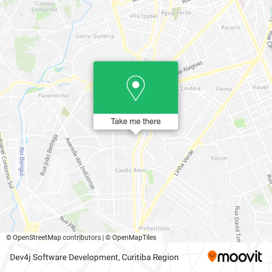
See Dev4j Software Development, Novo Mundo, on the map
Public Transit to Dev4j Software Development in Novo Mundo
Wondering how to get to Dev4j Software Development in Novo Mundo? Moovit helps you find the best way to get to Dev4j Software Development with step-by-step directions from the nearest public transit station.
Moovit provides free maps and live directions to help you navigate through your city. View schedules, routes, timetables, and find out how long does it take to get to Dev4j Software Development in real time.
Looking for the nearest stop or station to Dev4j Software Development? Check out this list of stops closest to your destination: R. Deputado Waldemiro Pedroso; R. Deputado Waldemiro Pedroso; R. Paulina Ader; R. Antônio Gasparin; R. Francisco Ader; R. Francisco Ader; Pedro Gusso.
Bus: 021 INTERBAIRROS II (ANTI-HORÁRIO), 022 INTER 2 (HORÁRIO), 030 INTERBAIRROS III, 250 LIGEIRÃO NORTE / SUL, 508 SÍTIO CERCADO (ANTI-HORÁRIO), 658 CAPÃO RASO / CAIUÁ, G72 AREIA BRANCA / GUADALUPE, X41 REFORÇO SABARÁ, 620 SANTA CRUZ, 622 RONDON, 627 BOSCH, 628 CARBOMAFRA, 654 CAMPO ALEGRE, 828 CAMPO COMPRIDO / CAPÃO RASO, 831 FAZENDINHA / CAPÃO RASO, 623 PARQUE INDUSTRIAL, F71 FAZENDA / GUADALUPE, G72 QUITANDINHA / GUADALUPE, 027 CAPÃO RASO / CAMPINA DO SIQUEIRA, 020 INTERBAIRROS II (HORÁRIO).
Want to see if there’s another route that gets you there at an earlier time? Moovit helps you find alternative routes or times. Get directions from and directions to Dev4j Software Development easily from the Moovit App or Website.
We make riding to Dev4j Software Development easy, which is why over 1.5 million users, including users in Novo Mundo, trust Moovit as the best app for public transit. You don’t need to download an individual bus app or train app, Moovit is your all-in-one transit app that helps you find the best bus time or train time available.
For information on prices of bus, costs and ride fares to Dev4j Software Development, please check the Moovit app.
Use the app to navigate to popular places including to the airport, hospital, stadium, grocery store, mall, coffee shop, school, college, and university.
Dev4j Software Development Address: Rua Mário Chaubald Biscaia, 653 Novo Mundo Curitiba-PR 81050-240 street in Novo Mundo
- Garra Suprimentos,
- Rybinski Cosmeticos e Perfumaria,
- Assegurar,
- Sma Ecommerce,
- Cha Sistemas Empresariais,
- Nale Esportes,
- Techinfo Ti,
- Ipccavalheiro,
- Isdraw Consultoria Tecnica,
- Condominio Edificio Joao Bonat,
- Mbp Cortinas Marisol,
- Ml Data Scientist,
- Ykumoto,
- Garra Entregas,
- Jj Manas,
- Acir Ribeiro,
- Eliane Helmann Vanzin Mello,
- Joliab Informatica,
- Jr Mayer Fotografia,
- Alquieri Tur Transportes
Places Near Dev4j Software Development (Novo Mundo)
- Hospital Nossa Senhora Das Graças, Mercês,
- Hospital do Rocio, Campo,
- Parque Barigui, Mercês,
- Hhhhh, Fazendinha,
- Jockey Plaza Shopping Center, Tarumã,
- Pontifícia Universidade Católica do Paraná (PUCPR), Prado Velho,
- Hospital Angelina Caron, Campina Grande Do Sul,
- Rua General Mário Tourinho, Campina Do Siqueira,
- Campo Largo, Campo,
- Hospital Universitário Evangélico de Curitiba, Bigorrilho,
- Hospital Da Cruz Vermelha, Batel,
- Hospital de Clínicas (HC - UFPR), Centro,
- Hospital Erasto Gaertner, Jardim Das Américas,
- Arena Da Baixada - Curitiba,
- Hospital Madalena Sofia, Bairro Alto,
- Jardim Botânico de Curitiba PR, Centro,
- Rua Martim Afonso 558, Mercês,
- Park Shopping Barigüi, Mossunguê,
- Shopping Palladium, Portão,
- Shopping Estação, Rebouças
How to get to popular places in Curitiba Region with public transit
Get around Novo Mundo by public transit!
Traveling around Novo Mundo has never been so easy. See step by step directions as you travel to any attraction, street or major public transit station. View bus and train schedules, arrival times, service alerts and detailed routes on a map, so you know exactly how to get to anywhere in Novo Mundo.
When traveling to any destination around Novo Mundo use Moovit's Live Directions with Get Off Notifications to know exactly where and how far to walk, how long to wait for your line, and how many stops are left. Moovit will alert you when it's time to get off — no need to constantly re-check whether yours is the next stop.
Wondering how to use public transit in Novo Mundo or how to pay for public transit in Novo Mundo? Moovit public transit app can help you navigate your way with public transit easily, and at minimum cost. It includes public transit fees, ticket prices, and costs. Looking for a map of Novo Mundo public transit lines? Moovit public transit app shows all public transit maps in Novo Mundo with all Bus and Cable Car routes and stops on an interactive map.
Curitiba Region has 2 transit type(s), including: Bus and Cable Car, operated by several transit agencies, including Sistema Integrado de Mobilidade (URBS), Sistema Integrado de Mobilidade (AMEP), URBS (Cartões bancários e Dinheiro), URBS (Cartões bancários / Cartão URBS), AMEP (Cartões bancários / Cartão MetroCard), AMEP (Cartões bancários / Cartão MetroCard / Dinheiro), Viação Colombo (Dinheiro), TRIAR (Cartão TRIAR / Dinheiro), Empresa Curitiba Cerro Azul (Dinheiro), Expresso Nossa Senhora da Penha (Dinheiro), Empresa Campo Alto Tijucas (Dinheiro), Auto Viação São José (Cartão VEM / Dinheiro), BRT S/A (Cartão VEM / Dinheiro), TransPiedade (Cartão Cidadão / Dinheiro) and Oceânica Sul (Cartão Transporte / Dinheiro)