Directions to Dhaline Informatica (Novo Mundo) with public transportation
The following transit lines have routes that pass near Dhaline Informatica
How to get to Dhaline Informatica by bus?
Click on the bus route to see step by step directions with maps, line arrival times and updated time schedules.
From Rua Comendador Lustoza de Andrade, Bom Retiro
49 minFrom Alto da XV, Alto Da Rua XV
51 minFrom Faculdade Estácio Curitiba, Cristo Rei
47 minFrom Estação Tubo Kennedy, Rebouças
28 minFrom Coca-Cola Femsa Curitiba, Uberaba
65 minFrom Rua Francisco Derosso, Alto Boqueirão
46 minFrom set movie, Alto Da Rua XV
51 minFrom Av João Gualberto, Juvevê
50 minFrom Portão D - Rodoferroviária de Curitiba, Jardim Botânico
34 minFrom Rua Nicola Pellanda, Umbará
40 min
Bus stops near Dhaline Informatica in Novo Mundo
Bus lines to Dhaline Informatica in Novo Mundo
- 673 FORMOSA, Formosa → Praça Rui Barbosa,VIEW
- 828 CAMPO COMPRIDO / CAPÃO RASO, Terminal Capão Raso → Terminal Campo Comprido,VIEW
- 831 FAZENDINHA / CAPÃO RASO, Terminal Fazendinha → Terminal Capão Raso,VIEW
- 654 CAMPO ALEGRE, Terminal CIC → Terminal Capão Raso,VIEW
- X41 REFORÇO SABARÁ, Terminal Capão Raso → Sabará,VIEW
- 622 RONDON, Rondon → Terminal Capão Raso,VIEW
- 658 CAPÃO RASO / CAIUÁ, Terminal Caiuá → Terminal Capão Raso,VIEW
- 620 SANTA CRUZ, Senador Accioly Filho → Terminal Capão Raso,VIEW
What are the closest stations to Dhaline Informatica?
The closest stations to Dhaline Informatica are:
- Rua Doutor Luiz Losso Filho, 876 is 8 meters away, 1 min walk.
- R. Deputado Waldemiro Pedroso, 1777 is 101 meters away, 2 min walk.
- R. Deputado Waldemiro Pedroso, 1774 is 104 meters away, 2 min walk.
- R. Professor Algacyr Munhoz Mader, 195 is 242 meters away, 4 min walk.
- R. Deputado Waldemiro Pedroso, Unidade De Saúde Aurora is 301 meters away, 5 min walk.
Which bus lines stop near Dhaline Informatica?
These bus lines stop near Dhaline Informatica: 654 CAMPO ALEGRE, 673 FORMOSA, 828 CAMPO COMPRIDO / CAPÃO RASO, 831 FAZENDINHA / CAPÃO RASO.
What’s the nearest bus station to Dhaline Informatica in Novo Mundo?
The nearest bus station to Dhaline Informatica in Novo Mundo is Rua Doutor Luiz Losso Filho, 876. It’s a 1 min walk away.
What time is the first bus to Dhaline Informatica in Novo Mundo?
The 654 CAMPO ALEGRE is the first bus that goes to Dhaline Informatica in Novo Mundo. It stops nearby at 5:15 AM.
What time is the last bus to Dhaline Informatica in Novo Mundo?
The 673 FORMOSA is the last bus that goes to Dhaline Informatica in Novo Mundo. It stops nearby at 12:38 AM.
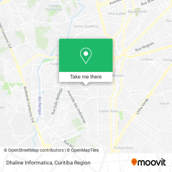
See Dhaline Informatica, Novo Mundo, on the map
Public Transit to Dhaline Informatica in Novo Mundo
Wondering how to get to Dhaline Informatica in Novo Mundo? Moovit helps you find the best way to get to Dhaline Informatica with step-by-step directions from the nearest public transit station.
Moovit provides free maps and live directions to help you navigate through your city. View schedules, routes, timetables, and find out how long does it take to get to Dhaline Informatica in real time.
Looking for the nearest stop or station to Dhaline Informatica? Check out this list of stops closest to your destination: Rua Doutor Luiz Losso Filho; R. Deputado Waldemiro Pedroso; R. Deputado Waldemiro Pedroso; R. Professor Algacyr Munhoz Mader; R. Deputado Waldemiro Pedroso.
Bus: 654 CAMPO ALEGRE, 673 FORMOSA, 828 CAMPO COMPRIDO / CAPÃO RASO, 831 FAZENDINHA / CAPÃO RASO, X41 REFORÇO SABARÁ, 622 RONDON, 658 CAPÃO RASO / CAIUÁ, 620 SANTA CRUZ.
Want to see if there’s another route that gets you there at an earlier time? Moovit helps you find alternative routes or times. Get directions from and directions to Dhaline Informatica easily from the Moovit App or Website.
We make riding to Dhaline Informatica easy, which is why over 1.5 million users, including users in Novo Mundo, trust Moovit as the best app for public transit. You don’t need to download an individual bus app or train app, Moovit is your all-in-one transit app that helps you find the best bus time or train time available.
For information on prices of bus, costs and ride fares to Dhaline Informatica, please check the Moovit app.
Use the app to navigate to popular places including to the airport, hospital, stadium, grocery store, mall, coffee shop, school, college, and university.
Dhaline Informatica Address: Rua Doutor Luiz Losso Filho, 995 Novo Mundo Curitiba-PR 81050-430 street in Novo Mundo
- Dieniffer Santos,
- Lizama S Comercio E Servicos,
- Nelio Sergio Miranda Boguz,
- Adriele Santos,
- Pet Shop Sao Bernardo,
- Megaengine,
- Quimtec Celulares e Computadores,
- Vanessa Schmidt Studio Hair Therapy,
- Sunflower,
- Kae Vinicius,
- Rua Doutor Luís Losso Filho, 876 - Novo Mundo,
- Italian Street Food,
- Aires Bebidas and Hookah,
- Lopes and Lopes Advogados,
- Pit Stop Lavacar,
- Ubrows Comunicacao Digital,
- Chaveiro Rocha,
- Loja Daka,
- Rika,
- Delicias da Lia
Places Near Dhaline Informatica (Novo Mundo)
- Park Shopping Barigüi, Mossunguê,
- Shopping Palladium, Portão,
- Hospital de Clínicas (HC - UFPR), Centro,
- Hospital Angelina Caron, Campina Grande Do Sul,
- Hospital Erasto Gaertner, Jardim Das Américas,
- Pontifícia Universidade Católica do Paraná (PUCPR), Prado Velho,
- Rua General Mário Tourinho, Campina Do Siqueira,
- Jardim Botânico de Curitiba PR, Centro,
- Hospital Da Cruz Vermelha, Batel,
- Hospital Universitário Evangélico de Curitiba, Bigorrilho,
- Parque Barigui, Mercês,
- Hospital Nossa Senhora Das Graças, Mercês,
- Arena Da Baixada - Curitiba,
- Hhhhh, Fazendinha,
- Shopping Estação, Rebouças,
- Hospital do Rocio, Campo,
- Jockey Plaza Shopping Center, Tarumã,
- Rua Martim Afonso 558, Mercês,
- Campo Largo, Campo,
- Hospital Madalena Sofia, Bairro Alto
How to get to popular places in Curitiba Region with public transit
Get around Novo Mundo by public transit!
Traveling around Novo Mundo has never been so easy. See step by step directions as you travel to any attraction, street or major public transit station. View bus and train schedules, arrival times, service alerts and detailed routes on a map, so you know exactly how to get to anywhere in Novo Mundo.
When traveling to any destination around Novo Mundo use Moovit's Live Directions with Get Off Notifications to know exactly where and how far to walk, how long to wait for your line, and how many stops are left. Moovit will alert you when it's time to get off — no need to constantly re-check whether yours is the next stop.
Wondering how to use public transit in Novo Mundo or how to pay for public transit in Novo Mundo? Moovit public transit app can help you navigate your way with public transit easily, and at minimum cost. It includes public transit fees, ticket prices, and costs. Looking for a map of Novo Mundo public transit lines? Moovit public transit app shows all public transit maps in Novo Mundo with all Bus and Cable Car routes and stops on an interactive map.
Curitiba Region has 2 transit type(s), including: Bus and Cable Car, operated by several transit agencies, including Sistema Integrado de Mobilidade (URBS), Sistema Integrado de Mobilidade (AMEP), URBS (Cartões bancários e Dinheiro), URBS (Cartões bancários / Cartão URBS), AMEP (Cartões bancários / Cartão MetroCard), AMEP (Cartões bancários / Cartão MetroCard / Dinheiro), Viação Colombo (Dinheiro), TRIAR (Cartão TRIAR / Dinheiro), Empresa Curitiba Cerro Azul (Dinheiro), Expresso Nossa Senhora da Penha (Dinheiro), Empresa Campo Alto Tijucas (Dinheiro), Auto Viação São José (Cartão VEM / Dinheiro), BRT S/A (Cartão VEM / Dinheiro), TransPiedade (Cartão Cidadão / Dinheiro) and Oceânica Sul (Cartão Transporte / Dinheiro)