How to get to DiDent by bus?
Click on the bus route to see step by step directions with maps, line arrival times and updated time schedules.
From Estación 28 de Julio - Metropolitano, Miraflores
29 minFrom Av Camino Real, San Isidro
26 minFrom ovalo huandoy, Los Olivos
44 minFrom Barranco, Barranco
23 minFrom Neoplasicas, San Borja
32 minFrom #Zzz, Santiago D
50 minFrom Ximesa - REYPLAST Planta, Ate
27 minFrom Ovalo Balta, Barranco
22 minFrom Av Perú cuadra 32 y 33, San Martin
29 minFrom Avenida Proceres de Huandoy, Los Olivos
44 min
How to get to DiDent by metro?
Click on the metro route to see step by step directions with maps, line arrival times and updated time schedules.
Bus stops near DiDent in Lima
Metro station near DiDent in Lima
- Miguel Grau, 47 min walk,VIEW
Bus lines to DiDent in Lima
- 9605, Bausate Y Meza (La Victoria) - CEPRE San Marcos (Callao) ,VIEW
- A, Terminal Naranjal (Independencia) - Estación Central (Centro De Lima),VIEW
- C, Terminal Matellini (Chorrillos) - Estación Ramón Castilla (Centro De Lima),VIEW
- EX10, Terminal Naranjal (Independencia) - Estación Central (Lima),VIEW
- L, Terminal Naranjal (Independencia) - Terminal Matellini (Chorrillos),VIEW
- 1005, Huánuco (La Victoria) - Punchauca (Carabayllo),VIEW
- 1045, Huáscar (San Juan De Lurigancho) - Mercado (Magdalena Del Mar),VIEW
- 404, Brasil (Magdalena Del Mar) - Wiesse (San Juan De Lurigancho),VIEW
- 405, Wiesse (San Juan De Lurigancho) - Canaval Y Moreyra (San Isidro),VIEW
- 406, Av. Bolivia (Centro De Lima) - Wiesse (San Juan De Lurigancho),VIEW
- 1042, Ate - San Juan de Lurigancho,VIEW
- 1056, Villa El Salvador - San Juan de Lurigancho,VIEW
- 1059, San Gabriel (Villa María Del Triunfo) - Bayóvar (San Juan de Lurigancho),VIEW
- 1064, San Juan De Lurigancho - Lurigancho,VIEW
- 1098, Wiesse (San Juan de Lurigancho) - Sumac Paccha (Lurín),VIEW
- 1160, Pachacútec (Ventanilla) - Gamarra (La Victoria),VIEW
- 1286, San Diego (S.M. Porres) - Mariategui (S.J. Lurigancho),VIEW
- 1462, Carabayllo - Universitaria - Brasil - Carabayllo,VIEW
- 1474, Hospital del Empleado (Jesús Maria) - Campoy (San Juan de Lurigancho),VIEW
- 1189, Izaguirre (San Martin De Porres) - Bravo Chico (El Agustino) ,VIEW
What are the closest stations to DiDent?
The closest stations to DiDent are:
- Parque Universitario - Abancay is 199 meters away, 4 min walk.
- Estación Jiron De La Union is 240 meters away, 4 min walk.
- Nicolás De Piérola is 252 meters away, 5 min walk.
- Jiron Apurimac is 347 meters away, 6 min walk.
- Puno is 364 meters away, 6 min walk.
- Plaza San Martín is 519 meters away, 8 min walk.
- Miguel Grau is 3668 meters away, 47 min walk.
Which bus lines stop near DiDent?
These bus lines stop near DiDent: 336, 9605, A, C.
Which metro line stops near DiDent?
LINEA 1 (Separadora Industrial (Villa El Salvador) - Bayóvar (San Juan De Lurigancho))
What’s the nearest bus station to DiDent in Lima?
The nearest bus stations to DiDent in Lima are Parque Universitario - Abancay and Estación Jiron De La Union. The closest one is a 4 min walk away.
What time is the first metro to DiDent in Lima?
The LINEA 1 is the first metro that goes to DiDent in Lima. It stops nearby at 5:15 AM.
What time is the last metro to DiDent in Lima?
The LINEA 1 is the last metro that goes to DiDent in Lima. It stops nearby at 10:32 PM.
What time is the first bus to DiDent in Lima?
The 1132 is the first bus that goes to DiDent in Lima. It stops nearby at 3:00 AM.
What time is the last bus to DiDent in Lima?
The 1132 is the last bus that goes to DiDent in Lima. It stops nearby at 1:05 AM.
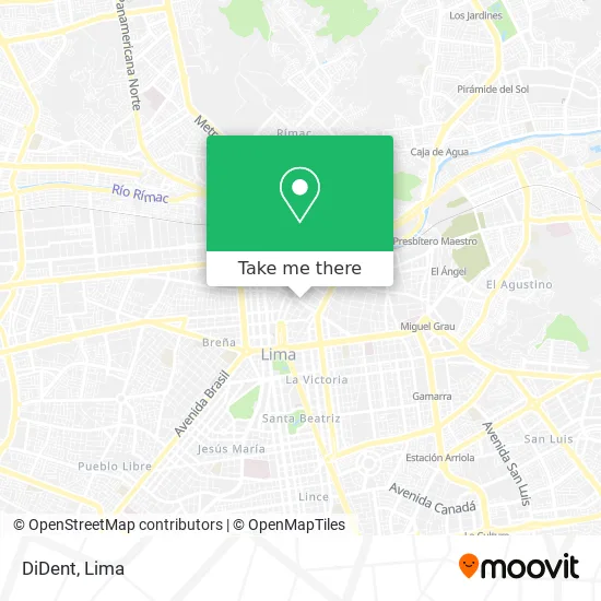
See DiDent, Lima, on the map
Public Transit to DiDent in Lima
Wondering how to get to DiDent in Lima? Moovit helps you find the best way to get to DiDent with step-by-step directions from the nearest public transit station.
Moovit provides free maps and live directions to help you navigate through your city. View schedules, routes, timetables, and find out how long does it take to get to DiDent in real time.
Looking for the nearest stop or station to DiDent? Check out this list of stops closest to your destination: Parque Universitario - Abancay; Estación Jiron De La Union; Nicolás De Piérola; Jiron Apurimac; Puno; Plaza San Martín; Miguel Grau.
Bus: 336, 9605, A, C, EX10, L, 1005, 1045, 404, 405, 406, 1042, 1056, 1189.Metro: LINEA 1.
Want to see if there’s another route that gets you there at an earlier time? Moovit helps you find alternative routes or times. Get directions from and directions to DiDent easily from the Moovit App or Website.
We make riding to DiDent easy, which is why over 1.5 million users, including users in Lima, trust Moovit as the best app for public transit. You don’t need to download an individual bus app or train app, Moovit is your all-in-one transit app that helps you find the best bus time or train time available.
For information on prices of bus and metro, costs and ride fares to DiDent, please check the Moovit app.
Use the app to navigate to popular places including to the airport, hospital, stadium, grocery store, mall, coffee shop, school, college, and university.
Location: Lima
- Estación Colmena - Metropolitano,
- Plaza de la Democracia,
- Av Nicolás de Piérola esquina con Jr Lampa,
- Parque De La Democracia,
- Jr lampa,
- Editorial Nutesa,
- Suiza,
- Peñaloza Delgado Raúl,
- C.I Republica de Holanda,
- Jurado Nacional de Elecciones - JNE,
- Galeria Lima Park,
- jiron contumaza,
- Centro Comercial Lima Park,
- Cruce de la Av Lampa con Jr Apurimac Galeria Ciudad de los Reyes,
- Army Prepper,
- Notaria Moises Espino Elguera,
- La Muralla Restaurante,
- Cabo Blanco II,
- La Colmena,
- Baldeon Caqui Tulio Dante
Places Near DiDent (Lima)
- Larcomar, Miraflores,
- Parque Kennedy, Miraflores,
- Centro Comercial Plaza Norte, Independen,
- Av. La Marina, San Miguel,
- Hospital Edgardo Rebagliati Martins, Jesus Mari,
- Mall Del Sur,
- Jockey Plaza, Santiago D,
- Barranco, Barranco,
- av arequipa, Lima,
- Miraflores, Miraflores,
- Av. Abancay, Lima,
- Parque de las Leyendas, San Miguel,
- Paradero Av.Brasil,
- Av. Salaverry, Jesus Mari,
- Circuito Mágico Del Agua, Lima,
- Real Plaza Puruchuco, Ate,
- Gamarra,
- Pontificia Universidad Católica del Perú - PUCP, San Miguel,
- Plaza San Miguel, San Miguel,
- Aeropuerto Internacional Jorge Chávez, Ventanilla
How to get to popular places in Lima with public transit
Get around Lima by public transit!
Traveling around Lima has never been so easy. See step by step directions as you travel to any attraction, street or major public transit station. View bus and train schedules, arrival times, service alerts and detailed routes on a map, so you know exactly how to get to anywhere in Lima.
When traveling to any destination around Lima use Moovit's Live Directions with Get Off Notifications to know exactly where and how far to walk, how long to wait for your line, and how many stops are left. Moovit will alert you when it's time to get off — no need to constantly re-check whether yours is the next stop.
Wondering how to use public transit in Lima or how to pay for public transit in Lima? Moovit public transit app can help you navigate your way with public transit easily, and at minimum cost. It includes public transit fees, ticket prices, and costs. Looking for a map of Lima public transit lines? Moovit public transit app shows all public transit maps in Lima with all Bus, Metro and Ferry routes and stops on an interactive map.
Lima has 3 transit type(s), including: Bus, Metro and Ferry, operated by several transit agencies, including Metro de Lima Línea 2 , Metro de Lima, Corredor Rojo, Metropolitano, Metropolitano - Alimentadores, Corredor Morado, Corredor Azul, Rutas Tradicionales, Transportes y Servicios La Esperanza S.A., Las Flores S.A., Virgen de la Asunción S.A., Consorcio HAM, Transportes y Service Canadá S.A., ETUL4SA and ETUCHISA