How to get to Diamond Network Group by bus?
Click on the bus route to see step by step directions with maps, line arrival times and updated time schedules.
From Adventist HealthCare Shady Grove Medical Center, Montgomery County
54 minFrom Clarksburg Premium Outlets, Montgomery County
68 minFrom Intercounty Connector (ICC)/MD 200, Montgomery County
78 minFrom Georgia Ave & Icc Park & Ride Lot, Montgomery County
83 minFrom Rockville, MD, Montgomery County
49 minFrom Montgomery College-Rockville, Montgomery County
41 minFrom Olney MD USA, Montgomery County
63 minFrom Germantown, Maryland, Montgomery County
58 minFrom RIO Washingtonian Center, Montgomery County
36 minFrom Clarksburg Premium Outlets, Montgomery County
60 min
How to get to Diamond Network Group by train?
Click on the train route to see step by step directions with maps, line arrival times and updated time schedules.
Bus stop near Diamond Network Group in Montgomery County
- Centerway Rd & Court 1, 2 min walk,VIEW
Train station near Diamond Network Group in Montgomery County
- Washington Grove Marc Wb, 43 min walk,VIEW
Bus lines to Diamond Network Group in Montgomery County
What are the closest stations to Diamond Network Group?
The closest stations to Diamond Network Group are:
- Centerway Rd & Court 1 is 63 yards away, 2 min walk.
- Washington Grove Marc Wb is 3653 yards away, 43 min walk.
Which bus line stops near Diamond Network Group?
64 (Montgomery Village)
Which train line stops near Diamond Network Group?
MARC (Outbound - Washington)
What’s the nearest bus station to Diamond Network Group in Montgomery County?
The nearest bus station to Diamond Network Group in Montgomery County is Centerway Rd & Court 1. It’s a 2 min walk away.
What time is the first train to Diamond Network Group in Montgomery County?
The MARC is the first train that goes to Diamond Network Group in Montgomery County. It stops nearby at 5:30 AM.
What time is the last train to Diamond Network Group in Montgomery County?
The MARC is the last train that goes to Diamond Network Group in Montgomery County. It stops nearby at 7:56 PM.
What time is the first bus to Diamond Network Group in Montgomery County?
The 64 is the first bus that goes to Diamond Network Group in Montgomery County. It stops nearby at 5:01 AM.
What time is the last bus to Diamond Network Group in Montgomery County?
The 64 is the last bus that goes to Diamond Network Group in Montgomery County. It stops nearby at 11:13 PM.
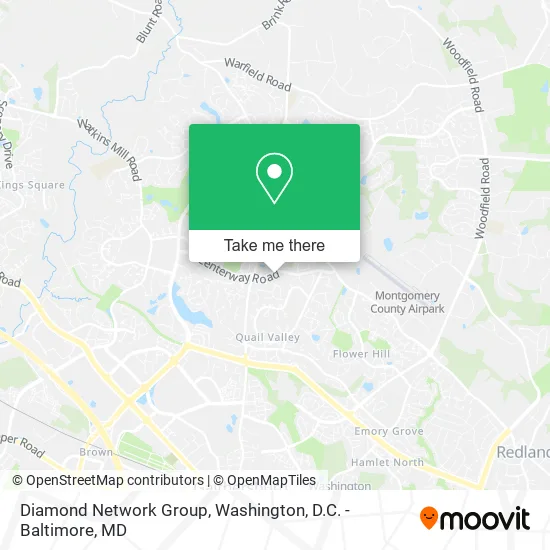
See Diamond Network Group, Montgomery County, on the map
Public Transit to Diamond Network Group in Montgomery County
Wondering how to get to Diamond Network Group in Montgomery County? Moovit helps you find the best way to get to Diamond Network Group with step-by-step directions from the nearest public transit station.
Moovit provides free maps and live directions to help you navigate through your city. View schedules, routes, timetables, and find out how long does it take to get to Diamond Network Group in real time.
Looking for the nearest stop or station to Diamond Network Group? Check out this list of stops closest to your destination: Centerway Rd & Court 1; Washington Grove Marc Wb.
Bus: 64, 60.Train: MARC.
Want to see if there’s another route that gets you there at an earlier time? Moovit helps you find alternative routes or times. Get directions from and directions to Diamond Network Group easily from the Moovit App or Website.
We make riding to Diamond Network Group easy, which is why over 1.5 million users, including users in Montgomery County, trust Moovit as the best app for public transit. You don’t need to download an individual bus app or train app, Moovit is your all-in-one transit app that helps you find the best bus time or train time available.
For information on prices of bus, metro and train, costs and ride fares to Diamond Network Group, please check the Moovit app.
Use the app to navigate to popular places including to the airport, hospital, stadium, grocery store, mall, coffee shop, school, college, and university.
Diamond Network Group Address: Centerway Rd Gaithersburg, MD 20879 street in Montgomery County
- Repair Partials and Dentures While You Wait,
- Secure Assembly Pros,
- Califer Painting,
- Deck Maxtor,
- Terravitals,
- Wika Designs,
- PG Brothers,
- Eduwatch,
- Badoumkassa for the Advancement of,
- Icazas Construction,
- Susan Driscoll,
- Lularoe Laura Franklin,
- Kariem Bassiem - Intuit Turbotax Verified Pro,
- Giant,
- AA Quality Services,
- Summit Custom Builder,
- JGS Remodeling,
- Samer Home Solutions,
- Keystone Electrical Services,
- Atlantis Cleaning Services
Places Near Diamond Network Group (Montgomery County)
- Washington DC VA Medical Center, Washington,
- Amazon Hq2, Arlington County,
- Pennsylvania Ave NW (3rd st and pennsylvania), Washington,
- Camden Yards, Baltimore,
- Basilica of the National Shrine, Washington,
- Marriott Marquis Washington, DC, Washington,
- Westfield Montgomery Mall, Montgomery County,
- Museum Of The Bible, Washington,
- M&T Bank Stadium, Baltimore,
- Warner Theatre, Washington,
- Capital One Arena, Washington,
- The Anthem, Washington,
- Sibley Memorial Hospital, Washington,
- National Zoo, Washington,
- PG Mall, Prince George's County,
- Rock Creek Tennis Center, Washington,
- National Theatre, Washington,
- Washington National Cathedral, Washington,
- Georgetown, Washington,
- National Museum of African American History and Culture, Washington
How to get to popular places in Washington, D.C. - Baltimore, MD with public transit
Get around Montgomery County by public transit!
Traveling around Montgomery County has never been so easy. See step by step directions as you travel to any attraction, street or major public transit station. View bus and train schedules, arrival times, service alerts and detailed routes on a map, so you know exactly how to get to anywhere in Montgomery County.
When traveling to any destination around Montgomery County use Moovit's Live Directions with Get Off Notifications to know exactly where and how far to walk, how long to wait for your line, and how many stops are left. Moovit will alert you when it's time to get off — no need to constantly re-check whether yours is the next stop.
Wondering how to use public transit in Montgomery County or how to pay for public transit in Montgomery County? Moovit public transit app can help you navigate your way with public transit easily, and at minimum cost. It includes public transit fees, ticket prices, and costs. Looking for a map of Montgomery County public transit lines? Moovit public transit app shows all public transit maps in Montgomery County with all Bus, Train, Metro, Light Rail and Ferry routes and stops on an interactive map.
Washington, D.C. - Baltimore, MD has 5 transit type(s), including: Bus, Train, Metro, Light Rail and Ferry, operated by several transit agencies, including WMATA, Montgomery County Ride On, Fairfax Connector, TheBus, PRTC, DASH - Alexandria, Arlington Transit (ART), RTA of Central Maryland, MDOT MTA, MDOT MTA Light RailLink, MDOT MTA Commuter Bus, MDOT MTA Local Bus, FXBGO!, Virginia Railway Express (VRE) and MARC