How to get to Diamonds Direct by bus?
Click on the bus route to see step by step directions with maps, line arrival times and updated time schedules.
From South Broward High School, Hollywood
45 minFrom Broward/Miami-Dade County Border, Miami Gardens
72 minFrom Aventura Mall, Miami Beach
45 minFrom Joe Dimaggio Children's Hospital at Memorial, Hollywood
73 minFrom Oakwood Plaza, Hollywood
59 minFrom Calder Race Course (Calder Casino), Miami Gardens
69 minFrom Satan's Church Of The Believer, Miami Beach
48 minFrom Walmart (Walmart Supercenter Hollywood - State Rd 7), Hollywood
54 minFrom Amazon warehouse, Miami
79 minFrom Joe Robbie Stadium, Miami Gardens
77 min
Bus stops near Diamonds Direct in Miami
Train station near Diamonds Direct in Miami
- Aventura, 28 min walk,VIEW
Bus lines to Diamonds Direct in Miami
- PURPLE EXPRESS ROUTE, Circular with library,VIEW
- AVTYEL, Yellow,VIEW
- 3, 3 - Downtown Miami,VIEW
- 9, 9a - Aventura Mall Terminal Via 171 St,VIEW
- 183, 183 - Okeechobee Station,VIEW
- 203, 203 - Downtown Miami,VIEW
- SATURDAY NIGHT EXPRESS SOUTH ROUTE, Aventura Mall Transit Terminal,VIEW
- SILVER EXPRESS ROUTE, Circular without Library,VIEW
- YELLOW EXPRESS ROUTE , Circular Without Library,VIEW
What are the closest stations to Diamonds Direct?
The closest stations to Diamonds Direct are:
- Venture at Aventura is 103 yards away, 2 min walk.
- Ventura At Aventura is 108 yards away, 2 min walk.
- Biscayne Bd & Ne 191 St is 194 yards away, 3 min walk.
- Town Center Aventure / Publix is 413 yards away, 6 min walk.
- Aventura is 2320 yards away, 28 min walk.
Which bus lines stop near Diamonds Direct?
These bus lines stop near Diamonds Direct: 183, 3, 9.
What’s the nearest train station to Diamonds Direct in Miami?
The nearest train station to Diamonds Direct in Miami is Aventura. It’s a 28 min walk away.
What’s the nearest bus station to Diamonds Direct in Miami?
The nearest bus stations to Diamonds Direct in Miami are Venture at Aventura and Ventura At Aventura. The closest one is a 2 min walk away.
What time is the first train to Diamonds Direct in Miami?
The BLFM is the first train that goes to Diamonds Direct in Miami. It stops nearby at 6:09 AM.
What time is the last train to Diamonds Direct in Miami?
The BLFM is the last train that goes to Diamonds Direct in Miami. It stops nearby at 12:07 AM.
What time is the first bus to Diamonds Direct in Miami?
The 3 is the first bus that goes to Diamonds Direct in Miami. It stops nearby at 3:18 AM.
What time is the last bus to Diamonds Direct in Miami?
The 3 is the last bus that goes to Diamonds Direct in Miami. It stops nearby at 2:45 AM.
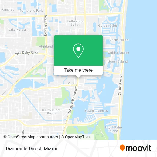
See Diamonds Direct, Miami, on the map
Public Transit to Diamonds Direct in Miami
Wondering how to get to Diamonds Direct in Miami? Moovit helps you find the best way to get to Diamonds Direct with step-by-step directions from the nearest public transit station.
Moovit provides free maps and live directions to help you navigate through your city. View schedules, routes, timetables, and find out how long does it take to get to Diamonds Direct in real time.
Looking for the nearest stop or station to Diamonds Direct? Check out this list of stops closest to your destination: Venture at Aventura; Ventura At Aventura; Biscayne Bd & Ne 191 St; Town Center Aventure / Publix; Aventura.
Bus: 183, 3, 9, PURPLE EXPRESS ROUTE, AVTYEL, 203, SATURDAY NIGHT EXPRESS SOUTH ROUTE, SILVER EXPRESS ROUTE, YELLOW EXPRESS ROUTE .Train: BLFM.
Want to see if there’s another route that gets you there at an earlier time? Moovit helps you find alternative routes or times. Get directions from and directions to Diamonds Direct easily from the Moovit App or Website.
We make riding to Diamonds Direct easy, which is why over 1.5 million users, including users in Miami, trust Moovit as the best app for public transit. You don’t need to download an individual bus app or train app, Moovit is your all-in-one transit app that helps you find the best bus time or train time available.
For information on prices of bus, costs and ride fares to Diamonds Direct, please check the Moovit app.
Use the app to navigate to popular places including to the airport, hospital, stadium, grocery store, mall, coffee shop, school, college, and university.
Diamonds Direct Address: 19001 Biscayne Blvd Miami, FL 33180 street in Miami
- Presto! Atm at Publix Super Market,
- Mor Berta Beauty,
- Publix,
- The Joint Chiropractic,
- Pizza Italica,
- Fred Astaire Dance Studio,
- Stylesiteopticiansco,
- Robert Sheir,
- Liquivida Aventura, Fl,
- South Florida Eye Health,
- Liquidvida,
- ATM,
- Bolay,
- Just Salad,
- Art Playce,
- Exxon,
- Sparkling Image Car Wash,
- Elan Store,
- Ashley Weissfield Pa,
- Td Bank
Places Near Diamonds Direct (Miami)
- Brickell City Centre, Miami,
- Sawgrass Mall, Miami,
- Richard E. Gerstein Justice Building, Miami,
- Port of Miami Cruise Terminal, Miami,
- Hard Rock Stadium, Miami Gardens,
- Dolphin Mall Bus, Miami,
- Miami-Dade County Courthouse, Miami,
- Aventura Mall, Miami Beach,
- Wynwood, Miami,
- Miami Design District, Miami,
- Sawgrass mall ( FL ), Miami Beach,
- Keiser University Flagship Campus, West Palm Beach,
- Dolphin Mall, Miami,
- Miami VA Hospital, Miami,
- Zoo Miami, Miami,
- Aventura Mall, Miami,
- Miami Freedom Park, Miami,
- Marlins Park, Miami,
- Little Havana, Miami,
- Bayside Marketplace, Miami
How to get to popular places in Miami with public transit
Get around Miami by public transit!
Traveling around Miami has never been so easy. See step by step directions as you travel to any attraction, street or major public transit station. View bus and train schedules, arrival times, service alerts and detailed routes on a map, so you know exactly how to get to anywhere in Miami.
When traveling to any destination around Miami use Moovit's Live Directions with Get Off Notifications to know exactly where and how far to walk, how long to wait for your line, and how many stops are left. Moovit will alert you when it's time to get off — no need to constantly re-check whether yours is the next stop.
Wondering how to use public transit in Miami or how to pay for public transit in Miami? Moovit public transit app can help you navigate your way with public transit easily, and at minimum cost. It includes public transit fees, ticket prices, and costs. Looking for a map of Miami public transit lines? Moovit public transit app shows all public transit maps in Miami with all Bus, Train, Light Rail and Ferry routes and stops on an interactive map.
Miami has 4 transit type(s), including: Bus, Train, Light Rail and Ferry, operated by several transit agencies, including Broward County Transit, Miami-Dade Transit, Metrorail, Palm Tran, Tri-Rail, Brightline, MARTY, City of Homestead Trolley, Key West Transit, Treasure Coast Connector, GoLine IRT, Amtrak, Greyhound-us, FlixBus-us and Aventura Express Shuttle Bus