How to get to Digify by bus?
Click on the bus route to see step by step directions with maps, line arrival times and updated time schedules.
From Metropolitan Opera, Manhattan
81 minFrom Peter Pan Bus Lines, Manhattan
42 minFrom Noguchi Museum, Queens
137 minFrom Hyatt Centric Times Square, Manhattan
54 minFrom David H. Koch Center for Cancer Care at Memorial Sloan Kettering Cancer Center, Manhattan
111 minFrom The Jewish Museum, Manhattan
118 minFrom Costco Wholesale, Queens
135 minFrom Northern Blvd, Queens
114 minFrom Harrison, NJ, Harrison
62 min
How to get to Digify by train?
Click on the train route to see step by step directions with maps, line arrival times and updated time schedules.
Bus stops near Digify in Jersey City
Light Rail stations near Digify in Jersey City
- Harborside Light Rail Station, 6 min walk,VIEW
Train station near Digify in Jersey City
- Grove Street, 6 min walk,VIEW
Bus lines to Digify in Jersey City
- 9, Montgomery St West Side Ave Newport Mall,VIEW
- 80, Gates Ave Via Journal Sq,VIEW
- 81, L Bayonne Local,VIEW
- 82, Union City Summit & Hague St,VIEW
- 16, Journal Square,VIEW
- 86, Newport Mall,VIEW
- 63, X Lakewood Express To Union Hill Park Ride,VIEW
- 64, Weehawken Hoboken,VIEW
- 68, Weehawken Via Exchange Pl Via Hoboken,VIEW
- 206, Jersey City - Parkway Express,VIEW
- 1, Newark-Ivy Hill Via River Terminal & Albert Ave,VIEW
What are the closest stations to Digify?
The closest stations to Digify are:
- Washington St at Columbus Dr is 50 yards away, 1 min walk.
- Montgomery St at Washington St is 189 yards away, 3 min walk.
- Marin Blvd at Metro Plaza Driveway is 274 yards away, 4 min walk.
- C Columbus Drive at Grove St is 423 yards away, 6 min walk.
- Grand Street 198 is 452 yards away, 6 min walk.
- Harborside Light Rail Station is 466 yards away, 6 min walk.
- Grove Street is 494 yards away, 6 min walk.
Which bus lines stop near Digify?
These bus lines stop near Digify: 1, 119, 123, 126, 80, 86.
Which train lines stop near Digify?
These train lines stop near Digify: RED, YEL.
What’s the nearest light rail station to Digify in Jersey City?
The nearest light rail station to Digify in Jersey City is Harborside Light Rail Station. It’s a 6 min walk away.
What’s the nearest train station to Digify in Jersey City?
The nearest train station to Digify in Jersey City is Grove Street. It’s a 6 min walk away.
What’s the nearest bus station to Digify in Jersey City?
The nearest bus station to Digify in Jersey City is Washington St at Columbus Dr. It’s a 1 min walk away.
What time is the first light rail to Digify in Jersey City?
The HBLR is the first light rail that goes to Digify in Jersey City. It stops nearby at 4:40 AM.
What time is the last light rail to Digify in Jersey City?
The HBLR is the last light rail that goes to Digify in Jersey City. It stops nearby at 2:19 AM.
What time is the first train to Digify in Jersey City?
The ATW is the first train that goes to Digify in Jersey City. It stops nearby at 3:14 AM.
What time is the last train to Digify in Jersey City?
The ATW is the last train that goes to Digify in Jersey City. It stops nearby at 3:14 AM.
What time is the first bus to Digify in Jersey City?
The 80 is the first bus that goes to Digify in Jersey City. It stops nearby at 4:42 AM.
What time is the last bus to Digify in Jersey City?
The 81 is the last bus that goes to Digify in Jersey City. It stops nearby at 1:03 AM.
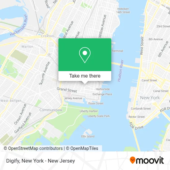
See Digify, Jersey City, on the map
Public Transit to Digify in Jersey City
Wondering how to get to Digify in Jersey City? Moovit helps you find the best way to get to Digify with step-by-step directions from the nearest public transit station.
Moovit provides free maps and live directions to help you navigate through your city. View schedules, routes, timetables, and find out how long does it take to get to Digify in real time.
Looking for the nearest stop or station to Digify? Check out this list of stops closest to your destination: Washington St at Columbus Dr; Montgomery St at Washington St; Marin Blvd at Metro Plaza Driveway; C Columbus Drive at Grove St; Grand Street 198; Harborside Light Rail Station; Grove Street.
Bus: 1, 119, 123, 126, 80, 86, 9, 81, 82, 16, 63, 64, 68, 206.Train: RED, YEL, ATW.
Want to see if there’s another route that gets you there at an earlier time? Moovit helps you find alternative routes or times. Get directions from and directions to Digify easily from the Moovit App or Website.
We make riding to Digify easy, which is why over 1.5 million users, including users in Jersey City, trust Moovit as the best app for public transit. You don’t need to download an individual bus app or train app, Moovit is your all-in-one transit app that helps you find the best bus time or train time available.
For information on prices of bus, train and subway, costs and ride fares to Digify, please check the Moovit app.
Use the app to navigate to popular places including to the airport, hospital, stadium, grocery store, mall, coffee shop, school, college, and university.
Digify Address: 95 Christopher Columbus Dr street in Jersey City
- Krispy Kreme,
- Toll Brothers New Jersey City Living Division Office,
- Opus Virtual Offices,
- Davinci Meeting Rooms,
- Mg Miller Intellectual Property Law Llc,
- جريمة قتل أحمد نبيه,
- Admani Law,
- Residence Inn by Marriott Jersey City,
- Puppyspot Adoption,
- Jersey City Pershing Field Ice,
- Sprove Sushi Bar,
- Qts Jersey City Data Center,
- 1 Pershing Plaza,
- Bny,
- Tk Platinum Holdings, Inc.,
- Valley Bank Atm,
- Grove Street (Path),
- Latham House,
- PATH-Grove Street Station,
- BNY Mellon Innovation Center
Places Near Digify (Jersey City)
- Mountainside Hospital, Glen Ridge,
- San Gennaro Feast, Manhattan,
- SoHo, Manhattan,
- 911 Memorial, Manhattan,
- Queens Center Mall, Queens,
- Times Square, Manhattan,
- Rockefeller Center, Manhattan,
- qqqq, Manhattan,
- 111 Centre New York City Supreme Court, Manhattan,
- 3 Stone St, Manhattan,
- Hudson Yards, Manhattan,
- 376 Hudson Street, Manhattan,
- 66 John Street, Manhattan,
- Chinatown, Manhattan,
- 1 Police Plaza, Manhattan,
- 26 Federal Plaza, Manhattan,
- Katz's Deli, Manhattan,
- Pier 83, Manhattan,
- Bellevue Hospital, Manhattan,
- Wall Street, Manhattan
How to get to popular places in New York - New Jersey with public transit
Get around Jersey City by public transit!
Traveling around Jersey City has never been so easy. See step by step directions as you travel to any attraction, street or major public transit station. View bus and train schedules, arrival times, service alerts and detailed routes on a map, so you know exactly how to get to anywhere in Jersey City.
When traveling to any destination around Jersey City use Moovit's Live Directions with Get Off Notifications to know exactly where and how far to walk, how long to wait for your line, and how many stops are left. Moovit will alert you when it's time to get off — no need to constantly re-check whether yours is the next stop.
Wondering how to use public transit in Jersey City or how to pay for public transit in Jersey City? Moovit public transit app can help you navigate your way with public transit easily, and at minimum cost. It includes public transit fees, ticket prices, and costs. Looking for a map of Jersey City public transit lines? Moovit public transit app shows all public transit maps in Jersey City with all Bus, Train, Subway, Light Rail, Ferry and Cable Car routes and stops on an interactive map.
New York - New Jersey has 6 transit type(s), including: Bus, Train, Subway, Light Rail, Ferry and Cable Car, operated by several transit agencies, including MTA Subway, Metro-North Railroad, LIRR, PATH, MTA New York City Transit - Express routes, MTA Bus, NJ Transit, NYC Ferry, NICE bus, Bee-Line Bus, NJ Transit Rail, Norwalk Transit District, Hartford Line, River Valley Transit and HART