How to get to Digify Graphics by bus?
Click on the bus route to see step by step directions with maps, line arrival times and updated time schedules.
From Bessey Crossing, Scarborough
78 minFrom Sparkle Clean Car Wash, Scarborough
76 minFrom Southern Maine Youth Basketball, Falmouth
60 minFrom Transformit, Westbrook
53 minFrom The Grande, South Portland
85 minFrom Mainehealth Professional Building, Scarborough
74 minFrom TJC Properties, Scarborough
73 minFrom O'Reilly's Cure, Scarborough
71 min
Bus stops near Digify Graphics in Portland, ME
Ferry station near Digify Graphics in Portland, ME
- Casco Bay Lines Terminal, 49 min walk,VIEW
Train station near Digify Graphics in Portland, ME
- Portland Station, 53 min walk,VIEW
What are the closest stations to Digify Graphics?
The closest stations to Digify Graphics are:
- Woodford I/B is 66 yards away, 2 min walk.
- Brighton Ave + Noyes St is 819 yards away, 10 min walk.
- Casco Bay Lines Terminal is 4131 yards away, 49 min walk.
- Portland Station is 4516 yards away, 53 min walk.
Which bus lines stop near Digify Graphics?
These bus lines stop near Digify Graphics: 2, 4.
What’s the nearest bus station to Digify Graphics in Portland, ME?
The nearest bus station to Digify Graphics in Portland, ME is Woodford I/B. It’s a 2 min walk away.
What time is the first train to Digify Graphics in Portland, ME?
The DOWNEASTER is the first train that goes to Digify Graphics in Portland, ME. It stops nearby at 5:18 AM.
What time is the last train to Digify Graphics in Portland, ME?
The DOWNEASTER is the last train that goes to Digify Graphics in Portland, ME. It stops nearby at 1:00 AM.
What time is the first bus to Digify Graphics in Portland, ME?
The 4 is the first bus that goes to Digify Graphics in Portland, ME. It stops nearby at 5:20 AM.
What time is the last bus to Digify Graphics in Portland, ME?
The 4 is the last bus that goes to Digify Graphics in Portland, ME. It stops nearby at 11:32 PM.
What time is the first ferry to Digify Graphics in Portland, ME?
The DB is the first ferry that goes to Digify Graphics in Portland, ME. It stops nearby at 5:00 AM.
What time is the last ferry to Digify Graphics in Portland, ME?
The PK is the last ferry that goes to Digify Graphics in Portland, ME. It stops nearby at 11:10 PM.
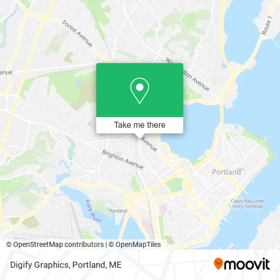
See Digify Graphics, Portland, ME, on the map
Public Transit to Digify Graphics in Portland, ME
Wondering how to get to Digify Graphics in Portland, ME? Moovit helps you find the best way to get to Digify Graphics with step-by-step directions from the nearest public transit station.
Moovit provides free maps and live directions to help you navigate through your city. View schedules, routes, timetables, and find out how long does it take to get to Digify Graphics in real time.
Looking for the nearest stop or station to Digify Graphics? Check out this list of stops closest to your destination: Woodford I/B; Brighton Ave + Noyes St; Casco Bay Lines Terminal; Portland Station.
Bus: 2, 4.Train: DOWNEASTER.Ferry: DB, IB, PK.
Want to see if there’s another route that gets you there at an earlier time? Moovit helps you find alternative routes or times. Get directions from and directions to Digify Graphics easily from the Moovit App or Website.
We make riding to Digify Graphics easy, which is why over 1.5 million users, including users in Portland, ME, trust Moovit as the best app for public transit. You don’t need to download an individual bus app or train app, Moovit is your all-in-one transit app that helps you find the best bus time or train time available.
For information on prices of bus, costs and ride fares to Digify Graphics, please check the Moovit app.
Use the app to navigate to popular places including to the airport, hospital, stadium, grocery store, mall, coffee shop, school, college, and university.
Digify Graphics Address: 523 Deering Ave Portland, ME 04103 street in Portland, ME
- Garry Bracken Chiropractor,
- David Turitz Office,
- Vital Energy,
- Krsam Grocery,
- Harmon's Rick Automotive Service & Repair,
- Hull Stephen MD,
- Black Door Barber Company,
- Big Sky Bread Company (Maine Bread),
- Mexicali Blues 003,
- Bradley J Graham Attorney,
- Jazeera Market,
- Bug Bytes,
- Glory Store,
- DUNKIN',
- Back Cove Books,
- Family Sport and Spine,
- The Salon on Forest,
- Guidi Graphics,
- Mary Anne Macmath,
- Kind & Co
Places Near Digify Graphics (Portland, ME)
- Portland International Jetport (PWM) (Portland International Jetport),
- ZzZzZzZzZzZ, Westbrook,
- Casco Bay Ferry Terminal,
- Portland Transportation Center,
- Mercy Hospital - Fore River Campus,
- Walmart Scarborough Supercenter,
- Clarion Hotel Portland,
- Exit 45 Park And Ride, South Portland,
- Southern Maine Community College, South Portland,
- Maine Medical Center,
- House Island,
- L. L. Bean Outlet,
- Fort Williams Park, Cape Elizabeth,
- The Old Port,
- Walmart,
- Fort Gorges,
- Cape Elizabeth, ME, Cape Elizabeth,
- On a bus to Kennebunkport,
- Cross Insurance Arena,
- Jewell Island
How to get to popular places in Portland, ME with public transit
Get around Portland, ME by public transit!
Traveling around Portland, ME has never been so easy. See step by step directions as you travel to any attraction, street or major public transit station. View bus and train schedules, arrival times, service alerts and detailed routes on a map, so you know exactly how to get to anywhere in Portland, ME.
When traveling to any destination around Portland, ME use Moovit's Live Directions with Get Off Notifications to know exactly where and how far to walk, how long to wait for your line, and how many stops are left. Moovit will alert you when it's time to get off — no need to constantly re-check whether yours is the next stop.
Wondering how to use public transit in Portland, ME or how to pay for public transit in Portland, ME? Moovit public transit app can help you navigate your way with public transit easily, and at minimum cost. It includes public transit fees, ticket prices, and costs. Looking for a map of Portland, ME public transit lines? Moovit public transit app shows all public transit maps in Portland, ME with all Bus, Train and Ferry routes and stops on an interactive map.
Portland, ME has 3 transit type(s), including: Bus, Train and Ferry, operated by several transit agencies, including Greater Portland Metro, City of South Portland, Biddeford Saco Old Orchard Beach Transit, Casco Bay Lines, Amtrak, Greyhound-us and FlixBus-us