How to get to Digital Locks McLean by bus?
Click on the bus route to see step by step directions with maps, line arrival times and updated time schedules.
From Hyatt Centric Arlington, Arlington County
44 minFrom Vienna, Virginia, Fairfax County
49 minFrom Dumbarton Oaks, Washington
74 minFrom Saint Sophia Greek Orthodox Cathedral, Washington
84 minFrom Deloitte, Arlington County
42 minFrom Hyatt Place-Arlington Courthouse Plaza (Hyatt Place Arlington/Courthouse Plaza), Arlington County
36 minFrom Baileys Crossroads, Fairfax County
57 minFrom Fannie Mae, Washington
85 minFrom Thomas Jefferson Community Center & Theatre, Arlington County
38 minFrom The Cheesecake Factory, Washington
96 min
How to get to Digital Locks McLean by metro?
Click on the metro route to see step by step directions with maps, line arrival times and updated time schedules.
From Hyatt Centric Arlington, Arlington County
63 minFrom Saint Sophia Greek Orthodox Cathedral, Washington
98 minFrom Deloitte, Arlington County
64 minFrom Hyatt Place-Arlington Courthouse Plaza (Hyatt Place Arlington/Courthouse Plaza), Arlington County
64 minFrom Fannie Mae, Washington
97 minFrom The Cheesecake Factory, Washington
87 min
Bus stops near Digital Locks McLean in Fairfax County
Metro station near Digital Locks McLean in Fairfax County
- Mclean, 39 min walk,VIEW
Bus lines to Digital Locks McLean in Fairfax County
What are the closest stations to Digital Locks McLean?
The closest stations to Digital Locks McLean are:
- Old Dominion Dr+Beverly Rd is 65 yards away, 1 min walk.
- Chain Bridge @ Emerson is 168 yards away, 3 min walk.
- Elm St @ Beverly Rd is 225 yards away, 3 min walk.
- Mclean is 3303 yards away, 39 min walk.
Which bus lines stop near Digital Locks McLean?
These bus lines stop near Digital Locks McLean: 715, 721, A70.
Which metro line stops near Digital Locks McLean?
SILVER (Ashburn)
What’s the nearest bus station to Digital Locks McLean in Fairfax County?
The nearest bus station to Digital Locks McLean in Fairfax County is Old Dominion Dr+Beverly Rd. It’s a 1 min walk away.
What time is the first metro to Digital Locks McLean in Fairfax County?
The SILVER is the first metro that goes to Digital Locks McLean in Fairfax County. It stops nearby at 5:11 AM.
What time is the last metro to Digital Locks McLean in Fairfax County?
The SILVER is the last metro that goes to Digital Locks McLean in Fairfax County. It stops nearby at 12:39 AM.
What time is the first bus to Digital Locks McLean in Fairfax County?
The A70 is the first bus that goes to Digital Locks McLean in Fairfax County. It stops nearby at 5:22 AM.
What time is the last bus to Digital Locks McLean in Fairfax County?
The A70 is the last bus that goes to Digital Locks McLean in Fairfax County. It stops nearby at 12:41 AM.
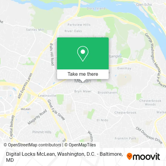
See Digital Locks McLean, Fairfax County, on the map
Public Transit to Digital Locks McLean in Fairfax County
Wondering how to get to Digital Locks McLean in Fairfax County? Moovit helps you find the best way to get to Digital Locks McLean with step-by-step directions from the nearest public transit station.
Moovit provides free maps and live directions to help you navigate through your city. View schedules, routes, timetables, and find out how long does it take to get to Digital Locks McLean in real time.
Looking for the nearest stop or station to Digital Locks McLean? Check out this list of stops closest to your destination: Old Dominion Dr+Beverly Rd; Chain Bridge @ Emerson; Elm St @ Beverly Rd; Mclean.
Bus: 715, 721, A70.Metro: SILVER.
Want to see if there’s another route that gets you there at an earlier time? Moovit helps you find alternative routes or times. Get directions from and directions to Digital Locks McLean easily from the Moovit App or Website.
We make riding to Digital Locks McLean easy, which is why over 1.5 million users, including users in Fairfax County, trust Moovit as the best app for public transit. You don’t need to download an individual bus app or train app, Moovit is your all-in-one transit app that helps you find the best bus time or train time available.
For information on prices of bus and metro, costs and ride fares to Digital Locks McLean, please check the Moovit app.
Use the app to navigate to popular places including to the airport, hospital, stadium, grocery store, mall, coffee shop, school, college, and university.
Digital Locks McLean Address: 1420 Chain Bridge Rd McLean, VA 22101 street in Fairfax County
- Four Seasons of McLean,
- Maman Joon Kitchen,
- Z Burger,
- My Own Pizza,
- Chain Bridge Rd and Old Dominion Dr,
- McLean, Virginia,
- Solutions, Inc.,
- Tom & Deniz Hair Studio,
- Kissme Nail Spa,
- Pikoteo,
- McLean Face and Body Spa,
- Cia Headquarters,
- Teriyaki Way,
- Otosan Ramen,
- Susan M Demello - PNC Mortgage Loan Officer (NMLS #1491977),
- Dan Aminoff - PNC Mortgage Loan Officer ,
- Dermestetics,
- Yolo Beauty Zone,
- Salon Michel,
- Flagship Carwash
Places Near Digital Locks McLean (Fairfax County)
- Westfield Montgomery Mall, Montgomery County,
- The Anthem, Washington,
- Rock Creek Tennis Center, Washington,
- Capital One Arena, Washington,
- National Zoo, Washington,
- Amazon Hq2, Arlington County,
- Georgetown, Washington,
- Museum Of The Bible, Washington,
- M&T Bank Stadium, Baltimore,
- Marriott Marquis Washington, DC, Washington,
- Washington National Cathedral, Washington,
- Washington DC VA Medical Center, Washington,
- PG Mall, Prince George's County,
- Pennsylvania Ave NW (3rd st and pennsylvania), Washington,
- Warner Theatre, Washington,
- Basilica of the National Shrine, Washington,
- National Mall, Washington,
- Camden Yards, Baltimore,
- National Museum of African American History and Culture, Washington,
- Sibley Memorial Hospital, Washington
How to get to popular places in Washington, D.C. - Baltimore, MD with public transit
Get around Fairfax County by public transit!
Traveling around Fairfax County has never been so easy. See step by step directions as you travel to any attraction, street or major public transit station. View bus and train schedules, arrival times, service alerts and detailed routes on a map, so you know exactly how to get to anywhere in Fairfax County.
When traveling to any destination around Fairfax County use Moovit's Live Directions with Get Off Notifications to know exactly where and how far to walk, how long to wait for your line, and how many stops are left. Moovit will alert you when it's time to get off — no need to constantly re-check whether yours is the next stop.
Wondering how to use public transit in Fairfax County or how to pay for public transit in Fairfax County? Moovit public transit app can help you navigate your way with public transit easily, and at minimum cost. It includes public transit fees, ticket prices, and costs. Looking for a map of Fairfax County public transit lines? Moovit public transit app shows all public transit maps in Fairfax County with all Bus, Train, Metro, Light Rail and Ferry routes and stops on an interactive map.
Washington, D.C. - Baltimore, MD has 5 transit type(s), including: Bus, Train, Metro, Light Rail and Ferry, operated by several transit agencies, including WMATA, Montgomery County Ride On, Fairfax Connector, TheBus, PRTC, DASH - Alexandria, Arlington Transit (ART), RTA of Central Maryland, MDOT MTA, MDOT MTA Light RailLink, MDOT MTA Commuter Bus, MDOT MTA Local Bus, FXBGO!, Virginia Railway Express (VRE) and MARC