How to get to Dima by bus?
Click on the bus route to see step by step directions with maps, line arrival times and updated time schedules.
From Arezzo Equestrian Center, Arezzo
59 minFrom Antica Querciolaia Thermal Baths, Rapolano Terme
88 minFrom Caprese Michelangelo, Caprese Michelangelo
93 minFrom Valdichiana Outlet Village, Foiano Della Chiana
79 minFrom Fratta Hospital, Arezzo
108 minFrom Pieve Santo Stefano, Pieve Santo Stefano
99 minFrom Monterchi, Monterchi
49 minFrom Prada - Space Outlet, Arezzo
70 minFrom Rondine, Arezzo
58 minFrom San Zeno, Arezzo
62 min
How to get to Dima by train?
Click on the train route to see step by step directions with maps, line arrival times and updated time schedules.
Bus stops near Dima in Arezzo
Bus lines to Dima in Arezzo
What are the closest stations to Dima?
The closest stations to Dima are:
- Arezzo Pescaiola is 176 meters away, 3 min walk.
- B. Da Maiano St (Corner of Tricca) is 583 meters away, 8 min walk.
- Arezzo Stadium is 637 meters away, 9 min walk.
- Sanzio Street Towards Cagli Street (Opposite Gardens) is 946 meters away, 13 min walk.
- Sanzio Street at Giotto Ave (Gardens) is 984 meters away, 13 min walk.
- Mecenate Avenue Opposite 40 is 1305 meters away, 17 min walk.
- Arezzo is 1433 meters away, 19 min walk.
Which bus lines stop near Dima?
These bus lines stop near Dima: 138, A+, BAAS, SI381, T.
Which train line stops near Dima?
R (Arezzo/Chiusi)
What’s the nearest train station to Dima in Arezzo?
The nearest train station to Dima in Arezzo is Arezzo Pescaiola. It’s a 3 min walk away.
What’s the nearest bus station to Dima in Arezzo?
The nearest bus station to Dima in Arezzo is B. Da Maiano St (Corner of Tricca). It’s a 8 min walk away.
What time is the first train to Dima in Arezzo?
The R is the first train that goes to Dima in Arezzo. It stops nearby at 5:43 AM.
What time is the last train to Dima in Arezzo?
The R is the last train that goes to Dima in Arezzo. It stops nearby at 12:50 AM.
What time is the first bus to Dima in Arezzo?
The B+ is the first bus that goes to Dima in Arezzo. It stops nearby at 8:19 AM.
What time is the last bus to Dima in Arezzo?
The SI381 is the last bus that goes to Dima in Arezzo. It stops nearby at 8:40 PM.
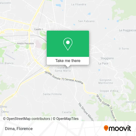
See Dima, Arezzo, on the map
Public Transit to Dima in Arezzo
Wondering how to get to Dima in Arezzo? Moovit helps you find the best way to get to Dima with step-by-step directions from the nearest public transit station.
Moovit provides free maps and live directions to help you navigate through your city. View schedules, routes, timetables, and find out how long does it take to get to Dima in real time.
Looking for the nearest stop or station to Dima? Check out this list of stops closest to your destination: Arezzo Pescaiola; B. Da Maiano St (Corner of Tricca); Arezzo Stadium; Sanzio Street Towards Cagli Street (Opposite Gardens); Sanzio Street at Giotto Ave (Gardens); Mecenate Avenue Opposite 40; Arezzo.
Bus: 138, A+, BAAS, SI381, T, Q, U, B+.Train: R, RL, RL.
Want to see if there’s another route that gets you there at an earlier time? Moovit helps you find alternative routes or times. Get directions from and directions to Dima easily from the Moovit App or Website.
We make riding to Dima easy, which is why over 1.5 million users, including users in Arezzo, trust Moovit as the best app for public transit. You don’t need to download an individual bus app or train app, Moovit is your all-in-one transit app that helps you find the best bus time or train time available.
For information on prices of bus and train, costs and ride fares to Dima, please check the Moovit app.
Use the app to navigate to popular places including to the airport, hospital, stadium, grocery store, mall, coffee shop, school, college, and university.
Dima Address: Via Santa Maria delle Grazie, 47 52100 Arezzo street in Arezzo
- Baseball Softball Club Arezzo,
- Margaritone Comprehensive Institute (Primary and Secondary School),
- Chimera Sports Center Municipal Pool,
- Mario Lebole Sports Field,
- New Gym New Gym,
- D & D by Di Dato Giorgio,
- Chimera Sports Center,
- Pranopratica School - Risvegli di Luce,
- Santa Maria of Graces,
- Green Eyes Club Sports Facility,
- Margaritone,
- Gate 21 Restaurant,
- Stadium,
- Via della Robbia 98 - S. Maria,
- Sandro Pertini Park,
- T. Torri Street 15,
- CONAD,
- Diouf Ousmane,
- El Condor,
- Scartoni Rina
Places Near Dima (Arezzo)
- Torregalli Hospital Scandicci *, Scandicci,
- Asmana, Campi Bisenzio,
- Wanny Palace, Florence,
- Michelangelo Square, Florence,
- IKEA Florence, Sesto Fiorentino,
- Campi Bisenzio, Campi Bisenzio,
- Santa Maria Novella Station, Florence,
- Verdi Theater, Florence,
- Santa Maria Nuova Hospital, Florence,
- OOO, Florence,
- Nelson Mandela Forum, Florence,
- Tobacco Manufacture, Florence,
- Piero Palagi Hospital Facility-Florence, Florence,
- Artemio Franchi Municipal Stadium, Florence,
- Michelangelo Square, Florence,
- Cascine Park, Florence,
- Field of Mars, Florence,
- Viola Park, Bagno a Ripoli,
- Mandela Forum (Nelson Mandela Forum), Florence,
- I Gigli, Campi Bisenzio
How to get to popular places in Florence with public transit
Get around Arezzo by public transit!
Traveling around Arezzo has never been so easy. See step by step directions as you travel to any attraction, street or major public transit station. View bus and train schedules, arrival times, service alerts and detailed routes on a map, so you know exactly how to get to anywhere in Arezzo.
When traveling to any destination around Arezzo use Moovit's Live Directions with Get Off Notifications to know exactly where and how far to walk, how long to wait for your line, and how many stops are left. Moovit will alert you when it's time to get off — no need to constantly re-check whether yours is the next stop.
Wondering how to use public transit in Arezzo or how to pay for public transit in Arezzo? Moovit public transit app can help you navigate your way with public transit easily, and at minimum cost. It includes public transit fees, ticket prices, and costs. Looking for a map of Arezzo public transit lines? Moovit public transit app shows all public transit maps in Arezzo with all Bus, Train, Light Rail, Ferry and Funicular routes and stops on an interactive map.
Florence has 5 transit type(s), including: Bus, Train, Light Rail, Ferry and Funicular, operated by several transit agencies, including Florence Urban - Tuscan Bus Lines, GEST, Florence and Province - Tuscan Bus Lines, Livorno and Province - Tuscan Bus Lines, Arezzo, Florence and Provinces - Tuscan Bus Lines, Prato and Province - Tuscan Bus Lines, Massa, Carrara and Province - Tuscan Bus Lines, Pisa and Province - Tuscan Bus Lines, Grosseto, Siena and Provinces - Tuscan Bus Lines, Arezzo, Siena and Provinces - Tuscan Bus Lines, Pistoia and Province - Tuscan Bus Lines, Siena and Province - Tuscan Bus Lines, Arezzo and Province - Tuscan Bus Lines, Lucca and Province - Tuscan Bus Lines and Trenitalia