How to get to Dimension 2000 Rep de Computadoras by bus?
Click on the bus route to see step by step directions with maps, line arrival times and updated time schedules.
From Parque Deportivo El Cedazo, Aguascalientes
46 minFrom Salto de Ojocaliente, Aguascalientes
47 minFrom Fracc Miradores de Santa Elena, Aguascalientes
35 minFrom Fracc. Lomas del Sur, Aguascalientes
55 minFrom Pension Municipal, Aguascalientes
55 minFrom Villa Sur, Aguascalientes
65 minFrom Residencial Villa Sur, Aguascalientes
64 minFrom Si Unicen, Aguascalientes
27 minFrom Casa Club Necaxa, Aguascalientes
58 min
Bus stops near Dimension 2000 Rep de Computadoras in Aguascalientes
Bus lines to Dimension 2000 Rep de Computadoras in Aguascalientes
What are the closest stations to Dimension 2000 Rep de Computadoras?
The closest stations to Dimension 2000 Rep de Computadoras are:
- San Miguel El Alto, Lb is 420 meters away, 6 min walk.
- Avenida Aguascalientes Norte, 130 is 563 meters away, 8 min walk.
- Pulgas Pandas 2 is 573 meters away, 8 min walk.
- Pulgas Pandas Sur is 586 meters away, 8 min walk.
- Centro Comercial Agropecuario is 655 meters away, 9 min walk.
Which bus lines stop near Dimension 2000 Rep de Computadoras?
These bus lines stop near Dimension 2000 Rep de Computadoras: RUTA 06, RUTA 40.
What’s the nearest bus station to Dimension 2000 Rep de Computadoras in Aguascalientes?
The nearest bus station to Dimension 2000 Rep de Computadoras in Aguascalientes is San Miguel El Alto, Lb. It’s a 6 min walk away.
What time is the first bus to Dimension 2000 Rep de Computadoras in Aguascalientes?
The RUTA 40 is the first bus that goes to Dimension 2000 Rep de Computadoras in Aguascalientes. It stops nearby at 6:03 AM.
What time is the last bus to Dimension 2000 Rep de Computadoras in Aguascalientes?
The RUTA 10 is the last bus that goes to Dimension 2000 Rep de Computadoras in Aguascalientes. It stops nearby at 10:10 PM.
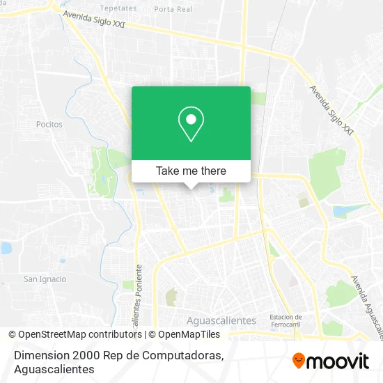
See Dimension 2000 Rep de Computadoras, Aguascalientes, on the map
Public Transit to Dimension 2000 Rep de Computadoras in Aguascalientes
Wondering how to get to Dimension 2000 Rep de Computadoras in Aguascalientes? Moovit helps you find the best way to get to Dimension 2000 Rep de Computadoras with step-by-step directions from the nearest public transit station.
Moovit provides free maps and live directions to help you navigate through your city. View schedules, routes, timetables, and find out how long does it take to get to Dimension 2000 Rep de Computadoras in real time.
Looking for the nearest stop or station to Dimension 2000 Rep de Computadoras? Check out this list of stops closest to your destination: San Miguel El Alto; Avenida Aguascalientes Norte; Pulgas Pandas 2; Pulgas Pandas Sur; Centro Comercial Agropecuario.
Bus: RUTA 06, RUTA 40, RUTA 30, RUTA 10, RUTA 18, RUTA 35, RUTA 45, RUTA 34.
Want to see if there’s another route that gets you there at an earlier time? Moovit helps you find alternative routes or times. Get directions from and directions to Dimension 2000 Rep de Computadoras easily from the Moovit App or Website.
We make riding to Dimension 2000 Rep de Computadoras easy, which is why over 1.5 million users, including users in Aguascalientes, trust Moovit as the best app for public transit. You don’t need to download an individual bus app or train app, Moovit is your all-in-one transit app that helps you find the best bus time or train time available.
For information on prices of bus, costs and ride fares to Dimension 2000 Rep de Computadoras, please check the Moovit app.
Use the app to navigate to popular places including to the airport, hospital, stadium, grocery store, mall, coffee shop, school, college, and university.
Dimension 2000 Rep de Computadoras Address: Calle Lagos de Moreno, Fátima, 20130 Aguascalientes, Aguascalientes street in Aguascalientes
- Plaza Zaragoza,
- Kiddie Care / Estancia Infantil y Preescolar,
- Tecnologico Aspidpro Aguascalientes,
- Alitas de Sabores,
- BBVA,
- ECN,
- Las Gordibuenas,
- Abuelitos Felices,
- Instituto Cumbres,
- Salon de Fiestas Las Ranas,
- Plaza Privilege,
- Deicam,
- Hojalatería y Pintura Cruz,
- Condominio Privillege,
- Tortillas de Harina Miranda,
- SPA MANICURE Y PEDICURE,
- HOSPITAL DE LENTES,
- Edmundo Gamez Orozco,
- Gimnasio al Aire Libre Parque Fatima,
- Cooperativa Escolar Instituto Alpes
Places Near Dimension 2000 Rep de Computadoras (Aguascalientes)
- Imss Clinica 1, Aguascalientes,
- Nuevo Hospital Hidalgo, Aguascalientes,
- Ciudad industrial, Aguascalientes,
- Jesús María, Aguascalientes,
- Hospital Imss No. 3, Aguascalientes,
- Parque Las Tres Centurias, Aguascalientes,
- Centro Comercial Altaria, Aguascalientes,
- Aeropuerto de Aguascalientes S.A. de C.V., Aguascalientes,
- La Isla San Marcos, Aguascalientes,
- Isla San Marcos, Aguascalientes,
- Central De Autobuses, Aguascalientes,
- Villas de Nuestra Señora de la Asunción, Aguascalientes,
- Villasuncion, Aguascalientes,
- Universidad Autónoma de Aguascalientes, Aguascalientes,
- Agropecuario, Aguascalientes,
- Blvd. Luis Donaldo Colosio, Aguascalientes,
- Centro, Aguascalientes,
- ESPACIOS, Aguascalientes,
- clinica 3 uaa, Aguascalientes,
- Terminal De Combis, Aguascalientes
How to get to popular places in Aguascalientes with public transit
Get around Aguascalientes by public transit!
Traveling around Aguascalientes has never been so easy. See step by step directions as you travel to any attraction, street or major public transit station. View bus and train schedules, arrival times, service alerts and detailed routes on a map, so you know exactly how to get to anywhere in Aguascalientes.
When traveling to any destination around Aguascalientes use Moovit's Live Directions with Get Off Notifications to know exactly where and how far to walk, how long to wait for your line, and how many stops are left. Moovit will alert you when it's time to get off — no need to constantly re-check whether yours is the next stop.
Wondering how to use public transit in Aguascalientes or how to pay for public transit in Aguascalientes? Moovit public transit app can help you navigate your way with public transit easily, and at minimum cost. It includes public transit fees, ticket prices, and costs. Looking for a map of Aguascalientes public transit lines? Moovit public transit app shows all public transit maps in Aguascalientes with all bus routes and stops on an interactive map.
Aguascalientes has 1 transit type(s), including: bus, operated by several transit agencies, including Coordinación General de Movilidad