Directions to Punta Ala Residence (Castiglione Della Pescaia) with public transportation
The following transit lines have routes that pass near Punta Ala Residence
 Bus: 29F.
How to get to Punta Ala Residence by bus?
Click on the bus route to see step by step directions with maps, line arrival times and updated time schedules.
From Tartana Disco, Scarlino
35 minFrom Casa Smeraldo Breeding, Follonica
52 minFrom Sports Hall Casa Mora, Castiglione Della Pescaia
133 minFrom Georg Solti Square, Castiglione Della Pescaia
136 minFrom Baluba Disco Village with Alessandro Izzo, Follonica
62 minFrom Cala Felice Beach Club, Scarlino
71 minFrom Rocchette, Castiglione Della Pescaia
144 minFrom Castiglione Della Pescaia, Castiglione Della Pescaia
138 minFrom Acqua Village, Follonica
51 minFrom Ranieri Meadow, Follonica
81 min
Bus stop near Punta Ala Residence in Castiglione Della Pescaia
- Punta Ala Pozzino, 10 min walk,VIEW
Bus lines to Punta Ala Residence in Castiglione Della Pescaia
- 29F, Riva del Sole,VIEW
What are the closest stations to Punta Ala Residence?
The closest stations to Punta Ala Residence are:
- Punta Ala Pozzino is 718 meters away, 10 min walk.
Which bus line stops near Punta Ala Residence?
29F (Punta Ala Port)
What’s the nearest bus station to Punta Ala Residence in Castiglione Della Pescaia?
The nearest bus station to Punta Ala Residence in Castiglione Della Pescaia is Punta Ala Pozzino. It’s a 10 min walk away.
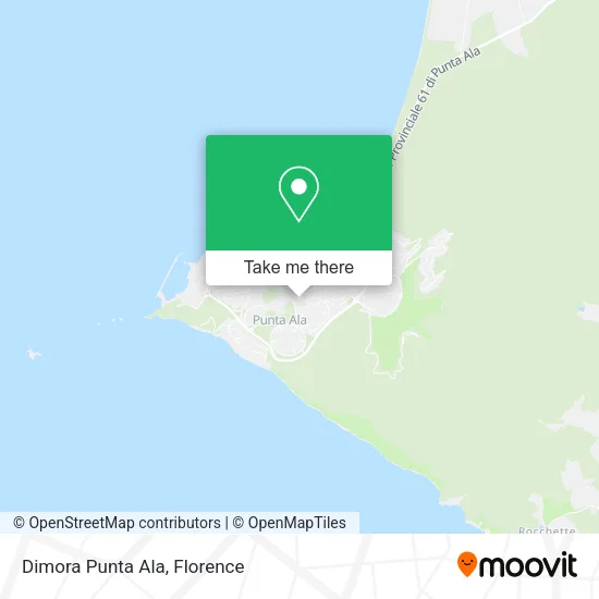
See Punta Ala Residence, Castiglione Della Pescaia, on the map
Public Transit to Punta Ala Residence in Castiglione Della Pescaia
Wondering how to get to Punta Ala Residence in Castiglione Della Pescaia? Moovit helps you find the best way to get to Punta Ala Residence with step-by-step directions from the nearest public transit station.
Moovit provides free maps and live directions to help you navigate through your city. View schedules, routes, timetables, and find out how long does it take to get to Punta Ala Residence in real time.
Looking for the nearest stop or station to Punta Ala Residence? Check out this list of stops closest to your destination: Punta Ala Pozzino.
Bus: 29F.
Want to see if there’s another route that gets you there at an earlier time? Moovit helps you find alternative routes or times. Get directions from and directions to Punta Ala Residence easily from the Moovit App or Website.
We make riding to Punta Ala Residence easy, which is why over 1.5 million users, including users in Castiglione Della Pescaia, trust Moovit as the best app for public transit. You don’t need to download an individual bus app or train app, Moovit is your all-in-one transit app that helps you find the best bus time or train time available.
For information on prices of bus, costs and ride fares to Punta Ala Residence, please check the Moovit app.
Use the app to navigate to popular places including to the airport, hospital, stadium, grocery store, mall, coffee shop, school, college, and university.
Punta Ala Residence Address: Via del Pozzino, 5 58043 Castiglione della Pescaia street in Castiglione Della Pescaia
- Spajani Lidia,
- Punta Ala Hotel,
- Punta Ala,
- Marin. Maremma Investments,
- Puntaalarooms B&B Rooms,
- Il Porticciolo,
- Salvadori Mineral Waters,
- Minigolf,
- La Tartana Beach,
- Punta Hidalgo Sporting Club,
- Barro Ampelio,
- I Bischeri of Padule B&B,
- Hahei NZ. Boat Rental,
- Cecchinelli Real Estate,
- Locanda Moa dei Barbari,
- Baglioni Resort Alleluja,
- Funeral Services La Castiglionese by Zazzeri T. & C.,
- Di Salvo Arch. Walter,
- The Mimosas,
- Villino Angelica
Places Near Punta Ala Residence (Castiglione Della Pescaia)
- Artemio Franchi Municipal Stadium, Florence,
- Visarno Hippodrome, Florence,
- I Gigli, Campi Bisenzio,
- Tobacco Manufacture, Florence,
- IKEA Florence, Sesto Fiorentino,
- Cascine Park, Florence,
- Michelangelo Square, Florence,
- Asmana, Campi Bisenzio,
- Field of Mars, Florence,
- Piero Palagi Hospital Facility-Florence, Florence,
- Santa Maria Novella Station, Florence,
- Nelson Mandela Forum, Florence,
- Campi Bisenzio, Campi Bisenzio,
- OOO, Florence,
- Torregalli Hospital Scandicci *, Scandicci,
- Verdi Theater, Florence,
- Visarno Arena, Florence,
- Mandela Forum (Nelson Mandela Forum), Florence,
- Santa Maria Nuova Hospital, Florence,
- Michelangelo Square, Florence
How to get to popular places in Florence with public transit
Get around Castiglione Della Pescaia by public transit!
Traveling around Castiglione Della Pescaia has never been so easy. See step by step directions as you travel to any attraction, street or major public transit station. View bus and train schedules, arrival times, service alerts and detailed routes on a map, so you know exactly how to get to anywhere in Castiglione Della Pescaia.
When traveling to any destination around Castiglione Della Pescaia use Moovit's Live Directions with Get Off Notifications to know exactly where and how far to walk, how long to wait for your line, and how many stops are left. Moovit will alert you when it's time to get off — no need to constantly re-check whether yours is the next stop.
Wondering how to use public transit in Castiglione Della Pescaia or how to pay for public transit in Castiglione Della Pescaia? Moovit public transit app can help you navigate your way with public transit easily, and at minimum cost. It includes public transit fees, ticket prices, and costs. Looking for a map of Castiglione Della Pescaia public transit lines? Moovit public transit app shows all public transit maps in Castiglione Della Pescaia with all Bus, Train, Light Rail, Ferry and Funicular routes and stops on an interactive map.
Florence has 5 transit type(s), including: Bus, Train, Light Rail, Ferry and Funicular, operated by several transit agencies, including Florence Urban - Tuscan Bus Lines, GEST, Livorno and Province - Tuscan Bus Lines, Arezzo, Florence and Provinces - Tuscan Bus Lines, Prato and Province - Tuscan Bus Lines, Lucca and Province - Tuscan Bus Lines, Massa, Carrara and Province - Tuscan Bus Lines, Pisa and Province - Tuscan Bus Lines, Grosseto, Siena and Provinces - Tuscan Bus Lines, Arezzo, Siena and Provinces - Tuscan Bus Lines, Florence and Province - Tuscan Bus Lines, Pistoia and Province - Tuscan Bus Lines, Siena and Province - Tuscan Bus Lines, Arezzo and Province - Tuscan Bus Lines and Trenitalia