How to get to Direccion del Bosque de Chapultepec by bus?
Click on the bus route to see step by step directions with maps, line arrival times and updated time schedules.
From Avenida Té 950, Granjas México, 08400, Cuauhtémoc
58 minFrom Estadio Olímpico Universitario, Alvaro Obregón
83 minFrom Deportivo El Zarco, Gustavo A. Madero
57 minFrom Plaza Torres Lindavista, Tultitlán
65 minFrom Calle Manuel Doblado, Azcapotzalco
32 minFrom Mercado Abelardo Rodriguez, Azcapotzalco
34 minFrom Pabellón Bosques (Pabellon Bosques), Naucalpan De Juárez
57 minFrom Magdalena Contreras, Miguel Hidalgo
47 minFrom Metrobus UPIICSA, Cuauhtémoc
57 minFrom Hospital Pediátrico Coyoacán, Alvaro Obregón
53 min
How to get to Direccion del Bosque de Chapultepec by metro?
Click on the metro route to see step by step directions with maps, line arrival times and updated time schedules.
Bus stops near Direccion del Bosque de Chapultepec in Azcapotzalco
- Gandhi., 5 min walk,VIEW
- José Vazconcelos - Avenida Chapultepec, 5 min walk,VIEW
- Paseo de La Reforma - Gandhi, 6 min walk,VIEW
- Avenida Maestro José Vasconcelos #36574, 6 min walk,VIEW
- Avenida Maestro José Vasconcelos #18476, 6 min walk,VIEW
- Avenida Maestro José Vasconcelos #18444, 6 min walk,VIEW
- Circuito Interior Maestro José Vasconcelos #1522, 7 min walk,VIEW
- Avenida Paseo de La Reforma #12062, 7 min walk,VIEW
- Avenida Chapultepec #36714, 8 min walk,VIEW
- Avenida Chapultepec #21144, 8 min walk,VIEW
- Paseo de La Reforma - Lago, 9 min walk,VIEW
Metro stations near Direccion del Bosque de Chapultepec in Azcapotzalco
Cable Car station near Direccion del Bosque de Chapultepec in Azcapotzalco
- Los Pinos / Constituyentes, 23 min walk,VIEW
Bus lines to Direccion del Bosque de Chapultepec in Azcapotzalco
- 18A, Valle Dorado - Chapultepec,VIEW
- 18B, 1ro de Mayo - Chapultepec,VIEW
- 18C, Valle Dorado - Insurgentes,VIEW
- 18D, Satélite - Chapultepec,VIEW
- 7, Garibaldi - Campo Marte,VIEW
- 200, Circuito Interior - Manuel Carpio,VIEW
- 8A, Bosques - Chapultepec,VIEW
- 8B, Chapultepec - Palmas,VIEW
- 8D, Tecamachalco - Chapultepec,VIEW
- 76, La Pila ,VIEW
- 76, Chapultepec - Acopilco,VIEW
- 76, Atlapulco-Potrero,VIEW
- 2, Chapultepec,VIEW
- 1, Pantitlán - Chapultepec,VIEW
- 2, Chapultepec ,VIEW
- 114, Chapultepec - Contadero,VIEW
- 76, Salazar,VIEW
- 24, Observatorio,VIEW
- 8C, Duraznos - Chapultepec,VIEW
What are the closest stations to Direccion del Bosque de Chapultepec?
The closest stations to Direccion del Bosque de Chapultepec are:
- Gandhi. is 386 meters away, 5 min walk.
- José Vazconcelos - Avenida Chapultepec is 391 meters away, 5 min walk.
- Paseo de La Reforma - Gandhi is 407 meters away, 6 min walk.
- Sevilla is 412 meters away, 6 min walk.
- Avenida Maestro José Vasconcelos #36574 is 427 meters away, 6 min walk.
- Avenida Maestro José Vasconcelos #18476 is 427 meters away, 6 min walk.
- Circuito Interior Maestro José Vasconcelos #1522 is 436 meters away, 7 min walk.
- Avenida Maestro José Vasconcelos #18444 is 439 meters away, 6 min walk.
- Avenida Paseo de La Reforma #12062 is 484 meters away, 7 min walk.
- Avenida Chapultepec #36714 is 563 meters away, 8 min walk.
- Avenida Chapultepec #21144 is 584 meters away, 8 min walk.
- Paseo de La Reforma - Lago is 652 meters away, 9 min walk.
- Los Pinos / Constituyentes is 1749 meters away, 23 min walk.
- Auditorio is 2746 meters away, 35 min walk.
Which bus lines stop near Direccion del Bosque de Chapultepec?
These bus lines stop near Direccion del Bosque de Chapultepec: 18A, 21B, 7, 8A.
Which metro line stops near Direccion del Bosque de Chapultepec?
1 (Dirección Observatorio)
What’s the nearest metro station to Direccion del Bosque de Chapultepec in Azcapotzalco?
The nearest metro station to Direccion del Bosque de Chapultepec in Azcapotzalco is Sevilla. It’s a 6 min walk away.
What’s the nearest bus station to Direccion del Bosque de Chapultepec in Azcapotzalco?
The nearest bus stations to Direccion del Bosque de Chapultepec in Azcapotzalco are Gandhi. and José Vazconcelos - Avenida Chapultepec. The closest one is a 5 min walk away.
What’s the nearest cable car station to Direccion del Bosque de Chapultepec in Azcapotzalco?
The nearest cable car station to Direccion del Bosque de Chapultepec in Azcapotzalco is Los Pinos / Constituyentes. It’s a 23 min walk away.
What time is the first metro to Direccion del Bosque de Chapultepec in Azcapotzalco?
The 1 is the first metro that goes to Direccion del Bosque de Chapultepec in Azcapotzalco. It stops nearby at 5:06 AM.
What time is the last metro to Direccion del Bosque de Chapultepec in Azcapotzalco?
The 7 is the last metro that goes to Direccion del Bosque de Chapultepec in Azcapotzalco. It stops nearby at 12:19 AM.
What time is the first bus to Direccion del Bosque de Chapultepec in Azcapotzalco?
The 7 is the first bus that goes to Direccion del Bosque de Chapultepec in Azcapotzalco. It stops nearby at 4:16 AM.
What time is the last bus to Direccion del Bosque de Chapultepec in Azcapotzalco?
The 7 is the last bus that goes to Direccion del Bosque de Chapultepec in Azcapotzalco. It stops nearby at 1:07 AM.
What time is the first cable car to Direccion del Bosque de Chapultepec in Azcapotzalco?
The L3 is the first cable car that goes to Direccion del Bosque de Chapultepec in Azcapotzalco. It stops nearby at 5:00 AM.
What time is the last cable car to Direccion del Bosque de Chapultepec in Azcapotzalco?
The L3 is the last cable car that goes to Direccion del Bosque de Chapultepec in Azcapotzalco. It stops nearby at 11:15 PM.
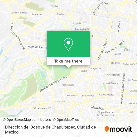
See Direccion del Bosque de Chapultepec, Azcapotzalco, on the map
Public Transit to Direccion del Bosque de Chapultepec in Azcapotzalco
Wondering how to get to Direccion del Bosque de Chapultepec in Azcapotzalco? Moovit helps you find the best way to get to Direccion del Bosque de Chapultepec with step-by-step directions from the nearest public transit station.
Moovit provides free maps and live directions to help you navigate through your city. View schedules, routes, timetables, and find out how long does it take to get to Direccion del Bosque de Chapultepec in real time.
Looking for the nearest stop or station to Direccion del Bosque de Chapultepec? Check out this list of stops closest to your destination: Gandhi.; José Vazconcelos - Avenida Chapultepec; Paseo de La Reforma - Gandhi; Sevilla; Avenida Maestro José Vasconcelos #36574; Avenida Maestro José Vasconcelos #18476; Circuito Interior Maestro José Vasconcelos #1522; Avenida Maestro José Vasconcelos #18444; Avenida Paseo de La Reforma #12062; Avenida Chapultepec #36714; Avenida Chapultepec #21144; Paseo de La Reforma - Lago; Los Pinos / Constituyentes; Auditorio.
Bus: 18A, 21B, 7, 8A, 18B, 18C, 18D, 200, 8B, 8D.Metro: 1, 7.Cable Car: L3.
Want to see if there’s another route that gets you there at an earlier time? Moovit helps you find alternative routes or times. Get directions from and directions to Direccion del Bosque de Chapultepec easily from the Moovit App or Website.
We make riding to Direccion del Bosque de Chapultepec easy, which is why over 1.5 million users, including users in Azcapotzalco, trust Moovit as the best app for public transit. You don’t need to download an individual bus app or train app, Moovit is your all-in-one transit app that helps you find the best bus time or train time available.
For information on prices of bus and metro, costs and ride fares to Direccion del Bosque de Chapultepec, please check the Moovit app.
Use the app to navigate to popular places including to the airport, hospital, stadium, grocery store, mall, coffee shop, school, college, and university.
Direccion del Bosque de Chapultepec Address: Direccion del Bosque de Chapultepec, Felipe Santiago Xicoténcatl, Bosque de Chapultepec I Sección, street in Azcapotzalco
- Playeras Gravadas,
- Bolsas Peluches,
- Algodonoes y Palomitas,
- Btroma Artículos Deportivos y Lentes,
- Peluches y Porcelana,
- GORRAS Y ARTESANIAS EN PLATA,
- Venta de Bolsas en General,
- Bolsas Artesanias y Juguetes,
- Artículos para Bebe Juguetes y Sombrillas,
- Playeras,
- Joyeria de Fantasia Bolsas y Sombrillas,
- Juguetes y Albunes,
- Refresco en General,
- Venta de Bolsas para Dama,
- Joyeria de Fantasia y Juguetes,
- Comercio al por Menor de Bisutería y Accesorios de Vestir,
- Huarache Artesanal Sombrilla y Juguete,
- Joyeria de Fantasia Bolsas y Artesania en Madera,
- Castillo de Chapultepec,
- Comercio al por Menor de Bebidas No Alcohólicas y Hielo
Places Near Direccion del Bosque de Chapultepec (Azcapotzalco)
- Hospital Regional Lic. Adolfo López Mateos, Miguel Hidalgo,
- Plaza Galerias De Las Estrellas, Azcapotzalco,
- Zona de Hospitales Tlalpan, Alvaro Obregón,
- Antara Polanco (Antara Polanco-Puerta 1), Naucalpan De Juárez,
- Central de Abasto de la Ciudad de México, Cuauhtémoc,
- Deportivo Los Galeana, Gustavo A. Madero,
- Hospital Gabriel Mancera - Urgencias, Miguel Hidalgo,
- Plaza Tepeyac, Gustavo A. Madero,
- Centro Banamex (Centro Citibanamex), Naucalpan De Juárez,
- HAMBURGO 213, Azcapotzalco,
- Clínica 29 Imss, Gustavo A. Madero,
- Hospital Juarez de México, Gustavo A. Madero,
- BUCARELI 134 COL CENTRO DELEG CUAUHTEMOC D F, Azcapotzalco,
- Monumental Plaza de Toros México, Miguel Hidalgo,
- CECyT 6 Miguel Othón de Mendizábal, Azcapotzalco,
- Parque Las Antenas, Iztapalapa,
- Instituto Nacional de Neurologia y Neurocirugia "Manuel Velasco Suarez", Alvaro Obregón,
- Plaza Parque Tezontle, Iztapalapa,
- Hospital Magdalena de las Salinas, Gustavo A. Madero,
- World Trade Center Ciudad de México, Miguel Hidalgo
How to get to popular places in Ciudad de Mexico with public transit
Get around Azcapotzalco by public transit!
Traveling around Azcapotzalco has never been so easy. See step by step directions as you travel to any attraction, street or major public transit station. View bus and train schedules, arrival times, service alerts and detailed routes on a map, so you know exactly how to get to anywhere in Azcapotzalco.
When traveling to any destination around Azcapotzalco use Moovit's Live Directions with Get Off Notifications to know exactly where and how far to walk, how long to wait for your line, and how many stops are left. Moovit will alert you when it's time to get off — no need to constantly re-check whether yours is the next stop.
Wondering how to use public transit in Azcapotzalco or how to pay for public transit in Azcapotzalco? Moovit public transit app can help you navigate your way with public transit easily, and at minimum cost. It includes public transit fees, ticket prices, and costs. Looking for a map of Azcapotzalco public transit lines? Moovit public transit app shows all public transit maps in Azcapotzalco with all Bus, Train, Metro, Cable Car and Gondola routes and stops on an interactive map.
Ciudad de Mexico has 5 transit type(s), including: Bus, Train, Metro, Cable Car and Gondola, operated by several transit agencies, including STC (Metro CDMX), Metrobús, RTP, Trolebús elevado, Trolebús, Tren El Insurgente, Tren Ligero, Cablebús, Corredores Concesionados, Ferrocarriles Suburbanos, Mexibus, Mexicable, Puma Bus and Potrobús